
Very strong M 7.3 earthquake struck South Sandwich Islands region
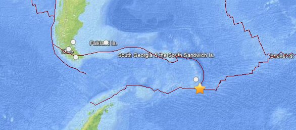
Image credit: USGS/Leaflet
A vey strong earthquake with recorded magnitude of 7.3 (USGS and EMSC preliminary reports) struck south of South Sandwich Islands on July 15, 2013 at 14:03 UTC. Both USGS and EMSC measured depth at 30 km.
Epicenter was located at sea, 185km (115mi) SSE of Bristol Island, South Sandwich Islands and 2587km (1607mi) ESE of Ushuaia, Argentina at coordinates 60.600°S 25.400°W. It is also at a subduction zone where different complex plates are colliding.
There are no people living within 100 km radius. No widespread tsunami warning was issued.
The islands are volcanic and only occupied by birds (including all sorts of penguins).
ER reports no widespread tsunami is expected and an eventual local tsunami will be ok because the birds can fly and the sea lions and penguins can swim 🙂
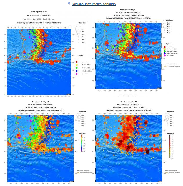
This seismicity maps have been generated by concatenating the ISC catalogue (since 1964), the EMSC Euro-Med Bulletin catalogue and the EMSC Real Time catalogue. Therefore, they show the seismicity from 1964 until the earthquake occurrence.
I'm a dedicated researcher, journalist, and editor at The Watchers. With over 20 years of experience in the media industry, I specialize in hard science news, focusing on extreme weather, seismic and volcanic activity, space weather, and astronomy, including near-Earth objects and planetary defense strategies. You can reach me at teo /at/ watchers.news.
Excellent materials!
Do you know if the strong ground motion records (accelerograms) exists for the main event M7.3?
Hi, thanks. We found only PGA, PGV and PSA maps from USGS.