
Active volcanoes in the world: March 6 – March 12, 2013
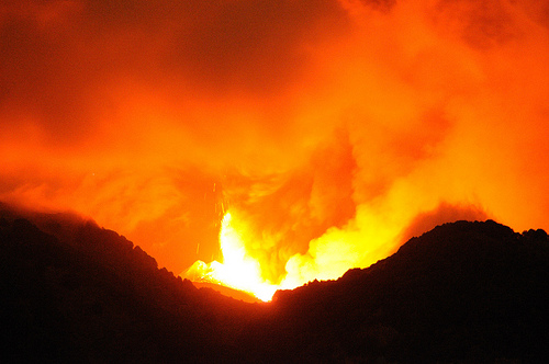
Image credit: gnuckx - CC BY 2.0
This week, 8 volcanoes were noticed to have new activity, whereas ongoing activity was reported for 15 volcanoes. This report covers active volcanoes in the world recorded from February 27 – March 5, 2013 based on Smithsonian/USGS criteria.
New activity/unrest: | Cleveland, Chuginadak Island | Descabezado Grande, Central Chile | Dieng Volcanic Complex, Central Java (Indonesia) | Etna, Sicily (Italy) | Fuego, Guatemala | Pacaya, Guatemala | Tangkubanparahu, Western Java (Indonesia) | Tungurahua, Ecuador
Ongoing activity: | Aoba, Vanuatu (SW Pacific) | Batu Tara, Komba Island (Indonesia) | Chirpoi, Kuril Islands (Russia) | Karymsky, Eastern Kamchatka (Russia) | Kilauea, Hawaii (USA) | Kizimen, Eastern Kamchatka (Russia) | Manam, Northeast of New Guinea (SW Pacific) | Paluweh, Lesser Sunda Islands (Indonesia) | Popocatépetl, México | Rabaul, New Britain | Ruapehu, North Island (New Zealand) | Sakura-jima, Kyushu | Santa María, Guatemala | Shiveluch, Central Kamchatka (Russia) | Tolbachik, Central Kamchatka (Russia)
The Weekly Volcanic Activity Report is a cooperative project between the Smithsonian’s Global Volcanism Program and the US Geological Survey’s Volcano Hazards Program. Updated by 2300 UTC every Wednesday, notices of volcanic activity posted on these pages are preliminary and subject to change as events are studied in more detail. This is not a comprehensive list of all of Earth’s volcanoes erupting during the week, but rather a summary of activity at volcanoes that meet criteria discussed in detail in the “Criteria and Disclaimers” section. Carefully reviewed, detailed reports on various volcanoes are published monthly in the Bulletin of the Global Volcanism Network.
New activity/unrest
CLEVELAND, Chuginadak Island
52.825°N, 169.944°W; summit elev. 1730 m
AVO reported that during 6-7 March clouds obscured satellite views of Cleveland’s lava dome. On 8 March AVO noted that the lava dome had remained unchanged since 6 February, and the last thermal anomalies were observed on 26 February. Although cloud cover often prevents observations of the dome, clear views between 1 and 5 March verified no changes. The Volcanic Alert Level was lowered to Advisory and the Aviation Color Code was lowered to Yellow.
Geologic summary: Symmetrical Mount Cleveland stratovolcano is situated at the western end of the uninhabited dumbbell-shaped Chuginadak Island in the east-central Aleutians. The 1,730-m-high stratovolcano is the highest of the Islands of Four Mountains group and is one of the most active in the Aleutians. Numerous large lava flows descend its flanks. It is possible that some 18th to 19th century eruptions attributed to Carlisle (a volcano located across the Carlisle Pass Strait to the NW) should be ascribed to Cleveland. In 1944 Cleveland produced the only known fatality from an Aleutian eruption. Recent eruptions from Mt. Cleveland have been characterized by short-lived explosive ash emissions, at times accompanied by lava fountaining and lava flows down the flanks.
DESCABEZADO GRANDE, Central Chile
35.58°S, 70.75°W; summit elev. 3953 m
OVDAS-SERNAGEOMIN reported that during 1-28 February seismicity increased at Descabezado Grande, in the Laguna del Maule volcanic complex area. There were 127 earthquakes detected, with magnitudes 1.7 or less, mostly comprised of volcano-tectonic earthquakes. The seismic swarms were associated with deformation and considered to be at a high level. On 8 March the Alert Level was raised to Yellow.
Geologic summary: Volcán Descabezado Grande is a late-Pleistocene to Holocene andesitic-to-rhyodacitic stratovolcano with a 1.4-km-wide ice-filled summit crater. Along with 3788-m-high Cerro Azul, only 7 km to the south, 3953-m-high Descabezado Grande lies at the center of a 20 x 30 km volcanic field. A lateral crater that formed on the upper NNE flank in 1932, shortly after the end of the major 1932 eruption from nearby Quizapu volcano on the north flank of Cerro Azul, was the site of the only historical eruption of Descabezado Grande. The Holocene Alto de las Mulas fissure on the lower NW flank of Descabezado Grande produced young rhyodacitic lava flows. Numerous small late-Pleistocene to Holocene volcanic centers are located north of the volcano. The northernmost of these, Lengua de Vulcano (or Mondaca) produced a very youthful rhyodacitic lava flow that dammed the Río Lentué.
DIENG VOLCANIC COMPLEX, Central Java (Indonesia)
7.20°S, 109.92°E; summit elev. 2565 m
CVGHM reported that during 7-11 March instruments monitoring the Dieng Volcanic Complex detected carbon dioxide plumes from Timbang Crater drifting 50-200 m S; the concentration increased during 9-10 March. A strong sulfur odor was also reported, along with dead animals near the crater on 7 March. Observers noted white plumes rising from the crater that were diffuse during 7-8 March and dense during 9-10 March. Because of the increase of carbon dioxide emissions, CVGHM raised the Alert Level to 2 (on a scale of 1-4) on 11 March and warned the public not to approach Timbang Crater within a 500 m radius.
Geologic summary: The Dieng plateau in the highlands of central Java is renowned both for the variety of its volcanic scenery and as a sacred area housing Java’s oldest Hindu temples, dating back to the 9th century AD. The Dieng volcanic complex consists of two or more stratovolcanoes and more than 20 small craters and cones of Pleistocene-to-Holocene age over a 6 x 14 km area. Prahu stratovolcano was truncated by a large Pleistocene caldera, which was subsequently filled by a series of dissected to youthful cones, lava domes, and craters, many containing lakes. Lava flows cover much of the plateau, but have not occurred in historical time, when activity has been restricted to minor phreatic eruptions. Toxic volcanic gas emission has caused fatalities and is a hazard at several craters. The abundant thermal features that dot the plateau and high heat flow make Dieng a major geothermal prospect.
ETNA, Sicily (Italy)
37.734°N, 15.004°E; summit elev. 3330 m
Sezione di Catania – Osservatorio Etneo reported that during 5-6 March a new episode of lava fountaining occurred at Etna’s New Southeast Crater (NSEC). On 5 March an explosion from the vent in the W part of NSEC was detected at 1854 and ejected incandescent bombs several tens of meters above the crater rim. This explosion was followed by similar ones, initially separated by intervals of 15-20 minutes, but then gradually became more frequent. As the evening went on, the activity at NSEC progressively intensified; likewise, the volcanic tremor amplitude started to rise. Around 0012 on 6 March, lava started to flow from the saddle between the two SEC cones; a few minutes later, an eruptive fissure with several vents opened in the lower portion of the saddle. Lava jets became continuous around 0017, forming a fountain that rose 200-300 m above the crater rim. Various vents were active within the NSEC, in the saddle area, and at the base of the saddle, from where a voluminous lava flow expanded S and SE. Around 0100 this lava flow had reached the area of Belvedere station. Lava also flowed through the breach in the SE rim of NSEC.
For the next 30 minutes, lava fountaining continued with jets rising 600 to 800 m above the crater. An eruption column heavily laden with pyroclastic material rose several kilometers above the summit and drifted NE. Deposition was intense on the upper NE flank of Etna, covering the area of the Valle del Leone, Pizzi Deneri, and Serra delle Concazze with incandescent bombs and scoriae. Further downslope, at Linguaglossa, scoria with diameters of several centimeters fell, and ash and lapilli fall was also observed at Piedimonte Etneo, Fiumefreddo, Taormina, and other towns along the Messinian Ionian coast.
Just after 0100, and within a few minutes, explosive activity nearly ceased, with only a few weak Strombolian explosions. During the same time, however, an eruptive vent opened on the lower E flank of the NSEC cone, which produced vigorous spattering and a well-fed lava flow that advanced SE. This activity continued at a slowly decreasing rate for a few days and ceased altogether on 9 March.
At the Voragine, Strombolian activity continued after the 5-6 March paroxysm at NSEC, but then alternated with short episodes of intense Strombolian activity and nearly totally quiet intervals. These oscillations were reflected in the volcanic tremor amplitude, which during the 24 hours following the paroxysmal episode at the NSEC showed about twenty small peaks.
Geologic summary: Mount Etna, towering above Catania, Sicily’s second largest city, has one of the world’s longest documented records of historical volcanism, dating back to 1500 BC. Historical lava flows cover much of the surface of this massive basaltic stratovolcano, the highest and most voluminous in Italy. Two styles of eruptive activity typically occur at Etna. Persistent explosive eruptions, sometimes with minor lava emissions, take place from one or more of the three prominent summit craters, the Central Crater, NE Crater, and SE Crater. Flank eruptions, typically with higher effusion rates, occur less frequently and originate from fissures that open progressively downward from near the summit. A period of more intense intermittent explosive eruptions from Etna’s summit craters began in 1995. The active volcano is monitored by the Instituto Nazionale di Geofisica e Volcanologia (INGV) in Catania.
FUEGO, Guatemala
14.473°N, 90.880°W; summit elev. 3763 m
INSIVUMEH reported that during 6-8 March rumbling noises from Fuego were reported and incandescent material was ejected 50-100 m above the crater. Avalanches traveled SSW down the Ceniza drainage during 6-7 March. Explosions during 8-11 March produced ash plumes that rose up to 450 m above the crater and drifted W, SW, S, SE, and E. During 11-12 March ash plumes drifted 10 km and produced ashfall in the Panimache villages (8 km SW) and Morelia (9 km SW). Lava flows were also observed.
Geologic summary: Volcán Fuego, one of Central America’s most active volcanoes, is one of three large stratovolcanoes overlooking Guatemala’s former capital, Antigua. The scarp of an older edifice, Meseta, lies between 3,763-m-high Fuego and its twin volcano to the N, Acatenango. Construction of Meseta volcano continued until the late Pleistocene or early Holocene, after which growth of the modern Fuego volcano continued the southward migration of volcanism that began at Acatenango. Frequent vigorous historical eruptions have been recorded at Fuego since the onset of the Spanish era in 1524, and have produced major ashfalls, along with occasional pyroclastic flows and lava flows. The last major explosive eruption from Fuego took place in 1974, producing spectacular pyroclastic flows visible from Antigua.
PACAYA, Guatemala
14.381°N, 90.601°W; summit elev. 2552 m
INSIVUMEH reported that during 8-12 March diffuse white plumes rose from Pacaya and drifted N, E, S, and SW.
Geologic summary: Eruptions from Pacaya, one of Guatemala’s most active volcanoes, are frequently visible from Guatemala City, the nation’s capital. Pacaya is a complex volcano constructed on the southern rim of the 14 x 16 km Pleistocene Amatitlan caldera. A cluster of dacitic lava domes occupies the caldera floor. The Pacaya massif includes the Cerro Grande lava dome and a younger volcano to the SW. Collapse of Pacaya volcano about 1,100 years ago produced a debris-avalanche deposit that extends 25 km onto the Pacific coastal plain and left an arcuate somma rim inside which the modern Pacaya volcano (MacKenney cone) grew. During the past several decades, activity at Pacaya has consisted of frequent Strombolian eruptions with intermittent lava flow extrusion on the flanks of MacKenney cone, punctuated by occasional larger explosive eruptions.
TANGKUBANPARAHU, Western Java (Indonesia)
6.77°S, 107.60°E; summit elev. 2084 m
According to news articles, an eruption from Tangkubanparahu on 4 March produced an ash plume that rose 500 m above the crater. An eight-minute-long eruption at 0559 on 7 March ejected ash 30 m above Ratu Crater.
Geologic summary: Tangkubanparahu is a broad shield-like stratovolcano overlooking Indonesia’s former capital city of Bandung that was constructed within the 6 x 8 km Pleistocene Sunda caldera. The volcano’s low profile is the subject of legends referring to the mountain of the “upturned boat.” The rim of Sunda caldera forms a prominent ridge on the western side; elsewhere the caldera rim is largely buried by deposits of Tangkubanparahu volcano. The dominantly small phreatic historical eruptions recorded since the 19th century have originated from several nested craters within an elliptical 1 x 1.5 km summit depression. Tangkubanparahu last erupted in September 1983, when ash rose up to 150 m above the rim of Kawah Ratu.
TUNGURAHUA, Ecuador
1.467°S, 78.442°W; summit elev. 5023 m
IG reported that during 2-12 March seismicity and sulfur dioxide emissions at Tungurahua were both moderate to high. Over 100 earthquakes were detected daily; 157 high-frequency tremors were recorded on 3 March and 233 long-period events were recorded on 6 March. Deformation measurements indicated that the rising magma body was small and concentrated beneath the NW flank.
Although cloud cover often prevented visual observations during 6-12 March, ash emissions were observed almost daily. On 6 March a steam plume with low ash content rose 1.5 km above the crater. Roaring was heard at night during 6-7 March, and ashfall was reported in Palitahua (S), El Manzano (8 km SW), Penipe (15 km SW), and Choglountus (SW). Ash plumes rose 1 km above the crater on 7 March and 2 km the next day, drifting W. During 8-12 March Strombolian activity ejected incandescent blocks that rolled at most 500 m down the flanks. Ash plumes drifted S, SW, and W. Ashfall during 10-11 March was reported in El Manzano and Choglountus. On 11 March ashfall was also reported in Pillate (8 km W).
Geologic summary: The steep-sided Tungurahua stratovolcano towers more than 3 km above its northern base. It sits ~140 km S of Quito, Ecuador’s capital city, and is one of Ecuador’s most active volcanoes. Historical eruptions have all originated from the summit crater. They have been accompanied by strong explosions and sometimes by pyroclastic flows and lava flows that reached populated areas at the volcano’s base. The last major eruption took place from 1916 to 1918, although minor activity continued until 1925. The latest eruption began in October 1999 and prompted temporary evacuation of the town of Baños on the N side of the volcano.
Ongoing activity
AOBA, Vanuatu (SW Pacific)
15.40°S, 167.83°E; summit elev. 1496 m
According to observations by the Vanuatu Meteorology and Geohazards Department, a report from 6 March stated that the minor activity at Aoba that began in December 2012 was likely continuing. Satellite images acquired on 3 and 26 February detected substantial sulfur dioxide emissions. The Vanuatu Volcano Alert Level (VVAL) remained at 1 (on a scale of 0-4).
Geologic summary: Aoba, also known as Ambae, is a massive 2500 cu km basaltic shield volcano that is the most voluminous volcano of the New Hebrides archipelago. A pronounced NE-SW-trending rift zone dotted with scoria cones gives the 16 x 38 km island an elongated form. A broad pyroclastic cone containing three crater lakes is located at the summit of the Hawaiian-style shield volcano within the youngest of at least two nested calderas, the largest of which is 6 km in diameter. Post-caldera explosive eruptions formed the summit craters of Lake Voui (also spelled Vui) and Lake Manaro Ngoru about 360 years ago. A tuff cone was constructed within Lake Voui about 60 years later. The latest known flank eruption, about 300 years ago, destroyed the population of the Nduindui area near the western coast.
BATU TARA, Komba Island (Indonesia)
7.792°S, 123.579°E; summit elev. 748 m
Based on analyses of satellite imagery and wind data, the Darwin Volcanic Ash Advisory Centre (VAAC) reported that during 8-9 March ash plumes from Batu Tara rose to an altitude of 2.4 km (8,000 ft) a.s.l. and drifted over 45 km E.
Geologic summary: The small isolated island of Batu Tara in the Flores Sea about 50 km north of Lembata (formerly Lomblen) Island contains a scarp on the eastern side similar to the Sciara del Fuoco of Italy’s Stromboli volcano. Vegetation covers the flanks of Batu Tara to within 50 m of the 748-m-high summit. Batu Tara lies north of the main volcanic arc and is noted for its potassic leucite-bearing basanitic and tephritic rocks. The first historical eruption from Batu Tara, during 1847-52, produced explosions and a lava flow.
CHIRPOI, Kuril Islands (Russia)
46.525°N, 150.875°E; summit elev. 742 m
SVERT reported that steam-and-gas emissions from Snow, a volcano of Chirpoi, were detected in satellite images on 5 March; cloud cover prevented observations of the volcano on other days during 4-11 March.
Geologic summary: Chirpoi, a small island lying between the larger islands of Simushir and Urup, contains a half dozen volcanic edifices constructed within an 8-9 km wide, partially submerged caldera. The southern rim of the caldera is exposed on nearby Brat Chirpoev Island. Two volcanoes on Chirpoi Island have been historically active. The symmetrical Cherny volcano, which forms the 691 m high point of the island, erupted twice during the 18th and 19th centuries. The youngest volcano, Snow, originated between 1770 and 1810. It is composed almost entirely of lava flows, many of which have reached the sea on the southern coast. No historical eruptions are known from 742-m-high Brat Chirpoev, but its youthful morphology suggests recent strombolian activity.
KARYMSKY, Eastern Kamchatka (Russia)
54.05°N, 159.45°E; summit elev. 1536 m
KVERT reported that moderate seismic activity at Karymsky was detected during 28 February-7 March. The Aviation Color Code remained at Orange.
Geologic summary: Karymsky, the most active volcano of Kamchatka’s eastern volcanic zone, is a symmetrical stratovolcano constructed within a 5-km-wide caldera that formed about 7,600-7,700 radiocarbon years ago. Construction of the Karymsky stratovolcano began about 2,000 years later. The latest eruptive period began about 500 years ago, following a 2,300-year quiescence. Much of the cone is mantled by lava flows less than 200 years old. Historical eruptions have been Vulcanian or Vulcanian-Strombolian with moderate explosive activity and occasional lava flows from the summit crater. Most seismicity preceding Karymsky eruptions has originated beneath Akademia Nauk caldera, which is located immediately S of Karymsky volcano and erupted simultaneously with Karymsky in 1996.
KILAUEA, Hawaii (USA)
19.421°N, 155.287°W; summit elev. 1222 m
During 6-12 March HVO reported that the circulating lava lake periodically rose and fell in the deep pit within Kilauea’s Halema’uma’u Crater. The plume from the vent continued to deposit variable amounts of ash, spatter, and Pele’s hair onto nearby areas.
At Pu’u ‘O’o Crater, glow emanated from four spatter cones on the crater floor. Multiple lava flows from the NE spatter cone, collectively and informally called the Kahauale’a flow, traveled across the NE flank of Pu’u ‘O’o cone to the cone’s base and advanced more than 3.5 km NE over older flows. A branch also traveled S, just S of Pu’u Kahauale’a, but possibly stalled at the end of the week. Lava flows were active above the pali (5 km SE of Pu’u ‘O’o), on the pali, and on the coastal plain. Web cameras recorded steam plumes from lava sporadically entering the ocean at multiple locations. A second lava-flow branch was active near the coast and a third branch was active near the base of the pali.
Geologic summary: Kilauea, one of five coalescing volcanoes that comprise the island of Hawaii, is one of the world’s most active volcanoes. Eruptions at Kilauea originate primarily from the summit caldera or along one of the lengthy E and SW rift zones that extend from the caldera to the sea. About 90% of the surface of Kilauea is formed of lava flows less than about 1,100 years old; 70% of the volcano’s surface is younger than 600 years. A long-term eruption from the East rift zone that began in 1983 has produced lava flows covering more than 100 sq km, destroying nearly 200 houses and adding new coastline to the island.
KIZIMEN, Eastern Kamchatka (Russia)
55.130°N, 160.32°E; summit elev. 2376 m
KVERT reported that during 28 February-7 March moderate seismic activity continued at Kizimen. Video data showed that lava continued to extrude from the summit, producing summit incandescence, strong gas-and-steam activity, and hot avalanches on the W and E flanks. Satellite images detected a daily thermal anomaly over the volcano. The Aviation Color Code remained at Orange.
Geologic summary: Kizimen is an isolated, conical stratovolcano that is morphologically similar to Mount St. Helens prior to its 1980 eruption. The summit of Kizimen consists of overlapping lava domes, and blocky lava flows descend the flanks of the volcano, which is the westernmost of a volcanic chain north of Kronotsky volcano. The 2,376-m-high Kizimen was formed during four eruptive cycles beginning about 12,000 years ago and lasting 2,000-3,500 years. The largest eruptions took place about 10,000 and 8300-8400 years ago, and three periods of longterm lava-dome growth have occurred. The latest eruptive cycle began about 3,000 years ago with a large explosion and was followed by lava-dome growth lasting intermittently about 1,000 years. An explosive eruption about 1,100 years ago produced a lateral blast and created a 1.0 x 0.7 km wide crater breached to the NE, inside which a small lava dome (the fourth at Kizimen) has grown. A single explosive eruption, during 1927-28, has been recorded in historical time.
MANAM, Northeast of New Guinea (SW Pacific)
4.080°S, 145.037°E; summit elev. 1807 m
RVO reported that on 1 March Manam’s Main and Southern Craters emitted small amounts of diffuse white vapor. The craters were either partially or totally obscured by meteorological cloud cover. On 4 and 7 March intermittent gray ash plumes rose 300 m, above the cloud cover.
Geologic summary: The 10-km-wide island of Manam, lying 13 km off the northern coast of mainland Papua New Guinea, is one of the country’s most active volcanoes. Four large radial valleys extend from the unvegetated summit of the conical 1807-m-high basaltic-andesitic stratovolcano to its lower flanks. These “avalanche valleys,” regularly spaced 90 degrees apart, channel lava flows and pyroclastic avalanches that have sometimes reached the coast. Two summit craters are present; both are active, although most historical eruptions have originated from the southern crater, concentrating eruptive products during much of the past century into the SE avalanche valley. Frequent historical eruptions, typically of mild-to-moderate scale, have been recorded at Manam since 1616. Occasional larger eruptions have produced pyroclastic flows and lava flows that reached flat-lying coastal areas and entered the sea, sometimes impacting populated areas.
PALUWEH, Lesser Sunda Islands (Indonesia)
8.32°S, 121.708°E; summit elev. 875 m
Based on analyses of satellite imagery and wind data, the Darwin VAAC reported that during 9-12 March ash plumes from Paluweh rose to altitudes of 2.4 km (7,000-13,000 ft) a.s.l. and drifted 25-75 km E and NW.
Geologic summary: Paluweh volcano, also known as Rokatenda, forms the 8-km-wide island of Paluweh N of the volcanic arc that cuts across Flores Island. Although the volcano rises about 3,000 m above the sea floor, its summit reaches only 875 m above sea level. The broad irregular summit region contains overlapping craters up to 900 m wide and several lava domes. Several flank vents occur along a NW-trending fissure. The largest historical eruption of Paluweh occurred in 1928, when a strong explosive eruption was accompanied by landslide-induced tsunamis and lava-dome emplacement.
POPOCATEPETL, México
19.023°N, 98.622°W; summit elev. 5426 m
CENAPRED reported that during 5-12 March seismicity at Popocatépetl indicated continuing gas-and-steam emissions that contained ash on most days. On 7 March seismicity increased, and incandescent tephra was ejected up to 1 km above the crater and fell on the NE flanks. An eruption plume rose 1.5 km above the crater; ashfall was reported in Puebla (50 km to the E). Activity decreased later that day. On 10 March incandescent tephra ejected 100 m above the crater again fell on the NE flanks, 400 m away from the crater. The next day incandescent tephra ejected from the crater fell back into the crater. The Alert Level remained at Yellow, Phase Two.
Geologic summary: Popocatépetl, whose name is the Aztec word for smoking mountain, towers to 5,426 m 70 km SE of Mexico City and is North America’s second-highest volcano. Frequent historical eruptions have been recorded since the beginning of the Spanish colonial era. A small eruption on 21 December 1994 ended five decades of quiescence. Since 1996 small lava domes have incrementally been constructed within the summit crater and destroyed by explosive eruptions. Intermittent small-to-moderate gas-and-ash eruptions have continued, occasionally producing ashfall in neighboring towns and villages.
RABAUL, New Britain
4.271°S, 152.203°E; summit elev. 688 m
RVO reported that ash emissions increased at Rabaul on 3 March and were mainly brownish. Emissions again increased the next day, occurring almost every minute. Billowing brown ash clouds slowly rose from the crater then quickly dispersed to the SE. The emissions decreased to about every hour on 7 March.
Seismicity was very high during 4-6 March and then declined in the evening of 7 March. Three regional earthquakes felt during this period ranged in magnitude from 5.1-5.5, and occurred SSE from Rabaul offshore outside the Wide Bay area at depths ranging between 50 and 60 km. They were felt in Rabaul town with intensities of III-IV. Emissions were absent during 8-11 March.
Activity resumed on 12 March at 1108. An explosion ejected tephra and a gray-to-black billowing ash plume rose 300 m and drifted SE. The forcefulness and color lessened over at least the next 40 minutes; ash plumes rose 100 m, but were carried to 1 km with the wind. Seismicity remained low.
Geologic summary: The low-lying Rabaul caldera on the tip of the Gazelle Peninsula at the NE end of New Britain forms a broad sheltered harbor. The outer flanks of the 688-m-high asymmetrical pyroclastic shield volcano are formed by thick pyroclastic-flow deposits. The 8 x 14 km caldera is widely breached on the E, where its floor is flooded by Blanche Bay. Two major Holocene caldera-forming eruptions at Rabaul took place as recently as 3,500 and 1,400 years ago. Three small stratovolcanoes lie outside the northern and NE caldera rims. Post-caldera eruptions built basaltic-to-dacitic pyroclastic cones on the caldera floor near the NE and western caldera walls. Several of these, including Vulcan cone, which was formed during a large eruption in 1878, have produced major explosive activity during historical time. A powerful explosive eruption in 1994 occurred simultaneously from Vulcan and Tavurvur volcanoes and forced the temporary abandonment of Rabaul city.
RUAPEHU, North Island (New Zealand)
39.28°S, 175.57°E; summit elev. 2797 m
On 12 March, GeoNet reported that the Volcanic Alert Level for Ruapehu remained at 1 (signs of volcano unrest) and the Aviation Colour Code was lowered to Green based on the analysis of monitoring data and the lack of recent seismic activity.
Geologic summary: Ruapehu, one of New Zealand’s most active volcanoes, is a complex stratovolcano constructed during at least four cone-building episodes. The 110 cu km volcanic massif is elongated in a NNE-SSW direction and is surrounded by another 100 cu km ring plain of volcaniclastic debris. A single historically active vent, Crater Lake, is located in the broad summit region, but at least five other vents on the summit and flanks have been active during the Holocene. Frequent mild-to-moderate explosive eruptions have occurred in historical time from the Crater Lake vent. Lahars produced by phreatic eruptions from the summit crater lake are a hazard to a ski area on the upper flanks and to river valleys below the volcano.
SAKURA-JIMA, Kyushu
31.585°N, 130.657°E; summit elev. 1117 m
JMA reported that nine explosions from Sakura-jima’s Showa Crater were detected during 4-8 March, and ejected tephra fell at most 1.3 km from the crater. Crater incandescence was clearly detected at night.
Based on information from JMA, the Tokyo VAAC reported that explosions during 6-12 March generated plumes that rose to altitudes of 1.5-3 km (5,000-10,000 ft) a.s.l. and drifted SE, E, and NE. Pilots observed ash plumes that rose to altitudes of 1.2-4.6 km (4,000-15,000 ft) a.s.l. during 7-11 March and drifted S and E.
Geologic summary: Sakura-jima, one of Japan’s most active volcanoes, is a post-caldera cone of the Aira caldera at the northern half of Kagoshima Bay. Eruption of the voluminous Ito pyroclastic flow was associated with the formation of the 17 x 23-km-wide Aira caldera about 22,000 years ago. The construction of Sakura-jima began about 13,000 years ago and built an island that was finally joined to the Osumi Peninsula during the major explosive and effusive eruption of 1914. Activity at the Kita-dake summit cone ended about 4,850 years ago, after which eruptions took place at Minami-dake. Frequent historical eruptions, recorded since the 8th century, have deposited ash on Kagoshima, one of Kyushu’s largest cities, located across Kagoshima Bay only 8 km from the summit. The largest historical eruption took place during 1471-76.
SANTA MARIA, Guatemala
14.756°N, 91.552°W; summit elev. 3772 m
INSIVUMEH reported that during 6-11 March explosions from Santa María’s Santiaguito lava-dome complex produced ash plumes that rose 700-900 m and drifted S, SE, and E. Ashfall was reported in Calahuaché, El Faro (SW flank), and San José Patzulin (SW flank). Avalanches from lava-flow fronts traveled down the flanks. On 8 March avalanches from the NE part of the lava dome generated ashfall on the volcano. During 11-12 March four lava flows were active, on the SW, S, SE, and E flanks, which sometimes produced avalanches that generated pyroclastic flows. The number of explosions ranged from 40 to 60 per day, often producing ash plumes that rose 0.5-1 km above the complex.
Geologic summary: Symmetrical, forest-covered Santa María volcano is one of a chain of large stratovolcanoes that rises dramatically above the Pacific coastal plain of Guatemala. The stratovolcano has a sharp-topped, conical profile that is cut on the SW flank by a large, 1-km-wide crater, which formed during a catastrophic eruption in 1902 and extends from just below the summit to the lower flank. The renowned Plinian eruption of 1902 followed a long repose period and devastated much of SW Guatemala. The large dacitic Santiaguito lava-dome complex has been growing at the base of the 1902 crater since 1922. Compound dome growth at Santiaguito has occurred episodically from four westward-younging vents, accompanied by almost continuous minor explosions and periodic lava extrusion, larger explosions, pyroclastic flows, and lahars.
SHIVELUCH, Central Kamchatka (Russia)
56.653°N, 161.360°E; summit elev. 3283 m
Based on visual observations and analyses of satellite data, KVERT reported that during 28 February-7 March a viscous lava flow effused on the E flank of Shiveluch’s lava dome, accompanied by hot avalanches, incandescence, and fumarolic activity. Satellite imagery showed a daily thermal anomaly on the lava dome. A single explosion on 4 March produced an ash plume that rose to an altitude of 7 km (23,000 ft) a.s.l. Collapses of hot material on 6 March generated ash plumes that rose to an altitude of 5 km (16,400 ft) a.s.l. and drifted 200 km SE. The Aviation Color Code remained at Orange.
Geologic summary: The high, isolated massif of Shiveluch volcano (also spelled Sheveluch) rises above the lowlands NNE of the Kliuchevskaya volcano group and forms one of Kamchatka’s largest and most active volcanoes. The currently active Molodoy Shiveluch lava-dome complex was constructed during the Holocene within a large breached caldera formed by collapse of the massive late-Pleistocene Strary Shiveluch volcano. At least 60 large eruptions of Shiveluch have occurred during the Holocene, making it the most vigorous andesitic volcano of the Kuril-Kamchatka arc. Frequent collapses of lava-dome complexes, most recently in 1964, have produced large debris avalanches whose deposits cover much of the floor of the breached caldera. Intermittent explosive eruptions began in the 1990s from a new lava dome that began growing in 1980. The largest historical eruptions from Shiveluch occurred in 1854 and 1964.
TOLBACHIK, Central Kamchatka (Russia)
55.830°N, 160.330°E; summit elev. 3682 m
KVERT reported that the S fissure along the W side of Tolbachinsky Dol, a lava plateau on the SW side of Tolbachik, continued to produce very fluid lava flows during 28 February-7 March that traveled to the W, S, and E sides of the plateau. Cinder cones continued to grow along the fissure. Gas-and-ash plumes rose to an altitude of 3.5 km (11,500 ft) a.s.l. and drifted in multiple directions. A very large thermal anomaly on the N part of Tolbachinsky Dol was visible daily in satellite imagery. The Aviation Color Code remained at Orange.
Geologic summary: The massive Tolbachik basaltic volcano is located at the southern end of the dominantly andesitic Kliuchevskaya volcano group. The Tolbachik massif is composed of two overlapping, but morphologically dissimilar volcanoes. The flat-topped Plosky Tolbachik shield volcano with its nested Holocene Hawaiian-type calderas up to 3 km in diameter is located east of the older and higher sharp-topped Ostry Tolbachik stratovolcano. The summit caldera at Plosky Tolbachik was formed in association with major lava effusion about 6500 years ago and simultaneously with a major southward-directed sector collapse of Ostry Tolbachik volcano. Lengthy rift zones extending NE and SSW of the volcano have erupted voluminous basaltic lava flows during the Holocene, with activity during the past two thousand years being confined to the narrow axial zone of the rifts. The 1975-76 eruption originating from the SSW-flank fissure system and the summit was the largest historical basaltic eruption in Kamchatka.
Source: Global Volcanism Program
Commenting rules and guidelines
We value the thoughts and opinions of our readers and welcome healthy discussions on our website. In order to maintain a respectful and positive community, we ask that all commenters follow these rules.