
Californian frequent landslides sign of major geological change?
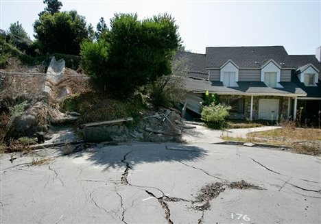
Image credit: TW
A major artery through southern Humboldt County was shut down on March 30 following a massive slide of mud and rocks, the California Highway Patrol said. Officials estimated that the stretch of Highway 101 could be closed for up to two weeks. Tons of debris tumbled and slid onto the highway about 5 miles north of Garberville causing the road to buckle under the weight. California Department of Transportation spokeswoman Julie East estimated the slide was about 183 meters wide and about 460 meters up the side of the slope.


San Francisco Bay area cities, Hercules and San Pablo, also declared states of emergency this week as mudslides threatened homes in those communities.
To the south, crews worked throughout the day trying to clear an 2.5 meters high pile of mud, trees and debris that blocked a remote neighborhood in the Uvas Canyon area of Santa Clara County. About 15 people were cut off by the slide, according to Michael Murdter, director of the county’s Office of Public Communication Roads and Airports Department. (SFExaminer)

When it comes to keeping U.S. Highway 101 open, Humboldt State University geology professor Lori Dengler said the county has millions of years working against it.
”It all has to do with geology and the fact that we’re living on top of 100 million years of subduction, this process that slowly scrapes off sediment and slaps it along the coast and creates this melange — this pudding of rock,” Dengler said, adding that the rock pudding — when saturated with rainfall — is highly susceptible to the forces of gravity. “That’s the problem, and that’s always the problem.”
National Weather Service meteorologist Nancy Dean said this has been the third wettest March on record, noting that the Eel River Camp near the slide measured in at 16.47 inches of rain.

 At the end of a soggy March, mudslides and erosion are cutting off homes and crumbling creek beds, stranding homeowners in Morgan Hill and forcing others to evacuate along Stevens Creek in Mountain View. At least three homes are at risk of sliding into the Peninsula creek after rains swallowed up entire backyards in a mobile home community. Residents, meanwhile, in the far south of the county near Uvas Canyon are waiting it out as crews try to dig out an 2.5 meteers high pile of mud and debris that buried Croy Road in one of the largest slides since 1998, when El Niño storms pounded California.
Meanwhile, a small mudslide prompted emergency crews to respond Monday night to a private road off Old Almaden Road next to southern San Jose. In Morgan Hill on Wednesday, work crews continued to chip away at the massive pile of trees, mud and debris blocking both lanes of Croy Road, the only access for a handful of residents who live in the rural area. Officials said 15 people were cut off from the outside world, but one resident pegged the number near 50. The biggest hurdle work crews face is that debris continues to fall as they haul away downed redwood trees, mud and rocks. (MercuryNews)

Butte County has declared a local emergency after saturated soil caused the ground to literally slide out from under two of the county’s roads. Oro Quincy Highway and Bardees Bar Road have been closed since March 29 when public works crews discovered sections of the road had developed cracks and started to drop.
Once the declaration is approved by state and federal officials the county will be eligible to receive funding for the repairs which could total more than half a million dollars. Nobody has been stranded by the closure of the roads. (KRCRTV)
About 33 homes in unincorporated Santa Cruz, near Scotts Valley, are affected by a landslide of shale and mud. With no road access, residents in the neighborhood cleared a footpath through the brush to be able to go back and forth through the area. The 61 meters wide landslide of shale and mud began around 10 a.m. on March 21st with rocks falling for hours, according to several residents, then, a major slide happened around 2 p.m., completely closing the road.
Geologists and the county public works department are monitoring the area and a plan to clear the road will soon be released. (Scott’sValleyPatch)

Reports are coming in that California has been flash flooding in areas around Capitola, and landslides in San Fransisco, and areas in San Pablo had flash floods as well. It is typical that flooding and large amounts of rain at this time of year. For a Sate, it has its problem with heat, fires, floods, and earthquakes, it seems the State has been dealt another walloping from the rain fall and today the mountains will be having heavy snow falls in the Rockies as it moves North East. (Adamite)
A powerful storm swept across California flooding part of Capitola, in Santa Cruz County, and forcing dozens of mobile homes residents to evacuate. The storm soaked hillsides along the coast threatening landslides as the rain continues. Flooding at the Pacific Cove Mobile Home Park in Capitola caused a sinkhole on March 25th. (Newshopper)


Sensors have been placed along local roads to monitor potential mudslides. The Department of Forestry installed the sensors after a mudslide in 1997 sent 35,000 truckloads of dirt onto Highway 50. The sensors are buried in the ground. Caltrans and the USGS use the real-time data from these sensors to detect potential slides. Geologists say that the saturated soil in 1997, are the same conditions we’re seeing this week. (CBS)
Landslide Overview Map of the Conterminous United States
Landslide Hazards Program
Southern California Landslides – An Overview (USGS)
Index to Landslide Maps in California
California Geological Survey – Landslides
TANC: Earthquakes and Landslides
Caltrans Corridor Landslides Maps

A landslide is defined as “the movement of a mass of rock, debris, or earth down a slope”. (Cruden, 1991). Landslides are a type of “mass wasting” which denotes any down slope movement of soil and rock under the direct influence of gravity. The term “landslide” encompasses events such as rock falls, topples, slides, spreads, and flows, such as debris flows commonly referred to as mudflows or mudslides (Varnes, 1996). Landslides can be initiated by rainfall, earthquakes, volcanic activity, changes in groundwater, disturbance and change of a slope by man-made construction activities, or any combination of these factors. Landslides can also occur underwater, causing tsunami waves and damage to coastal areas. These landslides are called submarine landslides.
 Failure of a slope occurs when the force that is pulling the slope downward (gravity) exceeds the strength of the earth materials that compose the slope. They can move slowly, (millimeters per year) or can move quickly and disastrously, as is the case with debris-flows. Debris-flows can travel down a hillside of speeds up to 200 miles per hour (more commonly, 30 – 50 miles per hour), depending on the slope angle, water content, and type of earth and debris in the flow. These flows are initiated by heavy, usually sustained, periods of rainfall, but sometimes can happen as a result of short bursts of concentrated rainfall in susceptible areas. Burned areas charred by wildfires are particularly susceptible to debris flows, given certain soil characteristics and slope conditions. It is estimated that between 25 and 50 people are killed by landslides each year in the United States. The worldwide death toll per year due to landslides is much higher. Most people are killed by rock fall, debris-flows, or volcanic landslides (called lahars). Debris flows occurring in December, 2003 killed 16 people in the San Bernardino, California area.
Material types are broadly categorized as either rock or soil, or a combination of the two for complex movements. Rock refers to hard or firm bedrock that was intact and in place prior to slope movement. Soil, either residual or transported material, is used in the engineering sense to mean unconsolidated particles or poorly cemented rock or aggregates. Soil is distinguished further on the basis of texture as debris (coarse fragments) or earth (fine fragments). The distinction between rock and soil, and the further distinction between debris and earth is most often based on interpretation of geomorphic characteristics within landslide deposits, but can also be inferred from geologic characteristics of the parent material described on maps or observed in the field.
Landslide movements are interpreted from the geomorphic expression of the landslide deposit and source area, and are categorized as falls, topples, spreads, slides, or flows. Falls are masses of soil or rock that dislodge from steep slopes and free-fall, bounce, or roll downslope. Topples move by the forward pivoting of a mass around an axis below the displaced mass. Lateral spreads, commonly induced by liquefaction of material in an earthquake, move by horizontal extension and shear or tensile fractures. Slides displace masses of material along one or more discrete planes. In rotational sliding the slide plane is curved and the mass rotates backwards around an axis parallel to the slope; in translational sliding the failure surface is more or less planar and the mass moves parallel to the ground surface. Flows mobilize as a deforming, viscous mass without a discrete failure plane. More than one form of movement may occur during a failure, in which case the movement is classified as complex if movements occur sequentially and composite if they do not.
TYPES OF LANDSLIDES

ROCK SLIDE: A landslide involving bedrock in which the rock that moves remains largely intact for at least a portion of the movement. Rock slides can range in size from small and thin to very large and thick, and are subject to a wide range of triggering mechanisms. The sliding occurs at the base of the rock mass along one to several relatively thin zones of weakness, which are variably referred to as “slide planes,” “shear surfaces,” “slip surfaces,” “rupture surfaces,” or “failure surfaces.” The sliding surface may be curved or planar in shape. Rock slides with curved sliding surfaces are commonly called “slumps” or “rotational slides,” while those with planar failure surfaces are commonly called “translational slides,” “block slides,” or “block glides.” Rock slides that occur on intersecting planar surfaces are commonly called “wedge failures.”
Rock slides commonly occur on relatively steep slopes in competent rocks. Slope gradients are commonly from 35% to as steep as 70%. Movement of an intact rock mass along a curved slide plane leads to a steep, arcuate headscarp at the upper boundary of the slide. Immediately below the headscarp is a block that is commonly rotated so that it is less steep than the surrounding hill slopes. Below the bench, the slide mass may be intact with a similar gradient to the surrounding slopes or may have additional scarps and benches. The lower parts of the slopes may bulge outward and be steeper that the surrounding slopes.

Diagram by J. Appleby, R. Kilbourne, and
C. Wills after Varnes, 1978
EARTH FLOW: A specific type of Soil Flow landslide where the majority of the soil materials are fine-grained (silt and clay) and cohesive. The material strength is low through much of the slide mass, and movement occurs on many discontinuous shear surfaces throughout the landslide mass. This movement along numerous internal slide planes disrupts the landslide mass leading to cumulative movement that resembles the flow of a viscous liquid characterized by a lumpy, or “hummocky” slope morphology. The lower parts of an earth flow usually bulge outward and are steeper than adjacent slopes.
Earth flows commonly occur on moderately steep slopes. Slope gradients are commonly from 10% to as steep as 30%, although steeper slopes may be found in headscarp and toe areas.
Earth flows typically are initiated by periods of prolonged rainfall and sometimes don’t initiate until well after a storm or the rainy season has passed. They are characteristically slow moving, in the millimeters or centimeters per day range, and may continue to move for a period of days to weeks after initiating.

Diagram by J. Appleby, R. Kilbourne, and
C. Wills after Varnes, 1978
DEBRIS SLIDE: A slide of coarse-grained soil, most common in unconsolidated sandy or gravelly units, but also are common in residual soils that form from in-place weathering of relatively hard rock. Owing to the granular constituents, overall strength of the debris slide mass generally is higher than that of earth flows, but there may be a very low strength zone at the base of the soil or within weathered bedrock. Debris slides typically move initially as shallow intact slabs of soil and vegetation, but break up after a short distance into falls and flows. Movement of the slide mass as a shallow slab leads to a smooth, steep, commonly curved scar. The debris is deposited at the base as a loose hummocky mass, although the deposit may be rapidly removed by erosion.
Debris slides commonly occur on very steep slopes, as steep as 60% to 70%, usually in an area where the base of a slope is undercut by erosion. Debris slides form steep, un-vegetated scars which are likely to remain un-vegetated for years. Re-vegetated scars can be recognized by their steep slopes, and a shallow amphitheater morphology.
A single heavy rainstorm or series of storms may deliver enough rain to trigger debris slides. Individual debris slides may move at rates ranging from meters per day to meters per minute. Debris slide scars are extremely steep and therefore are very sensitive to renewed disturbance. Natural erosion at the base of debris slide scars may trigger additional slides. Cutting into the base of a debris slide scar may also trigger renewed slides. Even without additional disturbance, debris slide scars tend to ravel and erode, leading to small rock falls and debris slides from the same slope.

Diagram by J. Appleby and R. Kilbourne, CGS
DEBRIS FLOW: A Soil Flow where the majority of the materials are coarse-grained (fine sand to boulder size particles) and non-cohesive. Debris flows are most often triggered by intense rainfall following a period of less intense precipitation, or by rapid snow melt. High pore water pressures cause the soil and weathered rock to rapidly lose strength and flow downslope. Debris flows can move very rapidly, at rates ranging from meters per hour to meters per second and travel relatively long distances, making them a significant threat to life and property.
Debris flows commonly begin as a slide of a shallow mass of soil and weathered rock. Their most distinctive landform is the scar left by the original shallow slide. The path of the debris flow may be marked by a small drainage that has been stripped of vegetation. The debris flow may not leave any deposit if it flows directly into a larger creek and is immediately eroded away. Many debris flow deposits are ephemeral, but in some cases successive debris flows may deposit material in the same area thereby forming a debris fan, which resembles a small, steep alluvial fan.
Individual debris flows typically are small in areal extent and their deposits are relatively thin. Evidence of past debris flow movements often is masked by vegetation growth which can cover the surface rapidly, sometimes within a few years, making them difficult to identify using aerial photographic and field reconnaissance methods. Therefore, only the larger and more recent debris flows typically are identified and included on landslide inventory maps

Diagram modified after Colorado Geological Survey
ROCK FALL: A landslide where a mass of rock detaches from a steep slope by sliding, spreading or toppling and descends mainly through the air by falling, bouncing or rolling. Intense rain, earthquakes or freeze-thaw wedging may trigger this type of movement.
Rockfalls occur on steep slopes of hard, fractured rock. The scar left by a rockfall on the slope may be no more apparent than an area of rock that is less weathered than the surrounding rocks. Rockfall deposits are loose piles of rubble that may be easily removed by erosion. Because neither the scar nor the deposit are distinctive, and because the most frequently occurring rockfalls are typically small, individual rock falls are usually not shown on regional-scale (1:24,000 and smaller) landslide maps.
Though infrequent, moderate- to large-volume rockfalls can be extremely dangerous and sometimes fatal. Large slabs of rock impacting a hard ledge after a long drop can rapidly break apart, leading to air entrainment and long runouts, induced airblasts, airborne projectiles (flyrock) and severe dust clouds.

Worldwide Overview of Large Landslides of the 20th and 21st Centuries
Significant Landslide Events in the United States
More media coverage:
Hercules: Oozing hillside threatens 8 homes (SFGate)
Mudslide shuts down Hwy 101 through Humboldt Co. (SFExaminer)
USGS Keeping A Close Eye On Mudslide Sensors (CBS Sacramento)
101 shut down by landslide (Times Standard)
Collapsing Roads Lead to Emergency Declaration (KRCRTV)
101 hit by mountainside collapse: California’s epidemic of landslides continue (TheExtinctionProtocol)
Landslide shuts Californian Highway 1 as a big chunk falls into the sea (News1)
California, US: Landslide Forces Evacuation of Ranch (SoTT)
——————-
http://landslides.usgs.gov/recent/
Commenting rules and guidelines
We value the thoughts and opinions of our readers and welcome healthy discussions on our website. In order to maintain a respectful and positive community, we ask that all commenters follow these rules.