
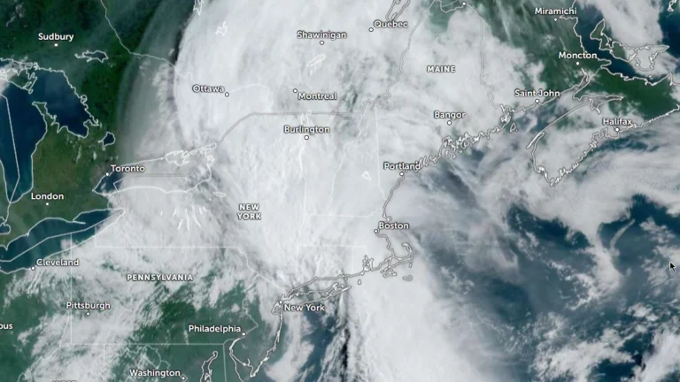
• Moderate Risk of excessive rainfall issued for parts of the Northeast, U.S.

    The Weather Prediction Center (WPC) has issued a Moderate Risk (Level 3 of 4) of excessive rainfall for portions of the northeastern United States on Wednesday, July 29, 2026. Repeated rounds of heavy rainfall could produce significant and potentially life-threatening flooding across parts of eastern New York, western Massachusetts, southern Vermont, and adjacent areas of Connecticut.
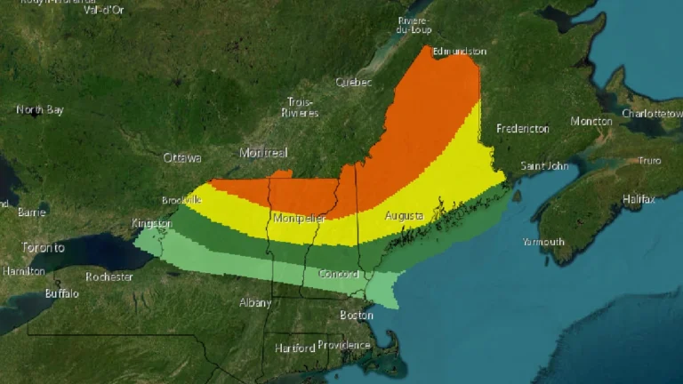
  • Enhanced Risk of severe thunderstorms issued for northern New York and New England

    The Storm Prediction Center (SPC) has placed parts of the New England region under an Enhanced Risk (Level 3 of 5) for severe thunderstorms on Tuesday, July 14, 2026. The greatest threat covers northern New York and northern New England, where thunderstorms are expected to produce widespread damaging wind gusts, large hail, and a few tornadoes. Forecasters also say that one or two strong tornadoes are possible if conditions develop as expected.

  • New storm threat for Vermont in wake of severe historic floods, U.S.

    Just as Vermont starts to recover from its worst flooding in nearly a hundred years, the storm system that triggered tornadoes in Chicago on July 12, 2023, is moving eastward, threatening the region with another deluge. As the state’s residents and officials brace for the impending downpour, there are fears that the additional rainfall will exacerbate the already dire situation.

  • Historic rainfall triggers worst Vermont flood in nearly a century, U.S.

    A historic downpour on Monday, July 10, 2023, unleashed a torrent of over 228.6 mm (9 inches) of rain across Vermont, leading to devastating floods, the worst the region has experienced in almost a century. The capital city, Montpelier, found itself in a precarious position as the Wrightsville Dam teetered on the brink of its capacity, a scenario unseen since its construction.
