
Remembering the 1920 Haiyuan earthquake, the second-deadliest of the twentieth century
An M7.8–M7.9 earthquake struck Haiyuan County, China, at 19:05 local time (LT) on December 16, 1920, killing an estimated 259 000 to 273 400 people and triggering tens of thousands of landslides across the Ningxia–Gansu region. This was the world’s second-deadliest earthquake of the twentieth century.
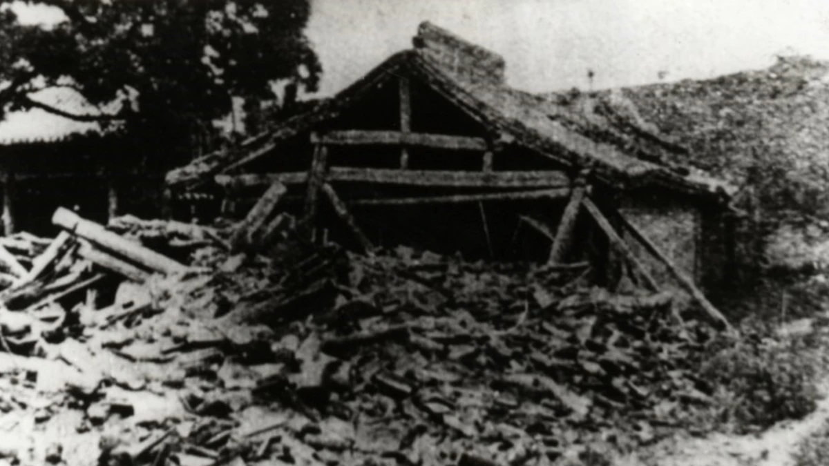
The ruins of a temple in the county seat of Jingning County, Gansu, in early 1921. Credit: Jingning County Archives
At 19:05 LT on December 16, 1920, the ground beneath Haiyuan County heaved and fractured. Modern analysis places the event between M7.8 and M7.9, making it the largest continental earthquake of the twentieth century in China. The rupture followed the left-lateral Haiyuan Fault, which runs along the northern edge of the Tibetan Plateau.
Surface breaks extended for about 230–237 km (143–147 miles), with offsets measured between 4–8 m (13–26 feet). Intensity reached XII on the Modified Mercalli scale, indicating total destruction over a zone more than 200 km (124 miles) wide.
The energy released by the rupture propagated across unmonitored terrain, leaving few direct instrumental records. Distant European seismographs detected the waves, revealing the event’s extraordinary magnitude and confirming that deep continental faults could rival coastal megathrusts in strength.
Across the epicentral area, the ground fractured in parallel strike-slip faults and subsidiary thrusts. These scars remain visible today and are used to model how similar fault systems in continental interiors accumulate and release strain.
A human tragedy on an unimagined scale
Reconstructions by the China Earthquake Administration and the Chinese Academy of Sciences estimate 259 000 to 273 400 fatalities, while earlier records listed about 234 000. Haiyuan County alone lost around 73 000 residents.
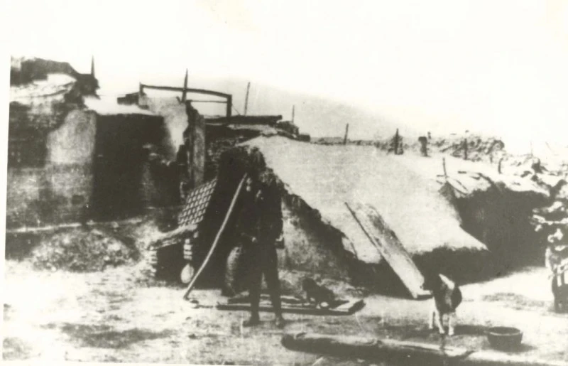
Most victims were killed in seconds. Traditional cave dwellings, or yaodong, were excavated into loess cliffs that collapsed instantly under strong shaking. Unreinforced adobe homes disintegrated under repeated shocks, burying occupants beneath tonnes of soil. Aftershocks lasting for days brought additional collapses and panic.
Winter intensified the suffering. Temperatures dropped below −15°C (5°F). Tens of thousands of survivors slept outdoors without heat or food, and many froze to death. Political division under the early Republic of China delayed organized relief, leaving the region isolated for weeks.
The earthquake destroyed more than 50 towns and hundreds of villages across Ningxia, Gansu, and Shaanxi. Roads were blocked by landslides, rivers were dammed, and telegraph lines were severed. When rescue teams finally arrived, they found entire communities erased. Aftershocks continued for months, forcing survivors to abandon shelters and live in the open through the cold season.
Loess slopes that turned to liquid
The Loess Plateau’s unique geology magnified the destruction. Loess is fine, wind-blown silt that can stand nearly vertical when dry but collapses when shaken. During the 1920 earthquake, these deposits failed catastrophically in a phenomenon now known as loess liquefaction.
Thousands of slopes gave way at once. Detailed mapping identifies about 3 700 large landslides in the highest-intensity zones, while remote-sensing studies show more than 50 000 failures across 40 000 km² (15 400 mi²). Some slides travelled over 1 km (0.6 miles), burying entire villages beneath tens of metres of debris.
At Sujiahe in Xiji County, a massive slide engulfed the valley floor, destroying every structure. The weight of debris dammed nearby rivers, forming temporary lakes that later burst and caused flooding downstream. Witnesses described the mountains as “walking,” a phrase that entered Chinese disaster records.
Researchers estimate around 32 000 deaths were caused directly by landslides, though historical uncertainty remains. Even today, the distribution of 1920 slides guides hazard-susceptibility models for the Loess Plateau. Laboratory tests on loess cores show that failure can occur under peak accelerations below 0.1 g, confirming the terrain’s extreme fragility.
Fault movement and seismic energy
The Haiyuan Fault marks a key boundary between the Tibetan Plateau and the Ordos Block. Its left-lateral motion accommodates east-west compression. In 1920, several fault segments ruptured in sequence, creating a continuous break about 230 km (143 miles) long.
Field investigations report lateral displacements of 4–8 m (13–26 feet). Trenching reveals earlier large earthquakes thousands of years apart, suggesting long recurrence intervals for events of this scale. Historical intensity maps based on eyewitness reports show an east-west elongation of severe shaking, consistent with rupture directivity.
In valleys filled with loess and soft sediments, shaking was amplified, widening the area of total destruction. Data from this earthquake remains central to Chinese seismic-hazard zoning. Modern ground-motion simulations calibrated to Haiyuan are used to test the country’s earthquake early-warning systems and building-code thresholds.
Records, recollections, and rediscovery
Witnesses described waves passing through the ground and dust clouds that turned day to night. Provincial records compiled in 1922 listed hundreds of temples and thousands of homes lost. Missionaries in Lanzhou and Xi’an reported continuous aftershocks for weeks.
Seismographs in Europe and North America recorded the earthquake, proving that continental ruptures could generate global signals. The data helped early seismologists refine magnitude calculations and contributed to the creation of regional intensity scales in Asia.
Historical documentation from 1920 remains a key dataset for understanding pre-instrumental quakes. Researchers continue to combine these accounts with field measurements to reconstruct how energy propagated and how soils responded. This blend of historical and geological evidence made Haiyuan a cornerstone of modern earthquake science in China.
Enduring legacy and continuing risk
The Haiyuan earthquake changed how scientists view continental interiors. It showed that major faults far from subduction zones can release enormous energy when stress exceeds crustal strength.
Loess continues to define the seismic risk of north-west China. Paleoseismic studies along the Haiyuan Fault reveal that ancient earthquakes produced similar landslide patterns, confirming a repeating link between fault rupture and slope collapse. These findings are now built into hazard-zoning maps used for planning and construction.
Many yaodong dwellings remain in use today, though local governments encourage reinforcement or relocation to safer structures. Monitoring networks now cover the entire region, using GPS and radar interferometry to detect ground deformation that could precede future quakes.
More than a century later, the memory of 1920 persists in the landscape and in scientific practice. The event stands as both a human catastrophe and a guide to understanding seismic behavior in the heart of a continent.
References:
1 Haiyuan earthquake, 1920 – Disaster History – Accessed December 12, 2025

I’m a science journalist and researcher at The Watchers, contributing to the Epicenter edition, where I cover peer-reviewed scientific research and emerging discoveries across Earth and space sciences. With a background in astronomy and a passion for environmental science, I’ve worked in shark and coral conservation in Fiji, conducting reef and shark-behavior research, contributing to mangrove restoration, and earning PADI Open Water and Coral Reef Certifications. I bring a blend of scientific rigor and storytelling to illuminate the discoveries shaping our planet and beyond.
Commenting rules and guidelines
We value the thoughts and opinions of our readers and welcome healthy discussions on our website. In order to maintain a respectful and positive community, we ask that all commenters follow these rules.