• Prolonged atmospheric river brings Flood Watch and high avalanche danger to British Columbia as some areas face up to 400 mm (15.7 inches) of rain

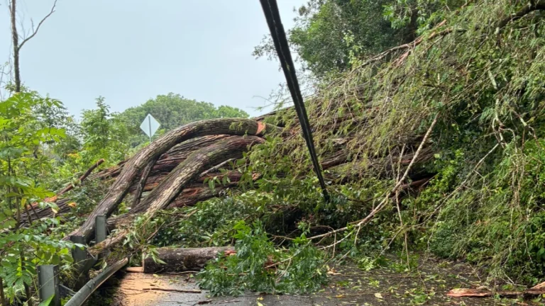
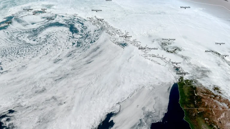
    A prolonged atmospheric river is affecting British Columbia this week, with Flood Watch, multiple rainfall warnings, and Special Weather Statements in effect across parts of the province. Some coastal areas could receive up to 400 mm (15.7 inches) of rain, while heavy rain on existing snowpack is increasing the risk of flooding, washouts, landslides and dangerous avalanche conditions.
  • Atmospheric river forecast to stall over Washington, raising flood risk through March 20

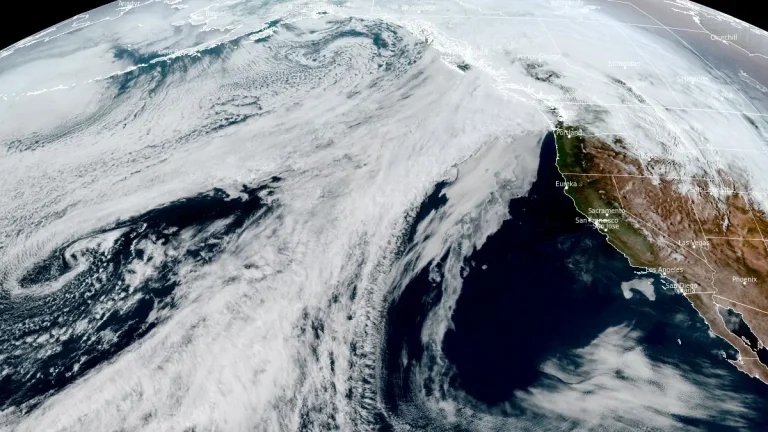
    A stalled atmospheric river over the Pacific Northwest is forecast to deliver 127–254 mm (5–10 inches) of precipitation to parts of Washington between March 17 and 20, 2026. High freezing levels above 2 100 m (7 000 feet) will result in rainfall across most elevations, accelerating snowmelt and increasing the likelihood of riverine flooding.

  • Tropical Cyclone Narelle forms in Coral Sea, forecast to intensify before Queensland impact, Australia

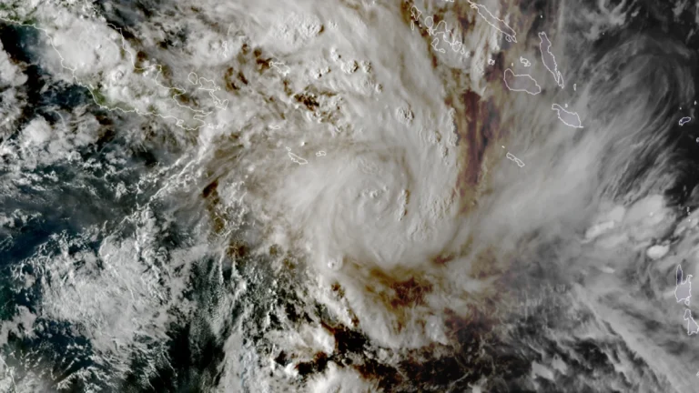
    ropical Cyclone Narelle developed in the northern Coral Sea on Tuesday, March 17, 2026, with sustained winds of 85 km/h (53 mph) and gusts to 120 km/h (75 mph). The system is moving west-southwest toward Far North Queensland and is forecast to intensify to severe tropical cyclone strength before approaching the coast later this week, with damaging winds, heavy rainfall, and coastal flooding being forecast.

  • Dust storm triggers multi-vehicle crash on U.S. 287 in northern Texas

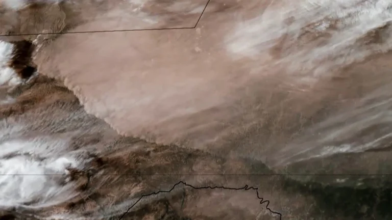
    A multi-vehicle crash occurred on U.S. Highway 287 near Quanah in Hardeman County, northern Texas, on March 15, after strong winds generated blowing dust that rapidly reduced visibility and created dangerous driving conditions. Video footage recorded in the area shows dense dust moving across the highway as vehicles traveled through the corridor. Visibility deteriorated rapidly…

  • Rare tornado kills 2 in Odisha’s Mayurbhanj district, India

    A rare tornado struck near Tato in Odisha’s Mayurbhanj District on March 15, 2026, killing at least two people and injuring 29 others who had to be hospitalized. More than a hundred homes have reportedly been damaged and destroyed. Local reports mention this was the widest tornado to have ever struck Odisha.

  • Rare Moderate Risk (4/5) issued for Mid-Atlantic as severe thunderstorms raise threat of damaging winds and tornadoes

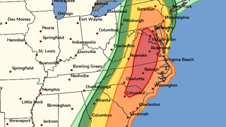
    A Moderate Risk (Level 4 of 5) for severe thunderstorms has been issued across parts of the Mid-Atlantic United States for Monday, March 16, 2026, as a powerful multi-hazard storm threatens over 100 million people across the U.S. Fast-moving storms capable of producing damaging winds and a few strong tornadoes are forecast to develop from the Carolinas into Virginia and Maryland during the afternoon and evening hours. A Moderate Risk is an unusually high severe weather category for the Mid-Atlantic and is not issued often for this region. The National Weather Service office serving the Washington, D.C. area described the setup as a “quite rare Day 2 Moderate Risk area” ahead of the event.

  • Snowstorm causes spinouts and closure of I-90 at Snoqualmie Pass, Washington

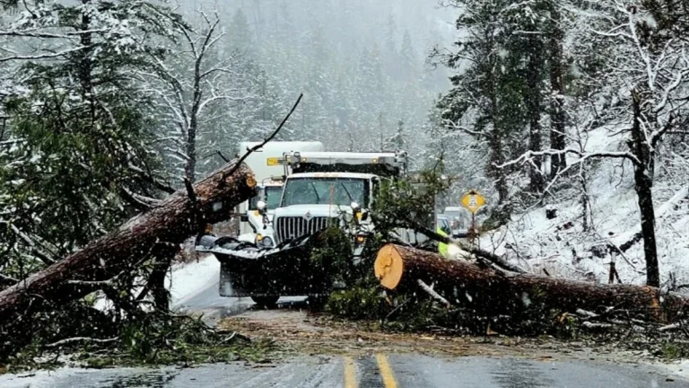
    Heavy snowfall caused multiple vehicle spinouts and crashes on I-90 at Snoqualmie Pass in Washington, forcing authorities to close the highway in both directions on March 13 and keep it closed overnight into March 14, 2026. Snoqualmie Pass received about 56 cm (22 inches) of new snow overnight, while the Summit at Snoqualmie reported about 107 cm (42 inches) over 48 hours during the storm.

  • Major winter storm brings blizzard conditions to Northern Plains and Great Lakes

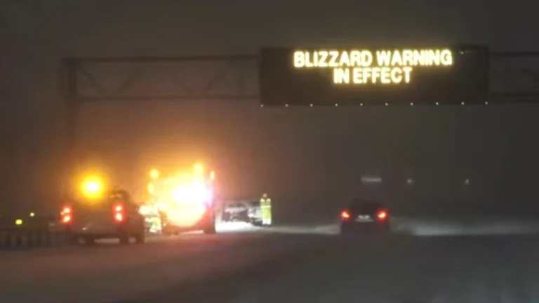
    A major winter storm is affecting the Northern Plains and the western Great Lakes in the United States on March 15–16, bringing heavy snowfall, strong winds, and widespread blizzard conditions. Snowfall rates of up to 7.5 cm (3 inches) per hour and wind gusts of up to 95 km/h (60 mph) are forecast across parts of eastern South Dakota, Wisconsin, and Michigan as a strengthening low-pressure system moves toward southeastern Canada. Travel conditions are expected to become extremely dangerous across the affected region.

  • Freeze Warnings and Watches issued across parts of Texas, Oklahoma, Arkansas, Louisiana, Mississippi, Alabama, Missouri, and Tennessee

    Freeze Warnings and Watches have been issued for parts of eight southern U.S. states as sub-freezing temperatures are forecast from March 16 into March 17, 2026. Temperatures could fall as low as −12°C (10°F) in the coldest parts of Arkansas, while many other areas are expected to bottom out in the −7°C to −2°C (19 to 28°F) range. Frost, freeze conditions, and gusty post-frontal winds may damage sensitive vegetation and, in the coldest areas, affect exposed outdoor plumbing.

  • Over 130 000 customers lose power across Hawaii as Kona low brings damaging winds and flash flooding

    Over 130 000 electricity customers across Hawaii lost power on March 13, 2026, as a powerful Kona low brought heavy rainfall, damaging winds, and thunderstorms to the islands. Wind gusts up to 126 km/h (78 mph) were recorded on Oʻahu while forecasters warned rainfall totals of 250–500 mm (10–20 inches) could raise the risk of flash flooding.