• Typhoon Sinlaku forecast to reach super typhoon strength before nearing the Marianas, Typhoon Warnings issued for Rota, Tinian and Saipan

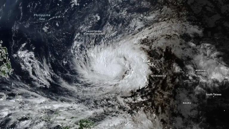
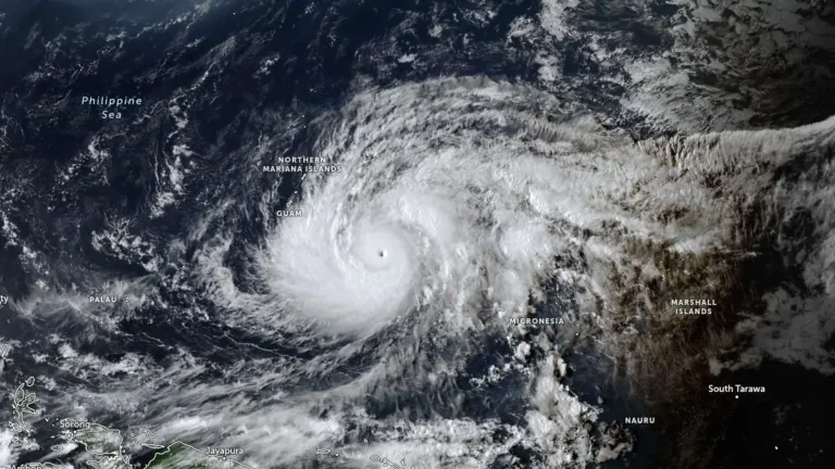
    Typhoon Sinlaku intensified into a dangerous major typhoon over the western Pacific on April 12, 2026, as officials issued typhoon warnings for Rota, Tinian and Saipan, and a tropical storm warning for Guam. The storm was forecast to strengthen further on April 13, reaching super typhoon strength, before nearing the Marianas, where destructive winds, coastal inundation, and flash flooding are possible from late April 13 into April 14.
  • Rare tornado touches down near Devipur in Akhnoor, Jammu and Kashmir

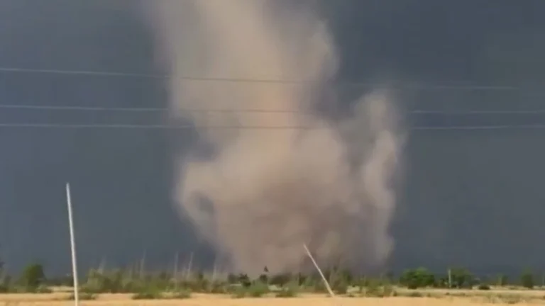
    A rare tornado was reported near Devipur in the Akhnoor area of Jammu district, Jammu and Kashmir, India, on April 11, 2026, during scattered afternoon thundershowers. Eyewitness videos showed a narrow funnel extending from the cloud base to a rotating dust plume at the surface, while preliminary reports indicated no damage, injuries, or casualties. Faizan Arif, a Kashmir-based weather analyst, described the Akhnoor tornado as a “never-before-witnessed” event in Jammu’s Akhnoor area.

  • Red wind warning and widespread severe weather alerts issued as Cyclone Vaianu approaches North Island, New Zealand

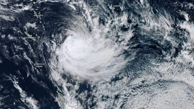
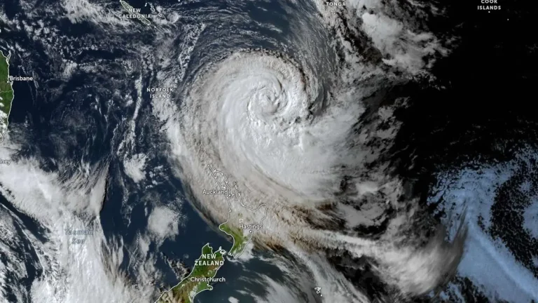
    Cyclone Vaianu is forecast to move south across New Zealand’s North Island on Sunday, April 12, 2026, bringing a multi-hazard threat, including damaging winds up to 140 km/h (87 mph), heavy rainfall, and coastal inundation risk. A Red Strong Wind Warning is in force for the Coromandel Peninsula and Great Barrier Island, with widespread Orange warnings and watches covering much of the North Island and upper South Island. Significant disruption to transport, power supply, and communities is expected.

  • Tropical Storm Sinlaku strengthens, rapid intensification forecast as it tracks toward Guam

    Tropical Storm Sinlaku formed on April 9, 2026, in the western Pacific and strengthened to 102 km/h (63 mph) by 15:00 UTC on April 10, approximately 904 km (562 miles) southeast of Andersen Air Force Base, Guam. The system is becoming more organized and is forecast to undergo rapid intensification while tracking toward the Mariana Islands, with a potentially dangerous passage near or over Guam.

  • Tropical Cyclone Vaianu expected to bring damaging winds and heavy rain to New Zealand this weekend

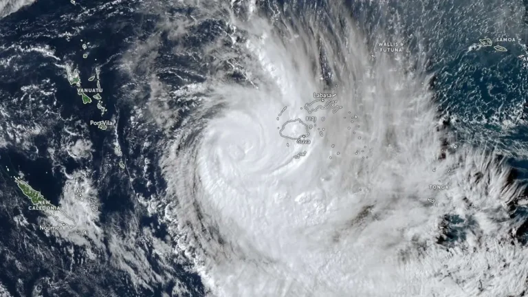
    Severe Tropical Cyclone Vaianu was located south of Fiji on April 8, 2026, producing localized flooding while weakening under strong wind shear. The system is forecast to transition into an extra-tropical system before moving toward New Zealand, where damaging winds, heavy rain, and hazardous coastal conditions are expected during the weekend of April 11-12.

  • Severe Tropical Cyclone Maila tracks toward Papua New Guinea and Queensland, Australia

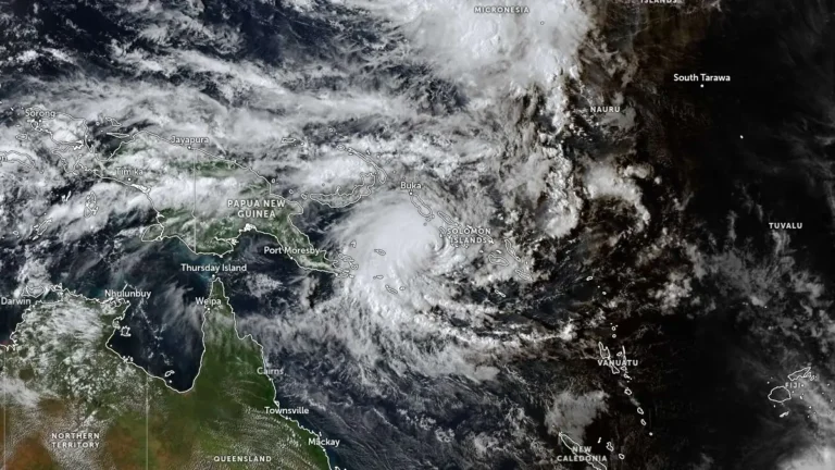
    Severe Tropical Cyclone Maila remained over the Solomon Sea at 06:00 UTC on April 8, 2026, with sustained winds of 165 km/h (103 mph) and a central pressure of 941 hPa, while beginning a gradual weakening trend after recent rapid intensification. The system is moving slowly northward at 6 km/h (3.7 mph) and is forecast to track west to southwest toward southeastern Papua New Guinea before entering the Coral Sea later this week.

  • Flood Watch issued across Hawaii as kona low system brings risk of heavy rain and flood

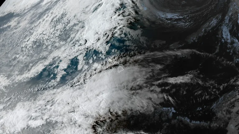
    The National Weather Service has issued a Flood Watch for all Hawaiian islands as a developing low-pressure system, described as a kona low, brings increasing moisture and instability to the region from Wednesday, April 8, through Friday, April 10, 2026. Excessive rainfall may lead to flash flooding, runoff impacts, and landslides across all major islands.

  • Severe Tropical Cyclone Vaianu affecting Fiji with heavy rain and flooding, forecast to move toward New Zealand

    Tropical Cyclone Vaianu reached Category 3 intensity near Fiji on April 7, 2026, generating heavy rainfall exceeding 140 mm (5.5 inches), flooding in low-lying areas, and strong winds. Authorities have issued multiple warnings across Fiji, including for flooding and dangerous marine conditions. The system is tracking southeast toward New Zealand, where severe weather impacts are forecast later this week.

  • Severe storms and Saharan dust batter Greece, leaving widespread disruption and 1 dead

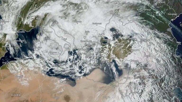
    A multi-day severe storm system, named Storm Erminio in Greek media, affected Greece in early April 2026, bringing heavy rainfall, strong winds, and Saharan dust that caused flooding, one fatality, multiple rescues, and widespread disruption to maritime and air transport. The hardest-hit areas included Attica, the Aegean islands, Crete, and parts of the Peloponnese.