• Spain sees wettest January–February in 47 years as Atlantic storms soak Iberian Peninsula

    Spain experienced an exceptionally wet winter between December 2025 and February 2026 as repeated Atlantic storms brought prolonged rainfall across the Iberian Peninsula. AEMET reported 323.2 mm (12.7 inches) of precipitation across peninsular Spain, equal to 171% of the 1991–2020 average, making it the country’s eighth wettest winter since 1961 and third wettest of the 21st century.

  • Prolonged atmospheric river brings Flood Watch and high avalanche danger to British Columbia as some areas face up to 400 mm (15.7 inches) of rain

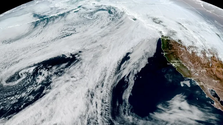
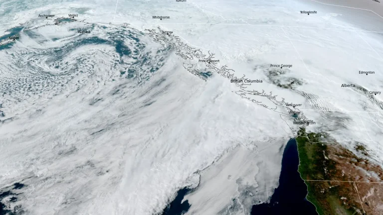
    A prolonged atmospheric river is affecting British Columbia this week, with Flood Watch, multiple rainfall warnings, and Special Weather Statements in effect across parts of the province. Some coastal areas could receive up to 400 mm (15.7 inches) of rain, while heavy rain on existing snowpack is increasing the risk of flooding, washouts, landslides and dangerous avalanche conditions.

  • Atmospheric river forecast to stall over Washington, raising flood risk through March 20

    A stalled atmospheric river over the Pacific Northwest is forecast to deliver 127–254 mm (5–10 inches) of precipitation to parts of Washington between March 17 and 20, 2026. High freezing levels above 2 100 m (7 000 feet) will result in rainfall across most elevations, accelerating snowmelt and increasing the likelihood of riverine flooding.

  • Tropical Cyclone Narelle forms in Coral Sea, forecast to intensify before Queensland impact, Australia

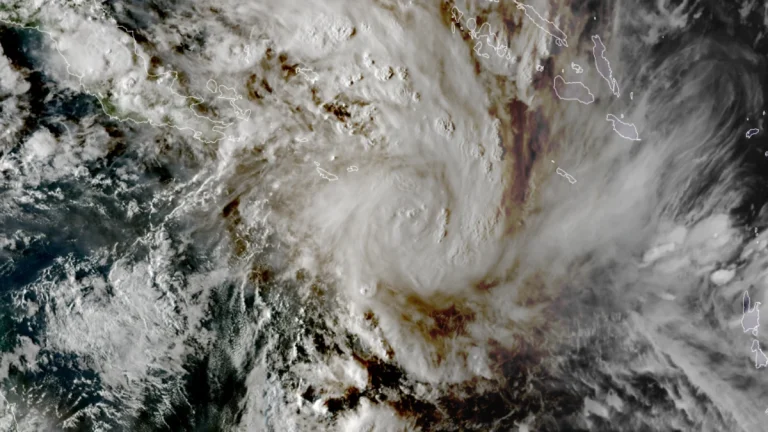
    ropical Cyclone Narelle developed in the northern Coral Sea on Tuesday, March 17, 2026, with sustained winds of 85 km/h (53 mph) and gusts to 120 km/h (75 mph). The system is moving west-southwest toward Far North Queensland and is forecast to intensify to severe tropical cyclone strength before approaching the coast later this week, with damaging winds, heavy rainfall, and coastal flooding being forecast.

  • Dust storm triggers multi-vehicle crash on U.S. 287 in northern Texas

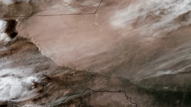
    A multi-vehicle crash occurred on U.S. Highway 287 near Quanah in Hardeman County, northern Texas, on March 15, after strong winds generated blowing dust that rapidly reduced visibility and created dangerous driving conditions. Video footage recorded in the area shows dense dust moving across the highway as vehicles traveled through the corridor. Visibility deteriorated rapidly…

  • Explosive eruption at Sheveluch volcano ejects ash to 10.4 km (34 000 feet), Russia

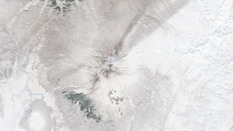
    Explosive activity at Sheveluch volcano on the Kamchatka Peninsula, Russia, produced a volcanic ash plume rising to approximately 10.4 km (34 000 feet) altitude at 11:20 UTC on March 16, 2026, drifting east across the North Pacific. Satellite imagery from Himawari-9 detected the ash cloud moving east at around 110 km/h (70 mph). The Aviation Color Code remains at Orange.

  • Rare tornado kills 2 in Odisha’s Mayurbhanj district, India

    A rare tornado struck near Tato in Odisha’s Mayurbhanj District on March 15, 2026, killing at least two people and injuring 29 others who had to be hospitalized. More than a hundred homes have reportedly been damaged and destroyed. Local reports mention this was the widest tornado to have ever struck Odisha.

  • Lava from Piton de la Fournaise enters the Indian Ocean after crossing RN2 coastal road, Réunion Island

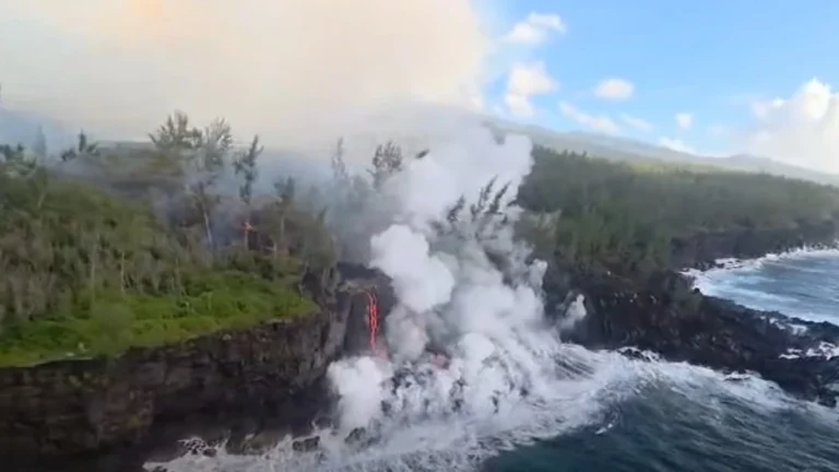
    Lava from an ongoing eruption at Piton de la Fournaise entered the Indian Ocean along the southeastern coast of Réunion Island at about 00:20 local time on March 16, 2026, after advancing downslope through the Grand Brûlé lava field and crossing the RN2 coastal road several days earlier, producing steam plumes and localized hazards where molten rock met seawater.

  • Schools closed, ashfall reported after explosive eruption at Kanlaon volcano, Philippines

    An explosive eruption occurred at Kanlaon volcano on Negros Island, central Philippines, at 18:07 LT (10:07 UTC) on March 15, 2026, producing an ash plume rising more than 5 km (3.1 miles) above the summit and depositing ashfall across at least 54 barangays in 11 local government units. Monitoring data associated with the event recorded nine volcanic earthquakes and sulfur-dioxide emissions of about 1 085 tonnes per day. Authorities also reported vegetation fires on the volcano’s slopes and suspended classes in several municipalities on March 16 as a precaution.