
Strong M6.1 earthquake hits New Ireland, Papua New Guinea
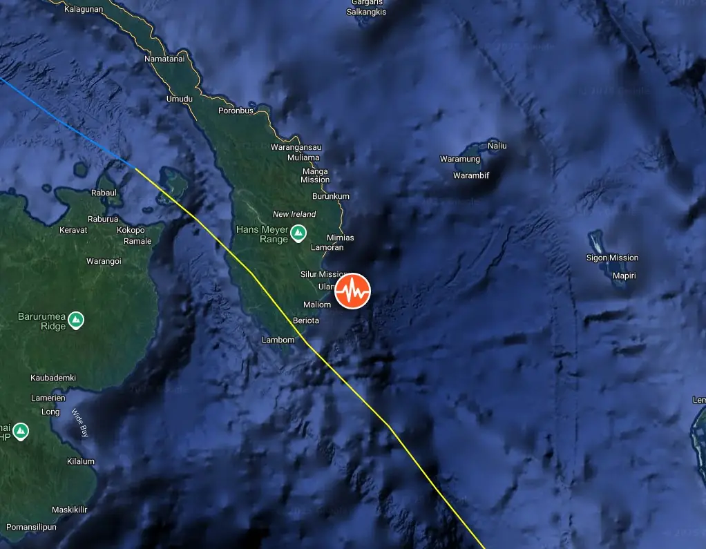
A strong earthquake registered by the USGS as M6.1 struck near the New Ireland Region, Papua New Guinea, at 03:47 UTC (13:47 local time) on April 12, 2025. The agency is reporting a depth of 62 km (38 miles). ESMC is reporting the same depth and magnitude.
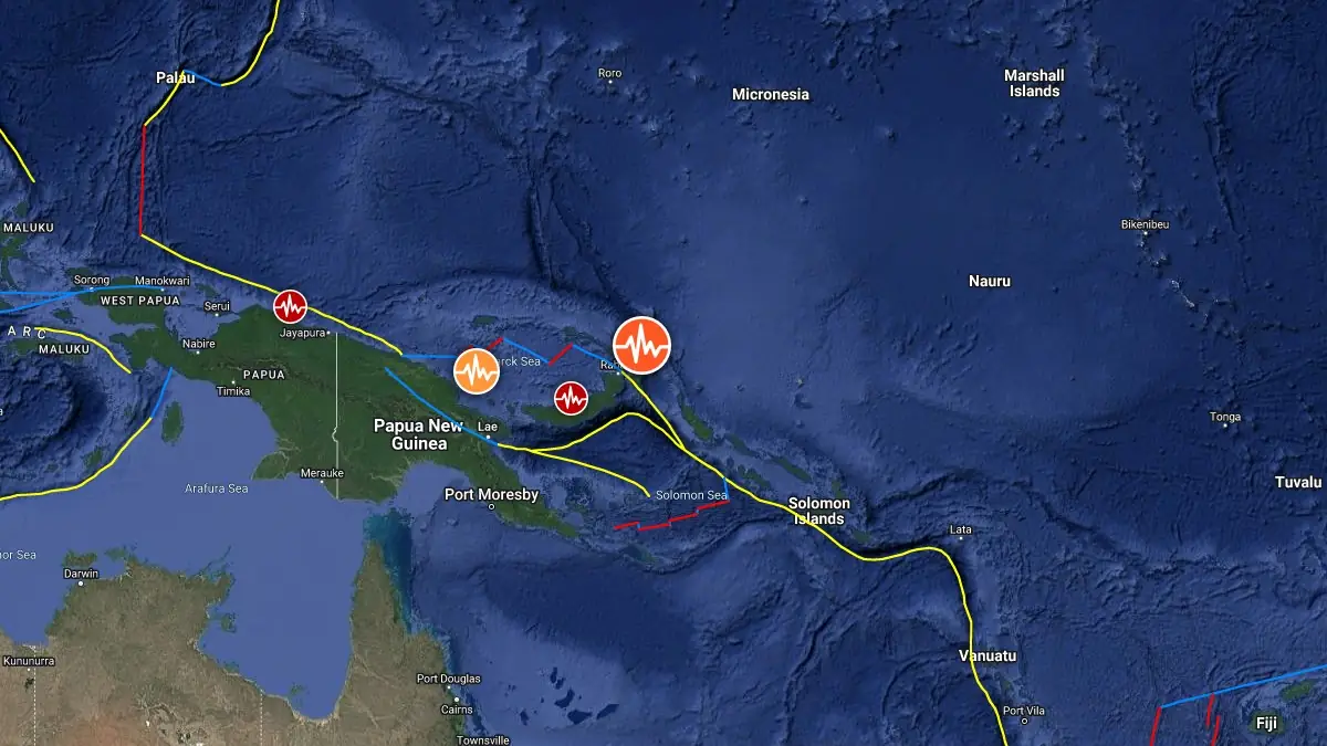
Image credit: TW SAM
The epicenter was located approximately 105 km (65 miles) ESE of Kokopo (population 26 000), 120 km (75 miles) ESE of Rabaul (population 8 000), and 317 km (197 miles) WNW of Arawa (population 40 266), Papua New Guinea.
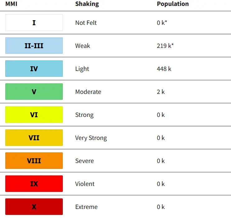
2 000 people are estimated to have felt moderate shaking, and 448 000 may have felt light shaking.
There is no tsunami threat from this earthquake.
The USGS issued a Green Alert for estimated fatalities and economic losses due to the quake. There is a low likelihood of casualties and damage.
Overall, the population in this region resides in structures that are a mix of vulnerable and earthquake-resistant construction. The predominant vulnerable building types are informal (metal, timber, GI etc.) and unreinforced brick masonry construction.
Recent earthquakes in this area have caused secondary hazards, such as landslides, that might have contributed to losses.
Estimated population exposure to earthquake shaking
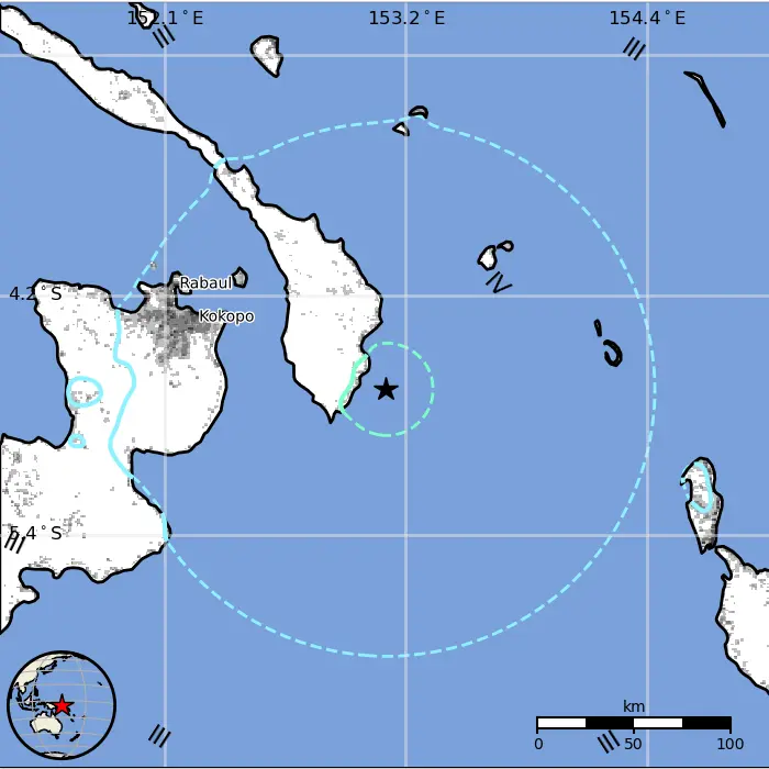
Regional seismicity

References:
1 M6.1 Papua New Guinea – USGS – April 12, 2025
2 M6.1 Papua New Guinea – EMSC – April 12, 2025

I am an Assistant Editor and Severe Weather & Science Journalist at The Watchers, specializing in real-time severe weather coverage, geophysical event reporting, and research-driven scientific analysis. You can reach me at rishav(at)watchers(.)news.
Commenting rules and guidelines
We value the thoughts and opinions of our readers and welcome healthy discussions on our website. In order to maintain a respectful and positive community, we ask that all commenters follow these rules.