
Brazil’s central and southern regions brace for intense storm activity this week
Isolated storms, ranging from moderate to severe, are forecast in several regions of Brazil as November 2024 concludes, driven by hot, humid tropical air creating unstable atmospheric conditions.
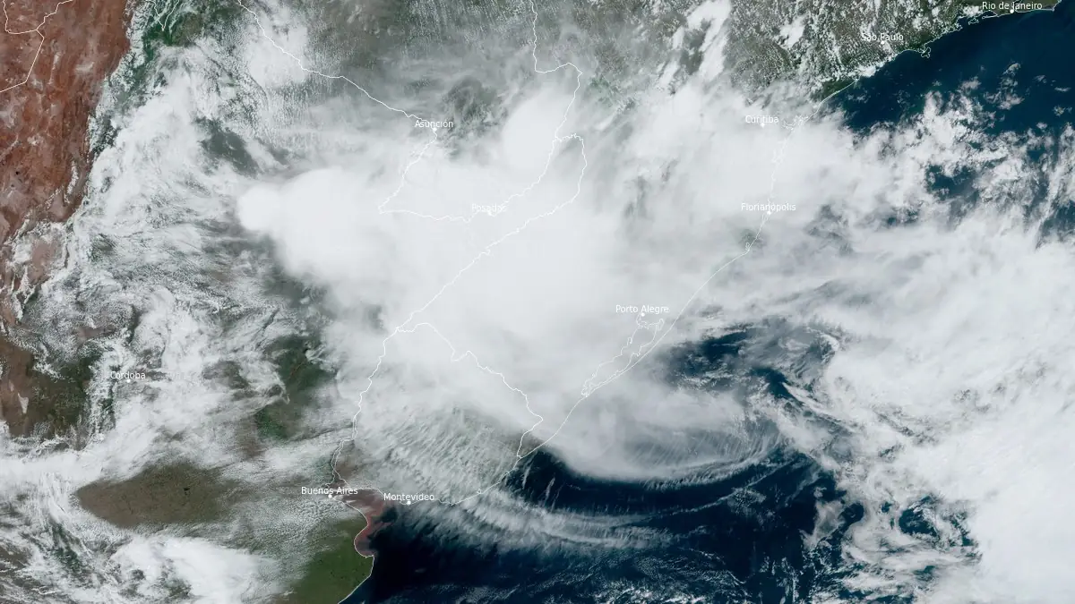
Image credit: NOAA/GOES-West, RAMMB/CIRA, The Watchers. Acquired at 14:30 UTC on November 28, 2024
Isolated storms are forecast in various regions of Brazil over the next several days as November concludes. These storms, ranging from moderate to severe in intensity, are linked to the presence of hot and humid tropical air, which is creating atmospheric instability.
The regions most at risk include the South, Central-West, and Southeast, where daytime heating and atmospheric conditions will favor storm development.
The storms are expected to develop primarily in the afternoon and evening. This pattern, driven by rising air (convection) caused by daytime heating, results in the formation of large vertical clouds such as Tower Cumulus (TCu) and Cumulonimbus (Cb), which can reach heights exceeding 10 km (6.2 miles). These clouds often produce localized thunderstorms that, although isolated, may be intense.
High temperatures and increased humidity act as fuel for these storms. Low atmospheric pressure further increases the potential for severe weather. On hotter days, the likelihood of thunderstorms rises, provided the air is not excessively dry. This week, atmospheric instability across Brazil’s Central-South regions is expected to result in a higher frequency of these localized weather events.
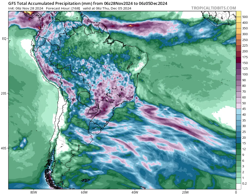
Instability will be most pronounced in the latter half of the week and during the weekend. The states most at risk for severe storms include:
- South Region: Northern areas of Rio Grande do Sul, Santa Catarina, and especially Paraná are likely to experience strong isolated storms later this week.
- Southeast Region: São Paulo is at heightened risk, particularly on Thursday and Friday. On Thursday, extreme heat with temperatures expected to exceed 35 °C (95 °F) in Greater São Paulo, combined with rising humidity, is likely to trigger strong storms in the afternoon and evening. The risk increases on Friday, with forecasts predicting multiple storm cells capable of heavy rainfall.
- Central-West Region: States in this region are also at elevated risk as atmospheric instability builds.
Central-South states are likely to experience strong wind gusts, hail, and lightning. The most significant risk is localized heavy to torrential rainfall with very high volumes over short periods.
References:
1 CENÁRIO DE RISCO: TEMPORAIS ATINGEM VÁRIOS ESTADOS NOS PRÓXIMOS DIAS – Metsul – November 27, 2024

Rishav Kothari is Editor-in-Chief of The Watchers, where he runs the newsroom and covers earthquakes, volcanoes, severe weather and space weather.
Earlier reporting
Nothing on Watchers was published in the last 24 hours. These are older articles.
- CPC posts a slight risk of heavy rain from the Gulf Coast to the Northeast urban corridor November 25-29, and a moderate risk of West Coast wind and Sierra snow on November 25
- The storms drenching California this week are fed by a river in the sky, a band of water vapor that can carry up to 15 times the flow of the Mississippi River, and this winter’s near-record El Niño could keep aiming more of them at the West Coast
- Atmospheric river brings moderate risk of heavy rain, mountain snow and high winds to northern California and southwest Oregon on November 24-25
- 190 mm of rain and 131 km/h gusts hit New Zealand's South Island, flooding West Coast highways
