
Small earthquake swarm near Santa Catalina Island, Southern California
A series of small earthquakes, including one with a magnitude of 3.6, struck off the coast of Southern California near Catalina Island on October 20 and 21, 2024.

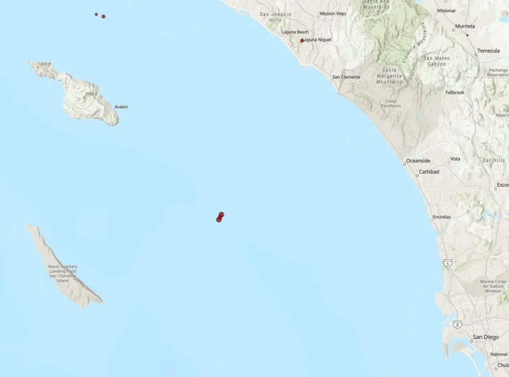
Image credit: TW/SAM, ESRI
- These earthquakes are part of the region’s ongoing seismic activity due to the Pacific-North American plate boundary, highlighting Southern California’s high earthquake risk.
- Southern California holds the highest earthquake risk in the U.S., with the region projected to bear half of the nation’s potential financial losses from seismic events.
A series of small earthquakes struck off the shore of Santa Catalina Island on October 20 and 21, the greatest of which was M3.6 at 00:32 UTC on October 21 at a depth of 5.8 km (3.6 miles).
The vibrations started with an M3.2 earthquake at 23:11 UTC, located 43 km (27 miles) from Avalon at a depth of 5.8 km (3.6 miles) and followed by an M2.5 aftershock just 4 minutes later at a depth of 5.2 km (3.2 miles).
The M3.6 earthquake occurred 43 km (27 miles) from Dana Point, 48 km (30 miles) from San Clemente, and 51 km (32 miles) from both Laguna Beach and San Juan Capistrano.
This fluctuation in depth can influence the severity of shaking felt on land, though reports indicate that people were not significantly disrupted.
Catalina Island is roughly 43 km (27 miles) from Avalon and 55 km (34 miles) south-southwest between Dana Point and San Clemente. This place is notable since it is part of a geologically active region renowned for its seismic activity.
Earthquakes in this region are typically caused by the shifting of tectonic plates along fault lines.
Southern California faces the highest earthquake risk in the United States, with the region expected to account for half of the nation’s potential financial losses from earthquakes.
Positioned along the Pacific-North American plate boundary near the Big Bend of the San Andreas Fault, Southern California has over 300 faults capable of producing magnitude six or larger earthquakes.
These faults significantly threaten more than 20 million residents in the densely populated Los Angeles and San Diego metropolitan areas, making it the most at-risk urban region for seismic activity.
References:
1 M3.6 earthquake of San Clemente Island, California – USGS – October 21, 2024
2 Southern California Earthquake Hazards – USGS – Accessed October 21, 2024

Harsha Borah is an experienced content writer with a proven track record in the industry. Harsha has worked with LitSpark Solutions and Whateveryourdose, honing skills in creating engaging content across various platforms. A gold medalist in a state-level writing competition organized by Assam Tourism, Harsha’s travelogue on Tezpur was widely appreciated. Harsha’s article, "The Dark Tale of the Only Judge in India to Be Hanged," ranks second on Google and has garnered over 11 000 views and 8 900 reads on Medium. Outside of writing, Harsha enjoys reading books and solving jigsaw puzzles.
Commenting rules and guidelines
We value the thoughts and opinions of our readers and welcome healthy discussions on our website. In order to maintain a respectful and positive community, we ask that all commenters follow these rules.