
Severe thunderstorms hit NSW and Sydney, Australia
A severe thunderstorm warning was issued for parts of New South Wales (NSW) and Sydney on Monday, October 14, 2024, after storms swept through the region, causing floods, power outages, and flight delays. Several incidents of flash flooding were reported by state emergency services after the storms struck the region on Monday afternoon.
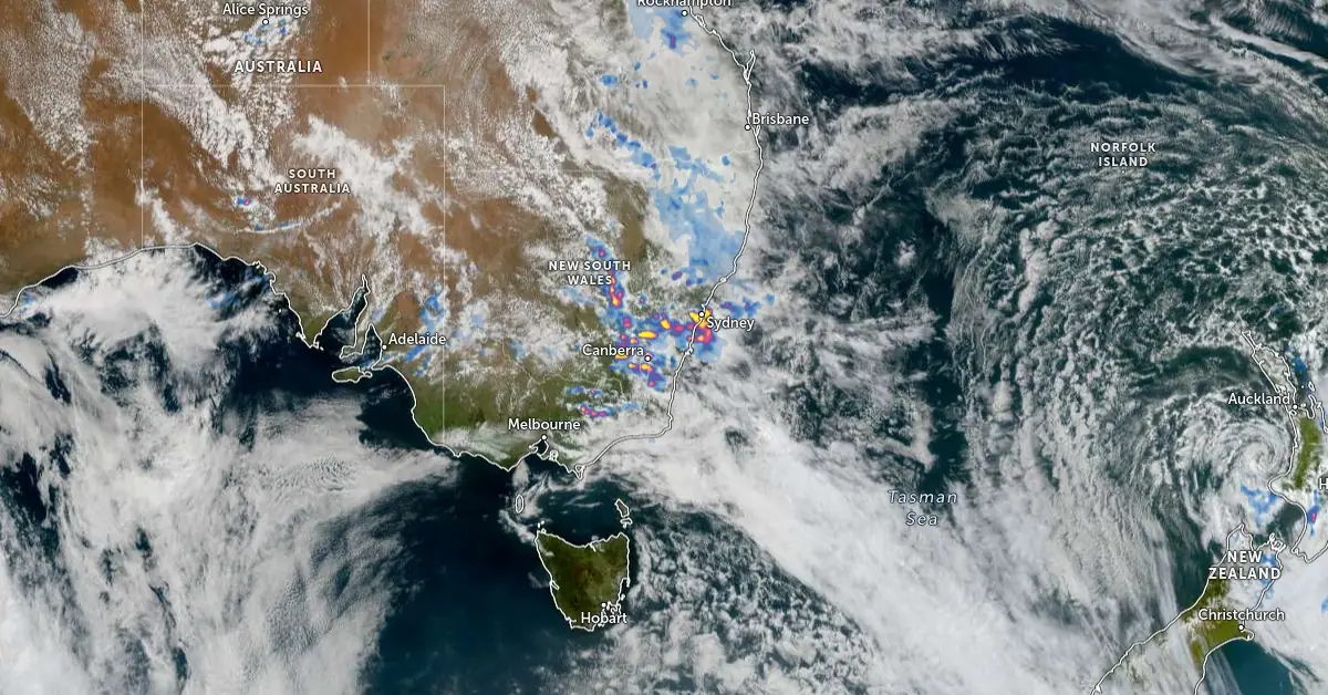
Satellite image of SE Australia acquired at 04:10 UTC on October 14, 2024. Credit: JMA/Himawari-9, Zoom Earth, The Watchers
A severe thunderstorm warning was issued for parts of New South Wales and Sydney on Monday, October 14 after heavy rainfall led to floods, power outages, and flight disruptions.
The storm, which struck Sydney on Monday afternoon, brought intense rain and thunderstorms. The Bureau of Meteorology (BOM) warned that additional downpours were possible, increasing the risk of flash flooding.
“This thunderstorm is moving towards the northeast. It is forecast to affect Manly, St Leonards, and waters off Manly Beach by 15:40 local time (LT), and Chatswood, Dee Why, and waters off Dee Why Beach by 16:10 LT,” said BOM.
The thunderstorm warning was canceled at 19:00 LT after the immediate threat passed. However, authorities are continuing to monitor the situation.
The State Emergency Services (SES) responded to 49 incidents related to the storm since its outbreak on Monday afternoon. Among these incidents were four flash flooding rescues, including one involving a car trapped in floodwaters.
The SES reported that most of the calls involved fallen trees and damaged roofs. The flood rescues were described as minor, and floodwaters are expected to recede quickly.
The storm also caused flight delays at Sydney Airport and disrupted railway operations after sections of the tracks were flooded.
Looking ahead, an outbreak of showers and thunderstorms is forecast for eastern Australia from Monday to Wednesday, October 16. Severe thunderstorms are possible in parts of southern NSW, particularly in areas near Canberra and Sydney, during this period.
References:
1 Severe thunderstorm warning issued for Sydney and parts of NSW east coast – 7 news – October 14, 2024
2 Severe storm and flash flood warnings cancelled across NSW – GCB – October 14, 2024

Rishav Kothari is Editor-in-Chief of The Watchers, where he runs the newsroom and covers earthquakes, volcanoes, severe weather and space weather.
Earlier reporting
Nothing on Watchers was published in the last 24 hours. These are older articles.
- CPC posts a slight risk of heavy rain from the Gulf Coast to the Northeast urban corridor November 25-29, and a moderate risk of West Coast wind and Sierra snow on November 25
- The storms drenching California this week are fed by a river in the sky, a band of water vapor that can carry up to 15 times the flow of the Mississippi River, and this winter’s near-record El Niño could keep aiming more of them at the West Coast
- Atmospheric river brings moderate risk of heavy rain, mountain snow and high winds to northern California and southwest Oregon on November 24-25
- 190 mm of rain and 131 km/h gusts hit New Zealand's South Island, flooding West Coast highways
