
Tropical Cyclone “Jasper” to make landfall between Cooktown and Innisfail, Queensland
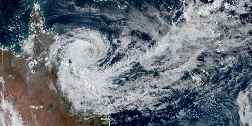
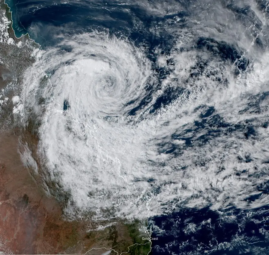
Featured image: Tropical Cyclone "Jasper" at 05:20 UTC on December 11, 2023. Credit: JMA/Himawari-9, RAMMB/CIRA, The Watchers
Tropical Cyclone “Jasper,” currently a Category 1 system, is moving towards the west-northwest and is expected to intensify to a Category 2 as it nears the Far North Queensland coast, with landfall likely between Cooktown and Innisfail on Wednesday, December 13, 2023.
Tropical Cyclone “Jasper” is advancing towards the Far North Queensland coast, with forecasts predicting the cyclone to maintain its intensity as it tracks west-northwest. The system, which remains a Category 1 as of 11:00 UTC on December 11, is expected to intensify to a Category 2 cyclone by Tuesday and maintain this strength until its coastal crossing on Wednesday. The most likely areas for landfall are between Cooktown and Innisfail.
Meteorologists also note a moderate chance for Jasper to redevelop in the Gulf of Carpentaria on Friday or the weekend. Depending on its trajectory and speed, there remains a slim possibility of a severe Category 3 crossing if Jasper crosses overnight on Wednesday or Thursday morning.
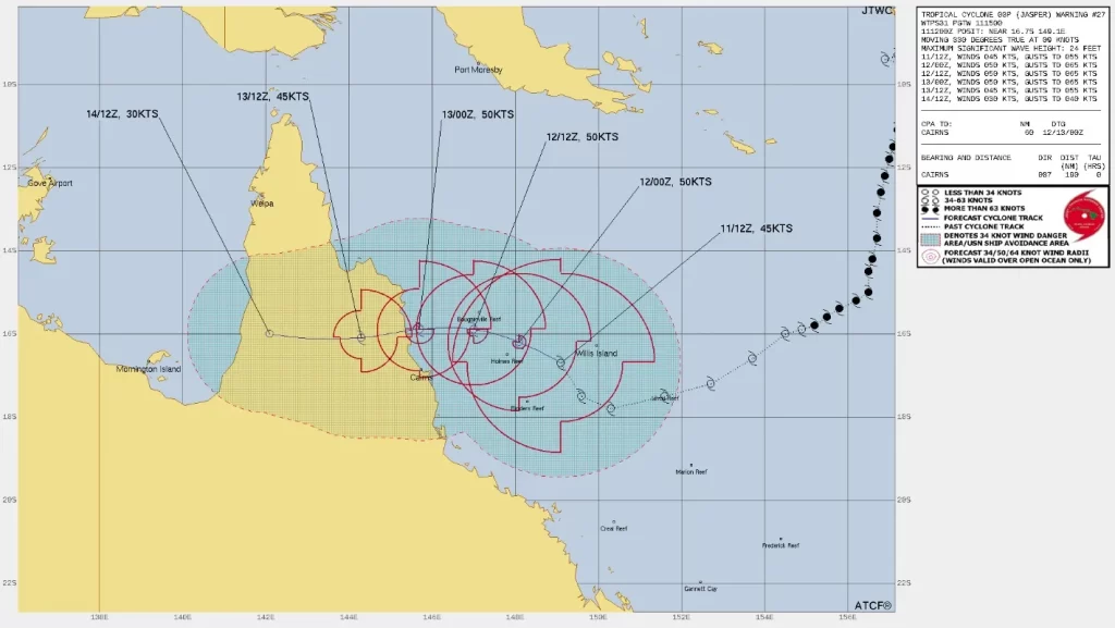
Residents along the Queensland coast and adjacent ranges between Cooktown and Townsville, including Cairns, are bracing for damaging wind gusts over 90 km/h ( 56 mph) starting Tuesday. These conditions are expected to extend inland to Palmerville and Chillagoe after Wednesday’s landfall. There’s also a possibility that damaging wind gusts could reach as far north as Cape Melville on Wednesday.
A separate severe weather warning is in place for damaging wind gusts for coastal and island areas between Cape Upstart and the Whitsunday Islands.
Heavy rainfall, capable of leading to flash flooding, is forecasted to develop from early Wednesday morning between Cape Flattery and Ingham. Six-hourly rainfall totals are likely to range between 100 to 150 mm (4 to 6 inches), with isolated falls of 250 mm (10 inches) possible along the coast and adjacent ranges. In a 24-hour period, rainfall totals between 150 to 250 mm (6 to 10 inches) are likely, with isolated falls up to 350 mm (14 inches) possible.
A flood watch is currently in effect for the North Tropical Coast, parts of the Cape York Peninsula, and Gulf Country. As Jasper approaches, a storm tide is expected between Cooktown and Townsville on Tuesday and Wednesday high tides. This could result in minor flooding along the foreshore due to large waves.
Residents between Cooktown and Townsville are urged to immediately commence or continue preparations, especially in securing boats and property, in anticipation of the cyclone’s landfall. People in areas likely to be affected by flooding should take measures to protect their property and be prepared to assist their neighbors in need.
References:
1 Tropical Cyclone “Jasper” Advice Number 9 – BOM – 01:48 EST on December 12, 2023
I'm a dedicated researcher, journalist, and editor at The Watchers. With over 20 years of experience in the media industry, I specialize in hard science news, focusing on extreme weather, seismic and volcanic activity, space weather, and astronomy, including near-Earth objects and planetary defense strategies. You can reach me at teo /at/ watchers.news.
Commenting rules and guidelines
We value the thoughts and opinions of our readers and welcome healthy discussions on our website. In order to maintain a respectful and positive community, we ask that all commenters follow these rules.