
Tropical Storm “Pilar” producing heavy rain over portions of Central America
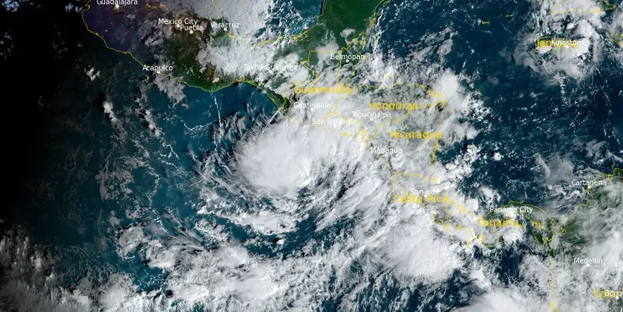
Featured image: Tropical Storm "Pilar" at 13:30 UTC on October 31, 2023. Credit: NOAA/GOES-East, RAMMB/CIRA, The Watchers
Tropical Storm “Pilar” formed offshore Central America at 03:00 UTC on Monday, October 30, 2023, as the 16th named storm of the 2023 Pacific hurricane season. The forecast shows Pilar nearing the El Salvador or Nicaragua coast late today to early Wednesday, with the core likely staying offshore. The storm is expected to move west-southwest away from land by Thursday.
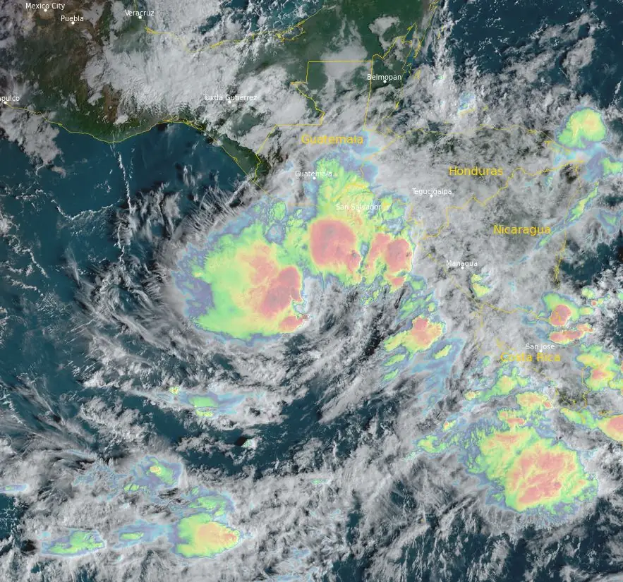
- Heavy rains from Pilar will produce flash and urban flooding, along with mudslides in areas of higher terrain of the Pacific coast of Central America from El Salvador southward to Costa Rica through Wednesday.
- Tropical storm conditions are possible beginning later today along portions of the Pacific coast of El Salvador, Honduras, and Nicaragua, where a Tropical Storm Watch remains in effect.
- Swells generated by Pilar will continue to affect the Pacific coast of Central America during the next few days. These swells are likely to cause life-threatening surf and rip current conditions.
At 12:00 UTC on October 31, the center of Tropical Storm “Pilar” was located about 280 km (175 miles) SSW of San Salvador, El Salvador, and 430 km (270 miles) W of Managua, Nicaragua.
The system had maximum sustained winds of 85 km/h (50 mph), minimum central pressure of 1 000 hPa, and was moving ENE at 6 km/h (3 mph).
A Tropical Storm Watch is in effect for the entire coast of El Salvador; Pacific coast of Honduras including the Gulf of Fonseca; and the Honduras/Nicaragua border southward to Puerto Sandino.
On the forecast track, Pilar could be approaching the coast of El Salvador or Nicaragua late today through early Wednesday, though the core of the system is expected to remain offshore. The storm is forecast to begin moving west-southwestward away from land by Thursday.
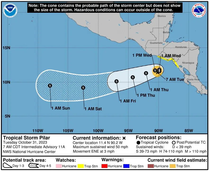
Pilar could intensify some over the next day or two before gradual weakening likely begins on Thursday.
This system is expected to produce storm total rainfall of 125 to 250 mm (5 to 10 inches), with local amounts to 380 mm (15 inches), over portions of Central America from El Salvador southward to Costa Rica through Wednesday. This rainfall will produce flash and urban flooding, along with mudslides in areas of higher terrain.
Swells generated by Pilar are expected to continue affecting the Pacific coast of Central America during the next few days. These swells are likely to cause life-threatening surf and rip current conditions.
Tropical storm conditions could begin in the Tropical Storm Watch areas this morning (LT).
References:
1 Tropical Storm Pilar – Intermediate Advisory Number 11A – NWS National Hurricane Center Miami FL EP192023 – 700 AM CDT Tue Oct 31 2023
I'm a dedicated researcher, journalist, and editor at The Watchers. With over 20 years of experience in the media industry, I specialize in hard science news, focusing on extreme weather, seismic and volcanic activity, space weather, and astronomy, including near-Earth objects and planetary defense strategies. You can reach me at teo /at/ watchers.news.
Commenting rules and guidelines
We value the thoughts and opinions of our readers and welcome healthy discussions on our website. In order to maintain a respectful and positive community, we ask that all commenters follow these rules.