
Tropical Storm “Aere” makes landfall over Kyushu, bringing record-breaking rainfall, Japan
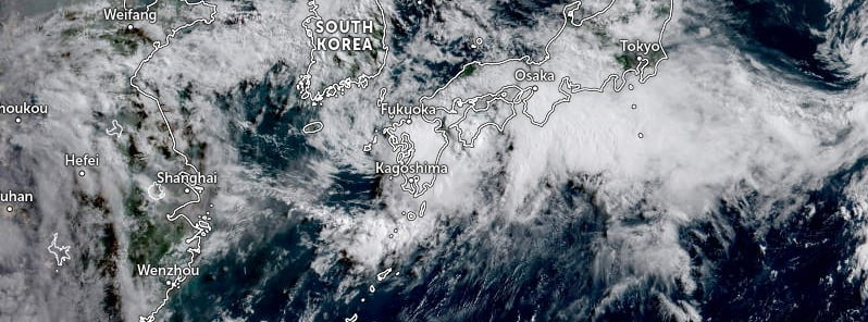
Featured image: Tropical Storm "Aere" at 22:20 UTC on July 4, 2022. Credit: JMA/Himawari-8, Zoom Earth, The Watchers
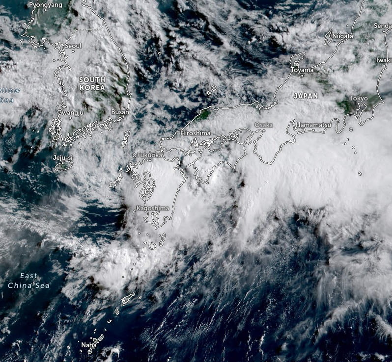
Tropical Storm “Aere” formed on July 2, 2022, as the 4th named storm of the 2022 Pacific typhoon season. The storm made its first landfall in Okinawa, Japan on the same day and reached Kyushu on July 4, making landfall near Sasebo, Nagasaki, shortly before 21:00 UTC (06:00 LT, July 5).
Aere continued moving slowly eastward toward the western and central parts of Japa, bringing torrential rainfall and causing floods and landslides.
According to the Japan Meteorological Agency (JMA), the storm brought record-breaking rainfall in areas of Kyushu, with Unzen, Nagasaki Prefecture, Arao, Kumamoto Prefecture, and Omuta, Fukuoka Prefecture, receiving an estimated 120+ mm (4.7 inches) in an hour.1
JMA officials said more than 20 houses were flooded and a major road was closed due to landslides in the western part of Kochi Prefecture.
Elsewhere in Kochi, 85 mm (3.3 inches) of rain was recorded in an hour in Susaki and 79.5 mm (3.1 inches) in the town of Shimanto.
In 24 hours to 12:00 LT on July 6, up to 200 mm (7.8 inches) of rain are expected in Shikoku and Tokai regions.
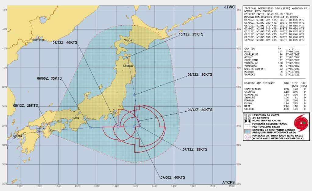
At 12:00 UTC on July 5, Aere was a tropical depression located just west of Kaiyo, Tokushima. It had maximum sustained winds of 45 km/h (29 mph) and was moving E at 20 km/h (12 mph), according to the JTWC.
If the vortex survives, the remnants of Aere will continue moving eastward along the northern periphery of the steering subtropical ridge, crossing the remainder of Shikoku and the southern point of Honshu before exiting back into the Pacific Ocean.2
By 03:00 UTC on July 7, the cyclone will slow down and become quasi-stationary as a secondary subtropical ridge, building to the north, assumes steering and, after 15:00 UTC on July 8, drive the cyclone NNE.
Favorable diffluence aloft and baroclinic interaction will promote intensification to a peak of 75 km/h (45 mph) from July 6 to 7 as the system gradually transforms into a subtropical low.
References:
1 Tropical Storm Aere moves eastward across Japan bringing torrential rain and flooding – The Japan Times – July 4, 2022
2 Prognostic reasoning for Tropical Depression 05W (Aere) warning number 021 – JTWC – 15:00 UTC on July 5, 2022
I'm a dedicated researcher, journalist, and editor at The Watchers. With over 20 years of experience in the media industry, I specialize in hard science news, focusing on extreme weather, seismic and volcanic activity, space weather, and astronomy, including near-Earth objects and planetary defense strategies. You can reach me at teo /at/ watchers.news.
Commenting rules and guidelines
We value the thoughts and opinions of our readers and welcome healthy discussions on our website. In order to maintain a respectful and positive community, we ask that all commenters follow these rules.