
Tropical depression near Fiji to intensify into a tropical cyclone
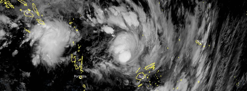
Featured image: Tropical depression 05F at 12:00 UTC on January 29, 2021. Credit: JMA/Himawari-8, RAMMB/CIRA, TW
Tropical depression 05F developed near Fiji on January 28, 2021, and is forecast to slowly track towards Fiji over the next 24 hours and develop into a tropical cyclone Category 1 on January 30, affecting the Fiji Group.
At 06:00 UTC on January 29, the center of TD05F was located between Fiji and Vanuatu, about 530 km (330 miles) WNW of Nadi.
The cyclone was moving E at about 13 km/h (8 mph) and is expected to track E and then SE towards Fiji in the next 24 hours, RSMC Fiji said.
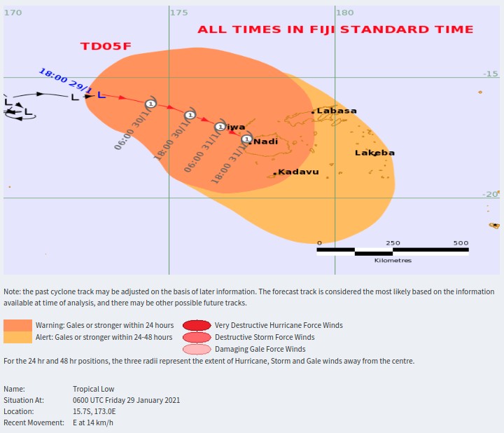
The depression has a very high potential to intensify into a tropical cyclone in the next 24 hours. The associated active trough of low pressure and convergence zone with active rainbands and strong to gale force winds affect the Fiji Group.
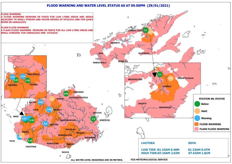
A Flood Warning is in place for all low lying areas and areas adjacent to small streams and major rivers of Viti Levu and for Qawa Rivers as well as for rivers along Bua through Nabouwalu to Kubulau in Vanua Levu.
A Flash Flood Warning is in place for all low lying areas and areas adjacent to small streams and creeks in Fiji.
Areas included in the flash flood warning are: Nabouwalu to Labasa, Nabouwalu to Kubulau, Dawara to Nabalebale village along the Wailevu west coast road, Naibalebale village to Savusavu. Savusavu to Natewa and Tunuloa, Koroalau to Saqani, and Saqani to Labasa.
Areas included in the flash flood warning for Viti Levu are: Western division; low lying areas from Sigatoka through Lautoka to Rakiraki, Semo, Naiwaicoba, Nadi back road, Lomolomo, and Barara flats, Navutu flats, Lovu, Saru back road, Vuda back road, Koronubu flat, Namosau, Veisari, Baravu flats and Nailaga areas, Nausori, Naqali, Serua, Korovou and Lodoni.
At 09:00 UTC today:
Water level at Nadi bridge station was 5.57 m (12.8 feet) which is at critical level and increasing.
Water level at BA FSC station was 6.8 m (22.3 feet) which is above critical level and increasing.
Water level at Navala station was 7.06 m (23.1 feet) which is above critical level and decreasing.
Water level at Keiyasi station was 8.4 m (27.5 feet) which is above critical level and increasing.
Water level at Nasivi station was 3.2 m (10.4 feet) which is below alert level and decreasing.
Water level at Emuri station was 2.96 m (9.7 feet) which is below alert level and decreasing.
Water level at Dreketilailai station was 1.6 m (5.2 feet) which is above alert level and increasing.
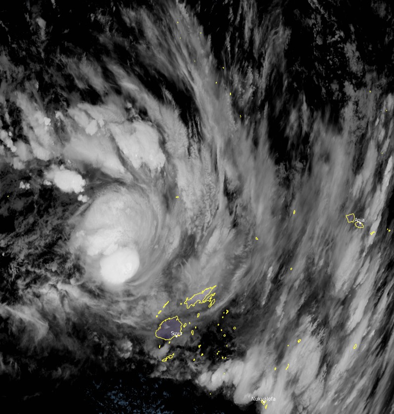
Tropical depression 05F at 12:00 UTC on January 29, 2021. Credit: JMA/Himawari-8, RAMMB/CIRA, TW
Forecast models
I'm a dedicated researcher, journalist, and editor at The Watchers. With over 20 years of experience in the media industry, I specialize in hard science news, focusing on extreme weather, seismic and volcanic activity, space weather, and astronomy, including near-Earth objects and planetary defense strategies. You can reach me at teo /at/ watchers.news.
Commenting rules and guidelines
We value the thoughts and opinions of our readers and welcome healthy discussions on our website. In order to maintain a respectful and positive community, we ask that all commenters follow these rules.