
Severe thunderstorms, large hail strike parts of Central U.S.
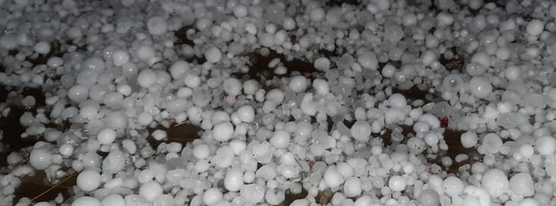
Image credit: @Arnone5/Twitter
Severe thunderstorms, with hailstones up to 5 cm (2 inches) in diameter, hit parts of central U.S., including Illinois, Arkansas, Kentucky, and nearby areas since Wednesday, March 11, 2020. The storms resulted in power outages for about 3 000 customers, particularly in Garland County and Hot Springs.
In Kentucky, hailstones were described as the size of a quarter, or about 2.5 cm (1 inch), covering highways. AccuWeather journalist and storm chaser Blake Naftel said the storm lasted for seven minutes.
.@Kentuckyweather .@WeatherNation .@weatherchannel Hail in Campbellsville Kentucky pic.twitter.com/wjGn8RJzQ0
— ketucky severe weather updates (@KetuckyU) March 12, 2020
Absolutely crazy #hail at my house in #Butlercounty #Kentucky #weather @wxornotBG #storms pic.twitter.com/pWPIg3ogUb
— Debby Lanham (@DebbyMomadeb82) March 13, 2020
Wait for it… Massive hail burst with the passage of the meso/wall cloud at Glasgow, Kentucky from 7p CT Thursday evening. Dime to quarter-size hail observed, lasting for 7 min. in duration. @accuweather @breakingweather @NWSNashville @NWSPaducah pic.twitter.com/HrfvJAgx9p
— Blake Naftel (@BlakeNaftel) March 13, 2020
Little hail near Dixon, Ky then Boom! @RonanRhodes @Wayne_C_Hart @NWSPaducah @weatherchannel @breakingweather @spann @MeanMotionMedia @Ginger_Zee #tristatewx pic.twitter.com/SPr4TwWrci
— Jeff Blair (@jblair_) March 12, 2020
In Arkansas, a heavy hailstorm battered the northwestern region, including Sonora on March 11. Hailstones were reportedly up to 2.5 cm (1 inch) in diameter, with wind gusts reaching 97 km/h (60 mph).
Among the worst-hit areas was Bella Vista, where lightning and hail struck together. Bismarck, Izard County, Batesville, and Horseshoe Bend also had reports of hail.
Almost 3 000 customers were left without electricity Thursday in Garland County and Hot Springs, according to Entergy.
Had bunches of hail this morning in #BellaVista. This video comes courtesy @4029emma folks. Some hail was as big as 1" in diameter #arwx #NWArk pic.twitter.com/sWYub538kn
— Darby Bybee (@4029Darby) March 11, 2020
Hail storm in Horseshoe Bend, AR earlier today. Thanks to KATV viewer Amy Boles. @Ginger_Zee #arwx pic.twitter.com/Em8nGm9G7Z
— Todd Yakoubian (@KATVToddYak) March 13, 2020
Holy Hail!!
A cluster of early morning severe #thunderstorms on Wednesday dropped hail on northwest Arkansas. #ARwx #OhHailNo #HailStorm #hailing #SevereWeather pic.twitter.com/IvU8HAIi0P
— WeatherNation (@WeatherNation) March 11, 2020
A hailstorm hit northwest Arkansas after thunderstorms moved through the area on March 11th. The storms hit the region with hailstones up to an inch in diameter, with wind gusts up to 60 mph. #WeatherBug #KnowBefore #wx #Arkansas pic.twitter.com/TU7y2Qangw
— WeatherBug (@WeatherBug) March 11, 2020
In Illinois, intense thunderstorms and huge hails rocked areas including South Jacksonville.
According to Weather Nation, up to 5 cm (2 inches) of hail fell in Johnson city, while West Frankfort, Du Quoin, Ina, and Marion saw between 1.25 to 1.75 cm (0.5 to 0.7 inches) of hail.
"Please watch out for flooded roads overnight and avoid them," the weather agency warned.
Rain is expected to continue into the weekend.
Between COVID-19 and the weather, all HAIL is breaking loose in Central Illinois. #Thunder #Hail #Covid_19 pic.twitter.com/MeVwDet4Nz
— Justin Carter (@JustinCarterTV) March 12, 2020
Pea to marble-sized hail reported in Chatham.#ilwx #cILwx
(: Brad Glynn) pic.twitter.com/FHGBwT3RjP
— FOX Illinois (@foxillinois) March 12, 2020
Parts of Illinois had hail up to hen egg size (2") while West Frankfort had 1.75" thick hail pic.twitter.com/9CRRBWLC1U
— Steve Glazier (@SteveGlazier) March 12, 2020
Heavy snow and flash flood threats continue across the western U.S. – severe thunderstorms possible across West Texas and Eastern New Mexico
Storm systems across the western U.S. will continue to bring heavy rainfall to portions of the Desert Southwest on Friday, March 13, 2020, with heavy snows continuing across many mountainous areas through the weekend.
Heavy snow is also possible across the Central Plains into Saturday, with a few severe thunderstorms possible across West Texas and Eastern New Mexico, NWS forecaster Tate noted.
Commenting rules and guidelines
We value the thoughts and opinions of our readers and welcome healthy discussions on our website. In order to maintain a respectful and positive community, we ask that all commenters follow these rules.