
Tropical Storm “Daniel” forms in the Eastern Pacific, no impact to land
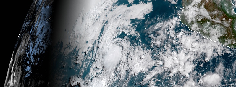
Featured image: Tropical Storm "Daniel" at 15:00 UTC on June 24, 2018. Credit: NOAA/GOES-East
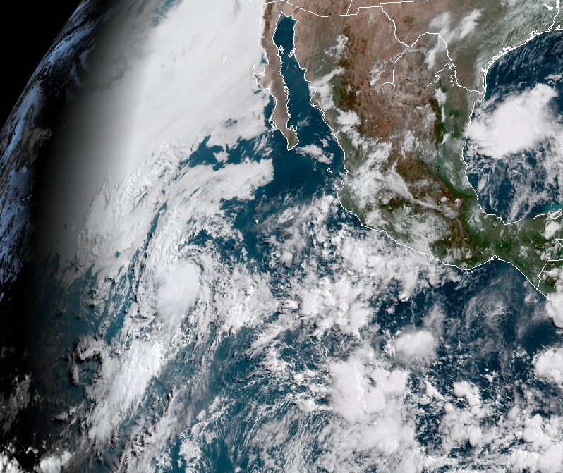
Tropical Storm "Daniel" formed June 24, 2018, as the 4th named storm of the 2018 Pacific hurricane season. There are no coastal watches or warnings in effect and Daniel is expected to remain over open waters until it dissipates.
At 15:00 UTC, June 24, the center of Tropical Storm "Daniel" was located 990 km (615 miles) SW of the southern tip of Baja California. Its maximum sustained winds were 65 km/h (40 mph) and gusts to 75 km/h (45 mph). The system was moving north at 17 km/h (10 mph) with the minimum central pressure of 1 006 hPa.
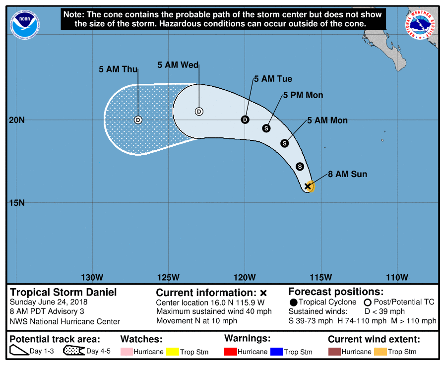
This general motion is expected to continue today, followed by a turn toward the northwest on June 25 and a westward motion on June 26 that will continue through the middle of the week.
Slight strengthening is expected through tonight, followed by a weakening trend on June 25 as Daniel tracks over sea surface temperatures below 26 °C (78.8 °F).
Tropical Storm "Daniel" at 15:00 UTC on June 24, 2018. Credit: NOAA/GOES-East
The system will most likely become a remnant low by the middle of the week, NOAA NHC forecasters said.
I'm a dedicated researcher, journalist, and editor at The Watchers. With over 20 years of experience in the media industry, I specialize in hard science news, focusing on extreme weather, seismic and volcanic activity, space weather, and astronomy, including near-Earth objects and planetary defense strategies. You can reach me at teo /at/ watchers.news.
Commenting rules and guidelines
We value the thoughts and opinions of our readers and welcome healthy discussions on our website. In order to maintain a respectful and positive community, we ask that all commenters follow these rules.