
Year of Weather 2017

Image credit: TW
EUMETSAT has just published its annual Year of Weather animation, which illustrates where 2017’s major storms formed, the conditions that spawned them, and their tracks, as well as other significant weather events.
The 11-minute animation is narrated by EUMETSAT Training Manager Dr. Mark Higgins. Higgins explains some of the major weather events that occurred in 2017, and the challenges weather forecasters face to provide accurate information to help save lives and mitigate losses.
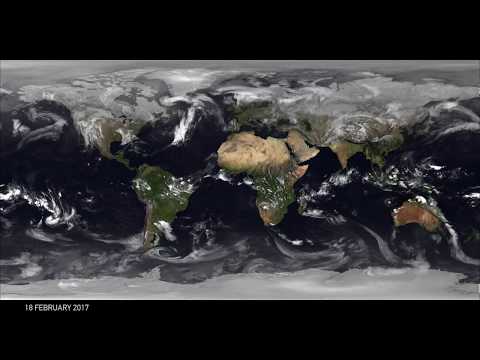
The movement of clouds in the polar regions and the changes in their behavior during the respective winters and summers, as well as the contrasting patterns in the tropics, can be seen from a perspective only possible with satellite imagery.
Visible in the animation are severe storms ranging from Tropical Cyclone "Debbie" which formed in the Arafura Sea and struck north-eastern Australia in March, Typhoon "Noru," which formed in the Northern Pacific in July and made landfall in Japan and the series of hurricanes which devastated parts of the Caribbean and United States in August and September.
The animation comprises cloud imagery provided by Météo-France – Centre de Météorologie Spatiale, based on infrared data from the geostationary and polar-orbiting satellites of EUMETSAT, the National Ocean and Atmospheric Administration (US), the China Meteorological Administration and the Japan Meteorological Agency.
Video courtesy EUMETSAT

Teo Blašković founded The Watchers in 2011 and edited it until 2026, covering seismic and volcanic activity, extreme weather, space weather and near-Earth objects. Articles on this page are his archive.
Published in the last 24 hours
- High Risk of excessive rainfall covers Florida’s Space Coast as St. Johns River near Cocoa reaches 5.67 m
- Asteroid 2026 WJ to pass Earth at 1.7 lunar distances at 04:20 UTC on November 22, with 2026 WD following at 4.4 lunar distances on November 23
- Cyclone Akvan crossed the north Andhra Pradesh and south Odisha coasts close to Gopalpur on November 20 with 70-80 km/h winds gusting to 90, and has weakened into a deep depression
- A broad low over southeastern Florida and the northwestern Bahamas has a 30 percent chance of subtropical or tropical development within 48 hours and a 50 percent chance within 7 days, the National Hurricane Center says
