
1st major winter storm of season blankets Northern Plains
Featured image: Pressure field over the US, November 19, 2016. Image credit: NWS/NOAA/NCEP/WPC
Argos, the first major US winter storm of the season has already blanketed parts of the Northern Plains. According to the National Weather Service (NWS), further heavy snow accompanied with strong winds is expected in the region of the Great Lakes and inner Northeast over the coming weekend.
Over 0.3 m (1 foot) of snowfall was reported in the Rockies and wind gusts between 48.3 and 64.4 km/h (30 and 40 mph) were recorded across the Northern Plains. According to media reports, the storm is currently affecting portions of South Dakota, Nebraska, northwest Iowa, and Minnesota and winter storm warnings are in effect in the region from the Nebraska to northern Minnesota.
Winter storm watches are in effect for parts of the Lake Superior and far northern Wisconsin. Dangerous driving conditions are likely present in some areas of the Northern Plains which may affect the traffic, prompting road closures in the affected regions.
A secondary are of low pressure field is expected to form over eastern Canada and bring heavy snowfall across the inner Northeast and Great Lakes for the coming weekend.
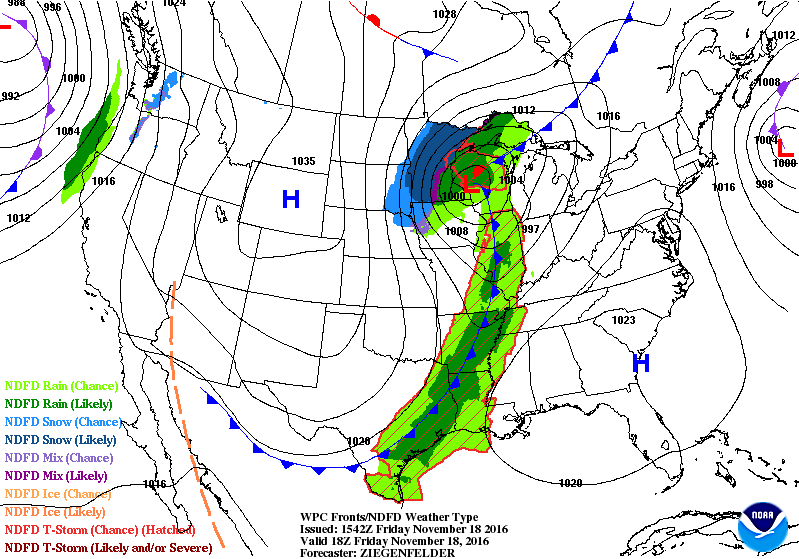
Pressure field over the US, November 18, 2016. Image credit: NWS/NOAA/NCEP/WPC
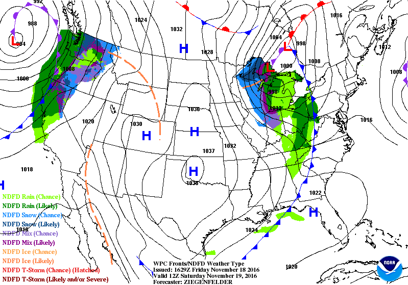
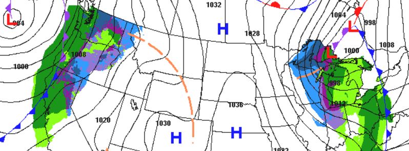
Pressure field over the US, November 19, 2016. Image credit: NWS/NOAA/NCEP/WPC
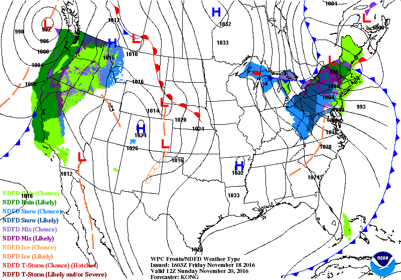
Pressure field over the US, November 20, 2016. Image credit: NWS/NOAA/NCEP/WPC
Snowfall will likely continue in the eastern Dakotas, northeast Nebraska, western and northern Minnesota and northwest Iowa while intense north and northwest winds will produce blizzard conditions in the open areas.
In the area of the Great Lakes snow belt, lake effects and lake-enhanced snow conditions are likely. Winter storm warnings are in effect for parts of Upper Michigan and far northern Wisconsin while the lake-effect snow watch will be in place across the southwestern New York in the period between the evening of November 19 until November 21 (local time).
Higher areas of Northwest and lower parts in the region between Pennsylvania, the Mohawk Valley, and northern New England can also expect strong snowstorms which are likely to continue through the night of November 21.
#Satellite loop from yesterday evening through 545 am CST this morning of the #WinterStorm across the central US. #ndwx pic.twitter.com/zWNyo90uD6
— NWS Bismarck (@NWSBismarck) November 18, 2016
More than 0.3 m (1 foot) of snow will blanket northern and western Minnesota and eastern South Dakota while moderate snowfall will affect northern NEbrasca, eastern North Dakota, central and southeast Minnesota.
The highest amount of snow, more than 0.3 m (1 foot) is anticipated in the Adirondacks, New York, and eastern Great Lakes. The Green and White Mountains in the northern New England, Lake Superior, and Lake Michigan will also likely experience heavy snowfall.
Commenting rules and guidelines
We value the thoughts and opinions of our readers and welcome healthy discussions on our website. In order to maintain a respectful and positive community, we ask that all commenters follow these rules.