
Powerful eruption of Sakurajima spews smoke 6 km a.s.l. in the first such eruption since August 2013
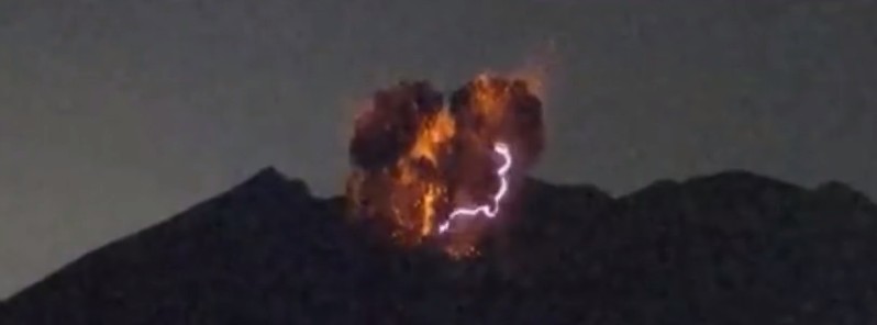
Image credit: Sakurajima erupts at 15:02 UTC on July 25, 2016
After 3 calm weeks, Japan's Mount Sakurajima erupted violently at 15:02 UTC on July 25, 2016 (00:02 JST on July 26), spewing ash from its Showa Crater 6 km (20 000 feet) above sea level, according to the Tokyo VAAC. The plume was extending to the SW.
It was the 47th eruption of Sakurajima this year, but this is the first time that the volcano spewed out smoke that high since August 18, 2013, according to the Kagoshima Meteorological Office. Before August 2013, Sakurajima erupted that high in 2006.
The observatory is warning residents and travelers in the area that traffic accidents may occur because of ashfall.
JMA maintains the volcano at alert level 3 since February 2016. The entire mountain is closed, except for residential areas along the coast.

Geological summary
The Aira caldera in the northern half of Kagoshima Bay contains the post-caldera Sakurajima volcano, one of Japan's most active. Eruption of the voluminous Ito pyroclastic flow accompanied formation of the 17 x 23 km caldera about 22,000 years ago. The smaller Wakamiko caldera was formed during the early Holocene in the NE corner of the Aira caldera, along with several post-caldera cones. The construction of Sakurajima began about 13,000 years ago on the southern rim of Aira caldera and built an island that was finally joined to the Osumi Peninsula during the major explosive and effusive eruption of 1914. Activity at the Kitadake summit cone ended about 4850 years ago, after which eruptions took place at Minamidake.
Frequent historical eruptions, recorded since the 8th century, have deposited ash on Kagoshima, one of Kyushu's largest cities, located across Kagoshima Bay only 8 km from the summit. The largest historical eruption took place during 1471-76. (GVP)

The Watchers team and our contributors bring the latest on extreme weather, earthquakes, volcanic eruptions, space weather, and all things science. We're all about making sense of the natural world and keeping you informed on what’s happening. Got a tip or a question? Hit us up using the form at newstips!
Earlier reporting
Nothing on Watchers was published in the last 24 hours. These are older articles.
- On October 22, 2017, a single flash of lightning stretched 515 miles from eastern Texas to near Kansas City, a distance that takes eight hours to drive, and nobody realized how far it had gone until scientists went back through the satellite data years later Epicenter
- CPC posts a slight risk of heavy rain from the Gulf Coast to the Northeast urban corridor November 25-29, and a moderate risk of West Coast wind and Sierra snow on November 25
- Florida's east coast faces a moderate flash flood risk Wednesday through Friday, with 4 to 8 inches of rain forecast and the St. Johns River near Cocoa already in major flood at 17.13 feet
- Cyclone Akvan to make landfall between Nellore and Visakhapatnam around noon on November 20, IMD forecasts 120-130 km/h winds gusting to 145
