
New eruption observed at Chikurachki volcano, Kuril Islands, Russia
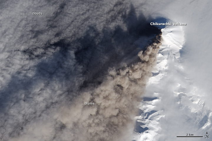
Featured image: Chikurachki erupting on March 30, 2016. Image credit: NASA/NOAA/DoD Suomi NPP/VIIRS
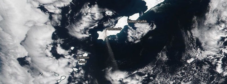
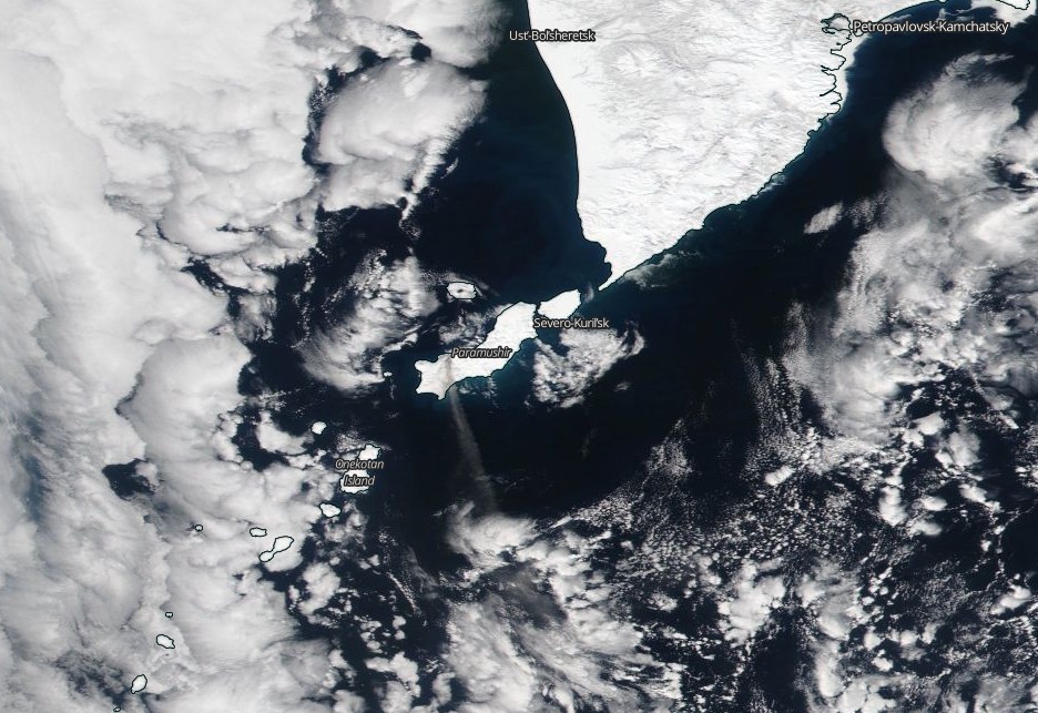
A new eruption started at Chikurachki, the highest volcano on Paramushir Island in the northern Kuriles, on March 29, 2016.
KVERT reported that an ash plume from Chikurachki was observed in satellite images rising to an altitude of 3 km (10 000 feet) a.s.l. and drifting about 50 km (31 miles) NE at 00:40 UTC on March 29. The Aviation Color Code was raised to Orange. By 08:52 on March 30, the ash plume was drifting 87 km (54 miles) S.
At 02:00 UTC on March 31, the ash plume was observed rising up to 1.5 – 2 km (4 900 – 6 560 feet) a.s.l. and extending 64 km (40 miles) to the SW.
Ash explosions up to 10 km (32 800 feet) a.s.l. could occur at any time, KVERT warned. Ongoing activity could affect international and low-flying aircraft.
After 7 years of slumber, Chikurachki erupted explosively on February 16, 2015, spewing ash high enough to prompt volcano monitoring agencies to post a code red aviation warning for aircraft.
Geological summary
Chikurachki, the highest volcano on Paramushir Island in the northern Kuriles, is actually a relatively small cone constructed on a high Pleistocene volcanic edifice. Oxidized basaltic-to-andesitic scoria deposits covering the upper part of the young cone give it a distinctive red color. Frequent basaltic plinian eruptions have occurred during the Holocene. Lava flows from 1781-m-high Chikurachki reached the sea and form capes on the NW coast; several young lava flows also emerge from beneath the scoria blanket on the eastern flank.
The Tatarinov group of six volcanic centers is located immediately to the south of Chikurachki, and the Lomonosov cinder cone group, the source of an early Holocene lava flow that reached the saddle between it and Fuss Peak to the west, lies at the southern end of the N-S-trending Chikurachki-Tatarinov complex. In contrast to the frequently active Chikurachki, the Tatarinov volcanoes are extensively modified by erosion and have a more complex structure.
Tephrochronology gives evidence of only one eruption in historical time from Tatarinov, although its southern cone contains a sulfur-encrusted crater with fumaroles that were active along the margin of a crater lake until 1959. (GVP)
I'm a dedicated researcher, journalist, and editor at The Watchers. With over 20 years of experience in the media industry, I specialize in hard science news, focusing on extreme weather, seismic and volcanic activity, space weather, and astronomy, including near-Earth objects and planetary defense strategies. You can reach me at teo /at/ watchers.news.
Commenting rules and guidelines
We value the thoughts and opinions of our readers and welcome healthy discussions on our website. In order to maintain a respectful and positive community, we ask that all commenters follow these rules.