
Atoyac River disappears overnight after large sinkhole opens up, Mexico
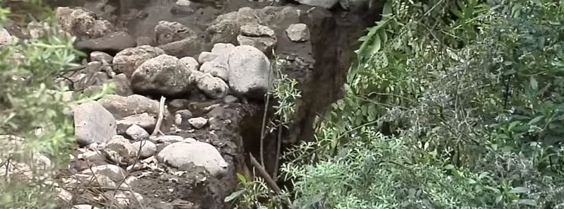
Image credit: Mas Noticias RTV
The Atoyac River, located in the central mountainous area of the Mexican state of Veracruz, has disappeared after a large sinkhole opened up on Sunday, February 28, 2016. In less than 48 hours, the river completely dried out.
The hole, which now crosses the Atoyac riverbed, appeared about 3 km (1.8 miles) from the source of the river, which supplies more than 10 000 families with drinking water.
Llaman a "salvar" el río Atoyac. Agustín Mollinedo dijo que aún se conserva el nacimiento https://t.co/Vkinen4dg2 pic.twitter.com/J5CdTkDGZG
— El Universal (@El_Universal_Mx) March 3, 2016
Juana Sanchez, who lives in the area said: "On Monday we saw that the water had disappeared and went to see what was happening. When we reached the riverbank, we saw a large hole there that was blocking the river."
According to provincial authorities, the hole is 30 meters (98 feet) long and 20 meters (65.5 feet) wide. “These cracks appear deep inside the Earth’s crust and keep getting wider and wider,” the local environmental services said in a report.
Residents living near the area reported hearing a bang and feeling the earth rumble as the ground cracked open.
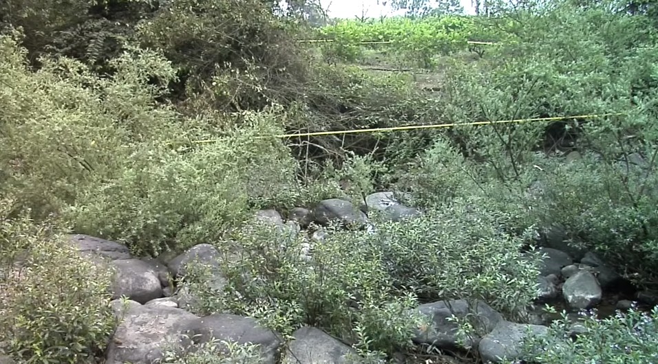
Image credit: Mas Noticias RTV
The basin of the Atoyac River rises in the city of Amatlán of Kings and extends to the mouth of the waterway in the municipality of Boca del Rio, on the coast of the Gulf of Mexico, and crosses the municipalities of Atoyac, Yanga, Cuitlahuac, Carrillo Puerto, Cotaxtla, and Medellin.
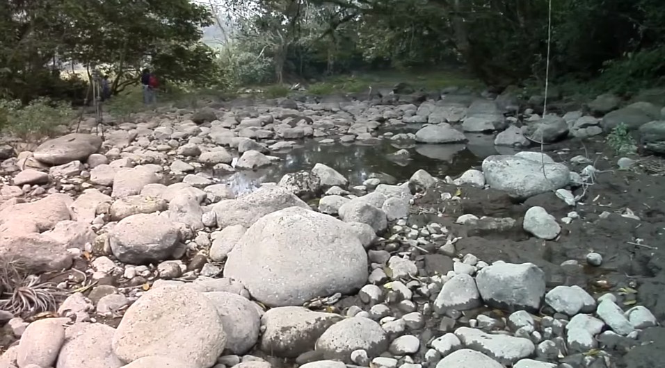
Image credit: Mas Noticias RTV
Personal Civil Protection and the National Water Commission warned that the Cotaxtla river, which flows into the Atoyac, is already below its normal level due to the disappearance of the affluent.
Update
On April 4, CONAGUA reported the Atoyac River is flowing back to normal after the sinkhole has been filled on March 24.
However, the agency believes the phenomenon that caused the drainage may return due to geological features of the region.
Studies are being conducted to identify areas that are subject to similar conditions and to design measures to mitigate the effects.
I'm a dedicated researcher, journalist, and editor at The Watchers. With over 20 years of experience in the media industry, I specialize in hard science news, focusing on extreme weather, seismic and volcanic activity, space weather, and astronomy, including near-Earth objects and planetary defense strategies. You can reach me at teo /at/ watchers.news.
Dear Sepp, Your name sounds in origin from Switzerland or Germany (my country) and Your practical approach is that of hard work , that You would not despise. Sounds like a good idea to me, the sooner the better.I hope they consider that since 10000 people depend on that water.
It shouldn’t be too difficult to dig an alternative river bed that avoids the hole and brings the water back to the old bed further down the river…