
Hurricane “Kate” inducing dangerous surfs and rip currents in Bermuda
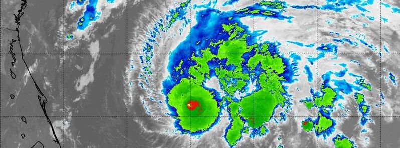
Featured image: Cloud top temperatures of thunderstorms around the eyewall varying between -70 and -80 °C (-94 and -112 °F) (red), as observed during NASA-NOAA's Suomi NPP satellite passage over Kate on November 10, 07:00 UTC. Image credit: NASA/NOAA/NRL
Hurricane "Kate" developed as the system was moving away from Bermuda on November 11, 2015. Kate is currently racing in the east-northeast direction across the Atlantic and is expected to merge with an approaching extratropical low over the next couple of days. Coastal parts of Bermuda can still expect dangerous surf and rip currents conditions following the storm's passage.
Tropical Storm "Kate" developed in the Atlantic basin on November 9, 2015, about 60 km (40 miles) from the Bahamas. The system was intensifying over the last two days and developed into a Category 1 hurricane on November 11.
The animation of infrared and visible imagery from NOAA's GOES-East satellite from November 7 to 9 showing the development and movement of Tropical Storm Kate to the Bahamas. Video credit: NASA/NOAA GOES Project
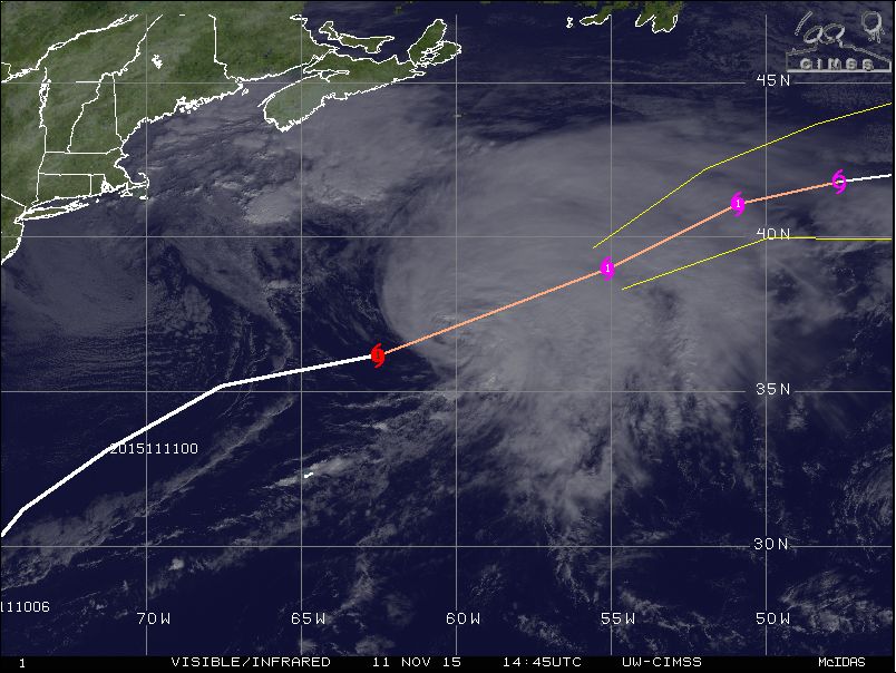
Hurricane "Kate" racing ENE, November 11, 2015, 14:45 UTC. Image credit: UW-CIMSS
The system was located 635 km (395 miles) northeast of Bermuda and 1 260 km (780 miles) south-southwest of Cape Race, Newfoundland and moving east-northeastward at 72 km/h (45 mph) on November 11, at 15:00 UTC, according to NHC. Kate was packing maximum sustained winds of 120 km/h (75 mph) and its minimum central pressure was estimated at 985 hPa at the time.
Winds of hurricane force extend up to 55 km (35 miles) away from Kate's center while the tropical storm force winds extend up to 335 km (205 miles) outward.
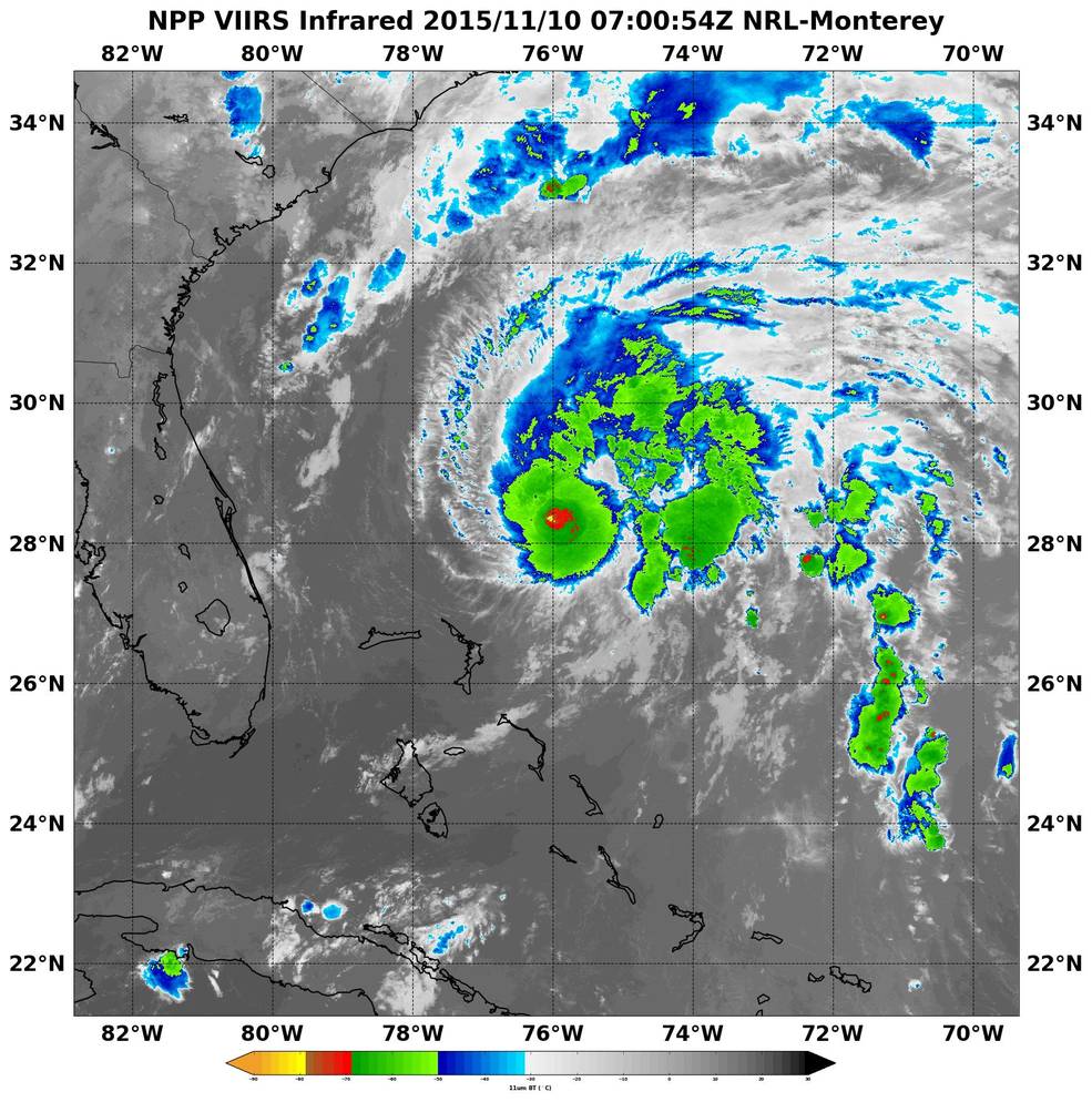
Cloud top temperatures of thunderstorms around the eyewall varying between -70 and -80 °C (-94 and -112 ° F) (red), as observed during NASA-NOAA's Suomi NPP satellite passage over Kate on November 10, 07:00 UTC. Image credit: NASA/NOAA/NRL
Over the next couple of days Hurricane "Kate" is expected to slow down its motion and turn toward the northeast. The system will most likely lose tropical characteristics by early November 12, but nevertheless remain a powerful cyclone over the next few days, as it interacts and ultimately merges with an extratropical low to its west. Following the interaction, a faster northeastward motion is forecast by November 14.
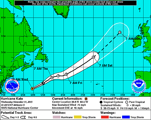
Hurricane "Kate" 5-day forecast track. Image credit: NOAA/NWS
Powerful swells, generated by the hurricane, capable of inducing life-threatening surf and rip current conditions, will continue affecting Bermuda throughout November 11, NHC warned.
Commenting rules and guidelines
We value the thoughts and opinions of our readers and welcome healthy discussions on our website. In order to maintain a respectful and positive community, we ask that all commenters follow these rules.