
Tropical Storm “Etau” hits mainland Japan, heavy rain causes flooding and landslides
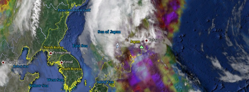
Featured image: Tropical Storm "Etau" around 08:00 UTC on September 9, 2015. Image credit: Google, NASA/JAXA GPM.
Tropical Storm "Etau" made landfall in Aichi prefecture, central Japan, around 01:00 UTC on September 9, 2015 (10:00 local time). Etau is bringing very heavy rain and causing floods and landslides. Weather officials issued evacuation advisories for several cities along the coast.
Etau formed as the eighteenth tropical depression of the 2015 northwestern Pacific Ocean typhoon season near the island of Iwo To, Japan on Sunday, September 7. At 09:00 UTC on September 8, the system was centered about 702 km (436 miles) south of Yokosuka, Japan, and moving to the north at 25.3 km/h (16.1 mph) with maximum sustained winds near 83.3 km/h (61.7 mph).
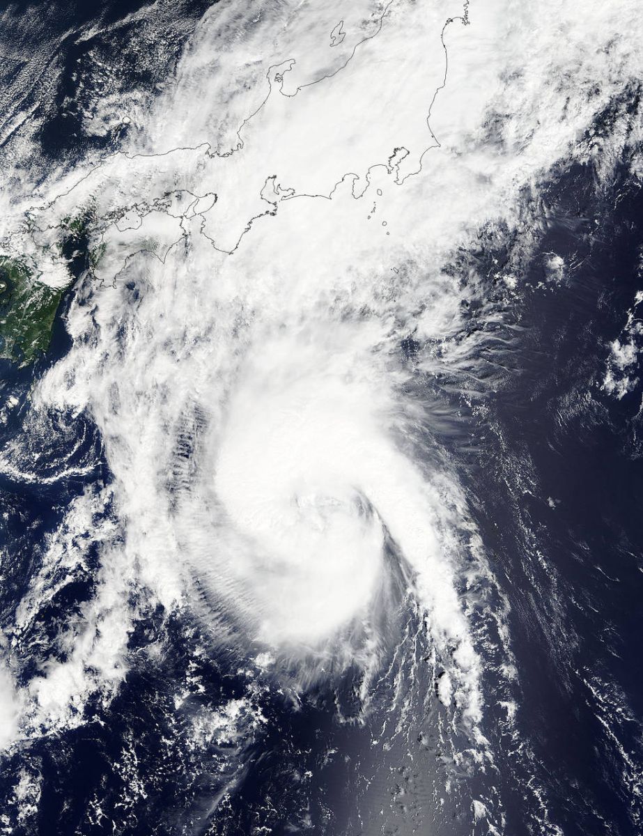
Tropical Storm "Etau" at 01:30 on September 8, 2015. Image credit: NASA Terra/MODIS.
As Etau approached the mainland Japan, the city of Toba recorded 99 mm (3.54 inches) of rain in one hour (up to 8:20 local time on September 9). 36 mm (1.41 inches) was recorded in the city of Sagamihara, west of Tokyo, in the hour up to 10:30 local time, according to NHK.
As of 00:00 UTC on September 9 (09:00 local time), Tropical Storm "Etau" had a central pressure of 990 hPa. It was packing winds of up to 82.8 km/h (51.3 mph), and was headed NW at 25 km/h (15.5 mph), according to JMA. By 07:45 UTC (16:45 local time), Etau's central pressure was 998 hPa, its maximum sustained winds were 64.8 km/h (40.2 mph), and it was moving to the NNW at 40 km/h (25 mph).
Meteorologist Robert Speta of the WestPacWx (and NHK) said some areas of the country have already seen well over 300 mm (11.8 inches) of rain, resulting in flooding and reports of landslides.
Flooding has closed roads and delayed numerous trains across central Japan. A 10 m (32.8 feet) wide landslide resulted in the damage of several homes in Shizuoka, however, no injuries have been reported, Speta added.
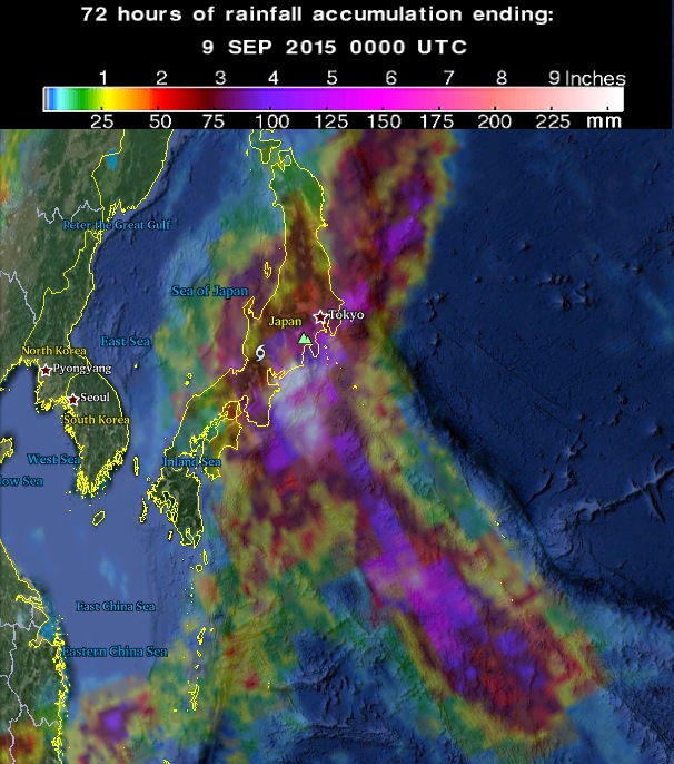
72-hr rainfall accumulation by September 9 at 00:00 UTC. Image credit: Google/NASA/JAXA GPM.
The maximum rainfall predicted over a 24-hour period up to 06:00 local time on September 10 (21:00 UTC on September 9) is 300 mm (11.8 inches) for the Kanto-Koshin region, 250 mm (9.84 inches) for the Tokai region, 200 mm (7.87 inches) for the Tohoku region, 150 mm (5.9 inches) for the Chugoku, Kinki, and Hokuriku regions, and 120 mm (4.72 inches) for the Izu island chain.

Etau is expected to move over Honshu through early afternoon (local time) and reach the Sea of Japan by the evening. Cooler sea surface temperatures in the Sea of Japan will eventually lead to its dissipation, but, for now, the threat of landslides remains high.
JMA is advising residents, particularly in eastern Japan and the Kinki region, to take precautions against landslides, flooding in low-elevation areas, swollen or flooded rivers, strong winds and high waves.
I'm a dedicated researcher, journalist, and editor at The Watchers. With over 20 years of experience in the media industry, I specialize in hard science news, focusing on extreme weather, seismic and volcanic activity, space weather, and astronomy, including near-Earth objects and planetary defense strategies. You can reach me at teo /at/ watchers.news.
This Vedic astrology writer is sad to learn the news of 10 September 2015 storm Etau hitting Japan, causing massive floods and large scale human evacuations. In this regard, it may not be out of place to mention that this was predicted by this writer in article – “ Total Lunar eclipse of 28 September 2015 and world” – published in Summer 2015 ( June) issue of The Astrologer’s Notebook , a print quarterly Newsletter from North Port, Florida. This writer is reproducing some of related main predictions from the article as :
(1). “ Dangers from sea or in sea like strong storms or sea tsunamis could be likely in vulnerable regions.”
(2). “ Somewhere a major war cannot be ruled out while natural calamities such as floods, landslides and earthquake could sadden.”
(3). “ Countries such as China , Japan and Thailand could also be in focus. Some islands located near the sea may need to take some precaution. Though second half of 2015 seems to be causing concern , months October and November of 2015 are likely to trigger many unwelcome things out of above mentioned aspects or areas of life.”
The intention was to hint the concerned for making preparations so as to reduce the harm to minimum. These predictions were given wide coverage by way of comments about two weeks ago in the context of earlier happenings in China, Japan and Thailand