
Heavy rainfall, storm surges and strong winds expected as Typhoon “Goni” approaches Japan
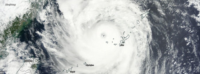
Featured image: Typhoon "Goni" on August 24, 2015. Credit: NASA Terra/MODIS.
Tropical Storm "Goni" formed from the Tropical Depression 16W east fo Guam in the North Pacific on August 14, 2015. On its journey across the North Pacific it battered the Luzon island, causing floods and landslides and it affected the Philippines, Japan and Taiwan.
Its intensity is expected to weaken during the next three days, although warnings for storm surges, strong winds and heavy rainfall remain in place across Taiwan and parts of Japan.
Goni passed over the Ishigaki and west of Miyako islands, southern Okinawa prefecture, Japan on August 23. Its center was located 93 km (58 miles) south-west of Kume island at 00:00 UTC on August 24, after its maximum sustained wind speed intensified to 204 km/h (127 mph).
Video credit: WestPacWx
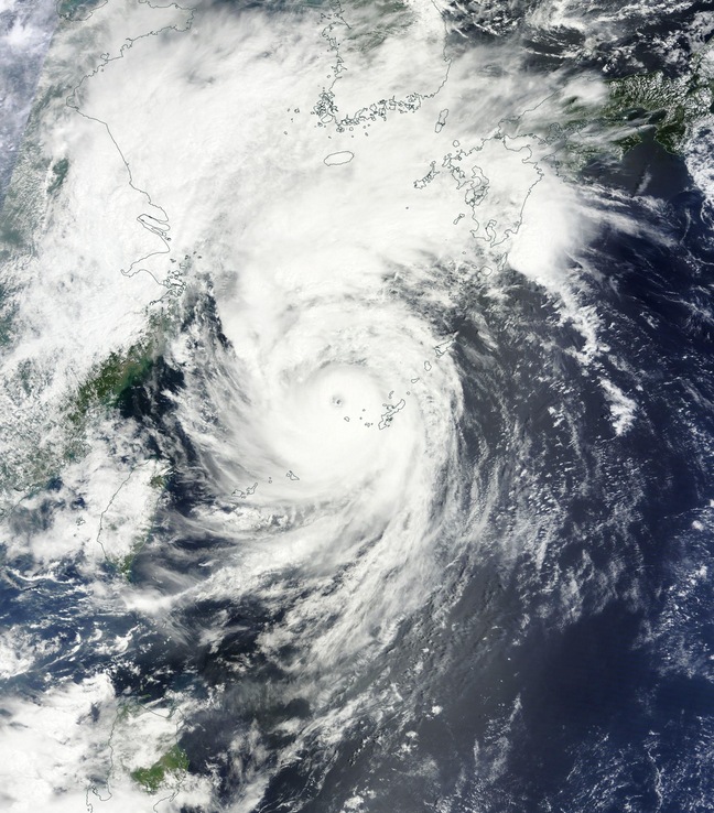
Typhoon "Goni" on August 24, 2015. Image credit: NASA Terra/MODIS.
According to JTWC, on August 24 at 09:00 UTC, the center of Typhoon "Goni" was located approximately 152 km (94 miles) north-north west of Kadena, Okinawa, Japan and it was moving northeastward at a speed of 39 km/h (24 mph).
The central pressure was estimated at 940 hPa, with maximum wind speed near the center estimated at 176 km/h (109 mph), and maximum wind gust speed reaching 250 km/h (155 mph), JMA reported.
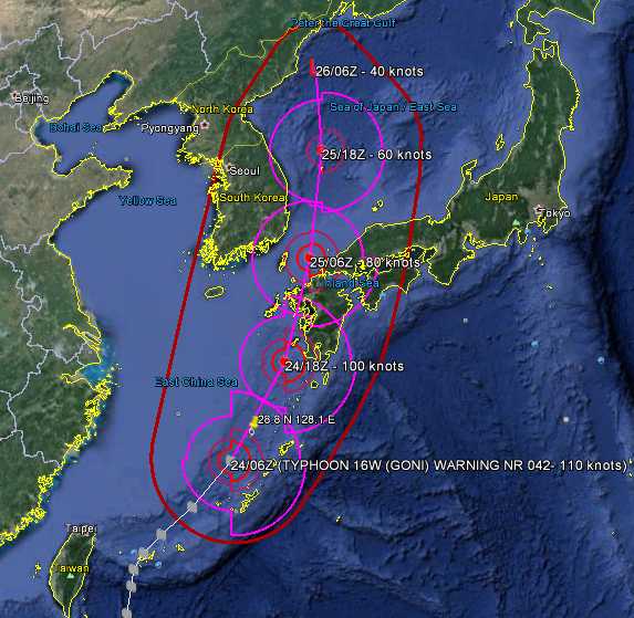
Forecasted track for Typhoon "Goni" over the next 48 hours. Image credit: JTWC/Google Earth
Over the next 24 hours, Typhoon "Goni" is expected to enter the Sea of Japan and pass over the Kyushu Island. Typhoon's strength is expected to gradually dissipate, due to its interaction with land and cooler waters of the Sea of Japan. The sustained wind speeds and wind gust speeds will decrease and the typhoon will begin its transition to a tropical storm level.
Goni will continue affecting the areas along its path with heavy rain, strong winds and storm surge which is estimated at 0.9 m (3 feet). Warnings for high waves, heavy rain, floods, storm and storm surge are in place across the regions of Okinawa and Kagoshima while a heavy rain warning remains in effect in most of Taiwan.
New favorite meteorological image of mine. Typhoon Goni sampled by high-res JMA radar 23Aug15 at peak intensity. pic.twitter.com/URkQECqQqh
— Anthony Sagliani (@anthonywx) August 23, 2015
So far, 14 people have been killed in the Philippines, and about 7 500 families were preventively evacuated in Luzon. In Ishigaki, Japan, 5 people reported injuries due to extreme weather conditions. In Taiwan, over 2 500 people had been preventively evacuated, however, luckily, no significant injuries of damage have so far been reported.
Over the next 72 hours the maximum sustained wind speed is expected to drop at 65 km/h (40 mph) with wind speed gusts decreasing to 93 km/h (58 mph). The central pressure is expected to rise to 998 hPa, and the tropical storm is expected to continue moving at the speed of 25 km/h (15 mph) north-north-west.
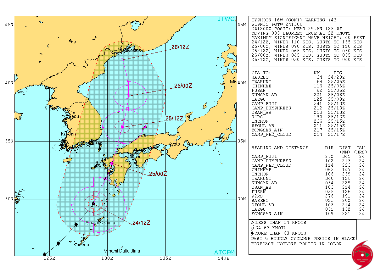
Typhoon "Goni" JTWC forecast track on August 24, 2015.
Commenting rules and guidelines
We value the thoughts and opinions of our readers and welcome healthy discussions on our website. In order to maintain a respectful and positive community, we ask that all commenters follow these rules.