
Almost stationary Typhoon “Goni” turns deadly, 5 dead and 2 missing in the Philippines
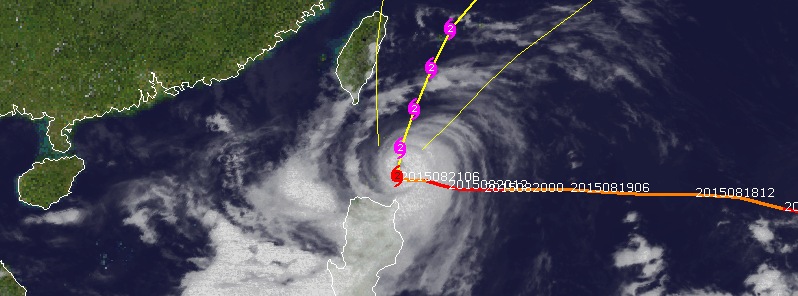
Featured image: Typhoon "Goni" on August 21, 2015. Credit: UW-CIMSS.
Typhoon "Goni" is crawling north of Philippines today and hitting hard the island of Luzon. At least 5 people were killed, and 2 are missing after heavy rains triggered floods and numerous landslides. Goni will pass east of Taiwan on August 22 and 23, and then turn NNE toward the Big Island of Japan.
Goni's center was about 100 km (62 miles) east of northern Calayan Island today, packing maximum sustained winds of 170 km/h (105 mph) and gusts of up to 205 km/h (127 mph), PAGASA reports.
Still, it managed to increase the southwest monsoon (Habagat) and cause enough heavy rain to trigger floods and landslides. PAGASA estimated rainfall amount is from moderate to heavy within the 600 km diameter of the typhoon.
Enhanced "Habagat" will bring monsoon rains over Metro Manila and the rest of Luzon and Western Visayas.
Residents in low lying and mountainous areas are alerted against possible flash floods and landslides which already claimed lives of at least 5 people. 4 of 5 casualties were killed in mudslides, according to National Disaster Risk Reduction and Management Council. Dozens of homes were destroyed by tornadoes.
Some areas already received over 300 mm (11.8 inches) of rain today, and more is on the way.
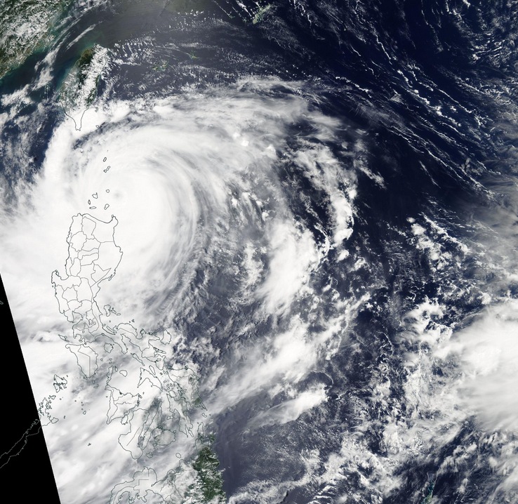
Typhon "Goni" on August 21, 2015. Image credit: NASA Aqua/MODIS.
A number of warnings are still in effect in the Philippines as Goni continues to move away. Public storm warning signal #3 is in effect in the Batanes Group of Islands, Northern Cagayan including Babuyan and Calayan Group of Islands. Public storm warning signal #2 is in effect for the rest of Cagayan, Northern Isabela, Kalinga, Apayao, Abra and Ilocos Norte. Finally, Public storm warning signal #1 is in effect for the rest of Isabela, Ifugao, Mt. Province, Benguet, La Union and Ilocos Sur.
According to JTWC, Goni's maximum sustained winds were near 176 km/h (109.3 mph) at 15:00 UTC today. The storm was centered about 639 km (397 miles) south of Taipei, Taiwan. At the time, Goni was moving north at 1.8 km/h (1.1 mph).
Taiwan's Central Weather Bureau estimates Goni's minimum central pressure is 940 hPa. The agency warned extremely heavy rain is possible in central and eastern Taiwan until Sunday, August 23.
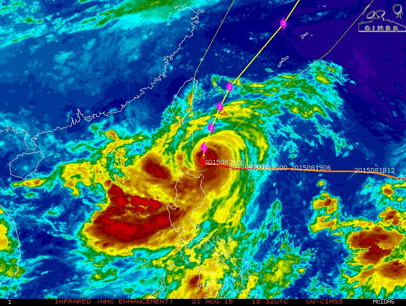
Typhoon "Goni" infrared image (NHC enhancement) on August 21, 2015. Image credit: UW-CIMSS.
JTWC forecasters expect that the center of Typhoon "Goni" will move north, passing east of Taiwan over the next two days (August 22 and 23). Their current forecast track takes it over Ishigaki Island on August 23. It is then expected to move NNE toward the Big Island of Japan.
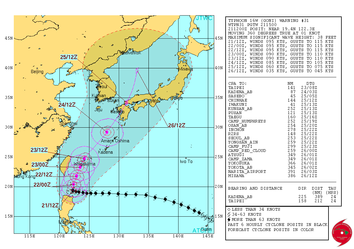
Typhoon "Goni" forecast track by JTWC on August 21, 2015.
Read more: Atsani becomes 6th super typhoon of the year

Typhoon "Goni" (left) and "Atsani" (right) on August 21, 2015. Image credit: JMA/RAMMB/CIRA (Himawari-8).
I'm a dedicated researcher, journalist, and editor at The Watchers. With over 20 years of experience in the media industry, I specialize in hard science news, focusing on extreme weather, seismic and volcanic activity, space weather, and astronomy, including near-Earth objects and planetary defense strategies. You can reach me at teo /at/ watchers.news.
Commenting rules and guidelines
We value the thoughts and opinions of our readers and welcome healthy discussions on our website. In order to maintain a respectful and positive community, we ask that all commenters follow these rules.