
Tropical Storm “Carlos” intensifies near the southern Pacific coast of Mexico
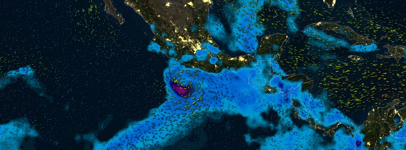
Image credit: Tropical Storm "Carlos" on June 12, 2015. Winds and precipitation model by MeteoEarth.
A new tropical depression formed on June 10 south of Mexico and strengthened into a Tropical Storm "Carlos" by 15:00 UTC on Thursday, June 11, 2015. This is the third named storm of the 2015 eastern Pacific hurricane season, expected to intensify into a hurricane and bring locally heavy rains and life-threatening surf and rip conditions over portions of the southern Pacific coast of Mexico.
A Tropical Storm Watch is currently in effect from Acapulco to Zihuatanejo.
At 15:00 UTC on June 11, Carlos was located about 370 km (230 miles) S of Acapulco and 475 km (295 miles) SSE of Zihuatanejo, Mexico. Its maximum sustained winds were 65 km/h (40 mph). Carlos was moving to the NW at 9 km/h (6 mph).
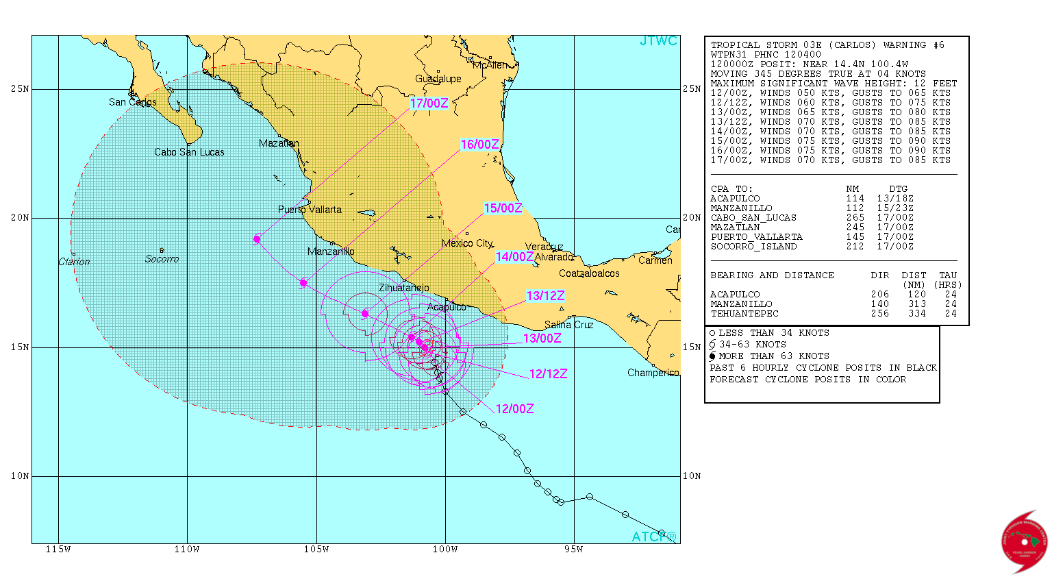
By 06:00 UTC on June 12, Carlos had maximum sustained winds of 95 km/h (60 mph), minimum central pressure of 997 hPa and was moving NNW at 4 km/h (2 mph).
The center of Tropical Storm "Carlos" was located about 270 km (165 miles) SSW of Acapulco and 350 km (215 mph) SSE of Zihuatanejo. A very slow NNW to NW motion is expected for the next couple of days.
Some additional strengthening is expected, and Carlos is forecast to become a hurricane during the next day or so, NWS NHC notes today.
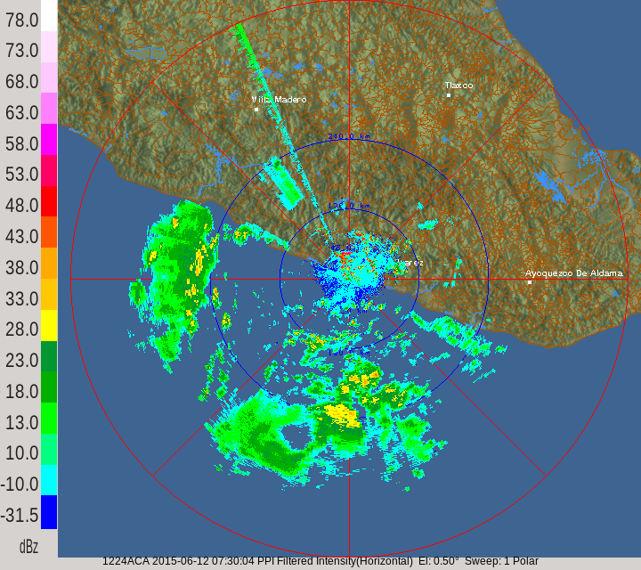
Acapulco radar image. Credit: SMN/CONAGUA.
Tropical storm force winds extend outward up to 130 km (80 miles) from the center.
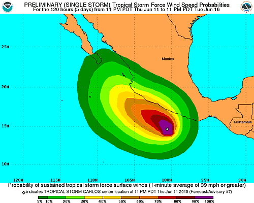
Locally heavy rains could spread over portions of the southern coast of Mexico during the next few days. These swells could cause life-threatening surf and rip conditions.
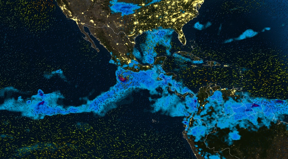
Tropical Storm "Carlos" on June 12, 2015. Winds and precipitation model by MeteoEarth.
Satellite animations
- Storm-Centered Infrared (GOES 15; NOAA/SSD)
- Storm-Centered Infrared (Aviation Color Enhancement) (GOES 15; NOAA/SSD)
- Storm-Centered Water Vapor (GOES 15; NOAA/SSD)
- Storm-Centered Visible (GOES 15; NOAA/SSD)
- Storm-Centered Visible (Colorized) (GOES 15; NOAA/SSD)
- Storm-Centered Infrared (GOES 15; CIMSS)
- Storm-Centered Enhanced Infrared (GOES 15; CIMSS)
- Storm-Centered Water Vapor (GOES 15; CIMSS)
- Storm-Centered Visible (GOES 15; CIMSS)
- East Pacific Infrared (GOES 15; NOAA/SSD)
- East Pacific (Aviation Color Enhancement) (GOES 15; NOAA/SSD)
- East Pacific Water Vapor (GOES 15; NOAA/SSD)
- East Pacific Visible (GOES 15; NOAA/SSD)
- East Pacific Visible (Colorized) (GOES 15; NOAA/SSD)
I'm a dedicated researcher, journalist, and editor at The Watchers. With over 20 years of experience in the media industry, I specialize in hard science news, focusing on extreme weather, seismic and volcanic activity, space weather, and astronomy, including near-Earth objects and planetary defense strategies. You can reach me at teo /at/ watchers.news.
Commenting rules and guidelines
We value the thoughts and opinions of our readers and welcome healthy discussions on our website. In order to maintain a respectful and positive community, we ask that all commenters follow these rules.