
GOCE revealed the height of sea is not the same everywhere on Earth
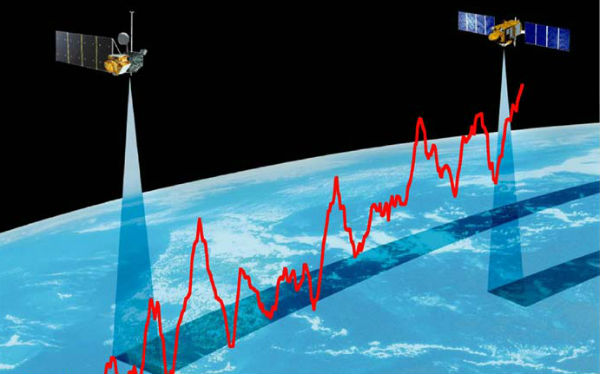
Image credit: JPL/NASA
New precision gravity data from ESA’s GOCE satellite revealed that the sea is lower heading north along the east coast of North America. Winds, currents, tides and different temperatures cause seawater to pile up in some regions and dip in others, so in fact, the height of sea is not the same everywhere on our planet.
Geodesists and oceanographers have disagreed about whether the sea is higher or lower heading north along east coast of North America. Just until recently, geodesists thought that the height of the sea increased with latitude along the Atlantic coast from Florida to Canada and now new GOCE measurements backed up oceanographers theories. Oceanographers were aware of the influence that the Gulf Stream would have on the height of the sea along the coast.
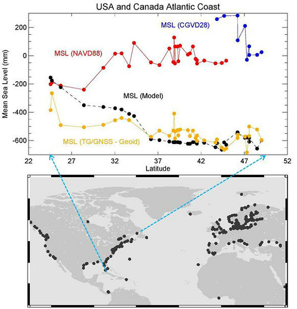 The red and blue dots show values of mean sea level (MSL) measured with respect to national datums in the US and Canada (red and blue, respectively). These data indicate that the height of the sea increases travelling north from Florida to Canada. However, most modern numerical models of ocean circulation (black dots) suggest that the slope of the sea should actually decrease travelling north and can be explained by the effects of the Gulf Stream in this region of the Atlantic Ocean. The new geoid from ESA’s GOCE gravity mission has resolved this long-debated mystery by providing conclusive proof that the height of the sea does, indeed, drop (yellow dots). (Credit: ESA/HSU science team)
Most modern computer models of ocean circulation suggest that sea level falls travelling north, especially along the Florida coast. As this major current then sweeps away from North Carolina, coastal sea level should be essentially flat thereafter. This contrasts with the Pacific coast where there is no significant slope with latitude. The height of Earth’s oceans changes by about 150 meters (almost 500 feet) from the north Indian Ocean (off the south coast of India) and western Pacific Ocean (off of New Guinea).
Until recently, conventional levelling, carrying surveying instruments thousands of kilometres and combining measurements in the national surveying datum that were assumed to be level reference surfaces, were used to determine conditions of sea height. Back from the 1920s, conclusions were based on traditional methods that connect values of mean sea level from tide gauge measurements.
It is quiet difficult to determine relative heights of the sea, especially near the coast. Waves, tides, ocean currents, ocean eddies and temperature of the upper ocean water are main factors to contribute the sea surface heights. Except for gravity, each changes over days, months, or a few years. Of these remaining factors, basin-wide ocean circulation is the most stable – it does not change significantly over periods of days or months.
GOCE maps variations in Earth’s gravity with extreme detail, resulting with a unique model of the ‘geoid’, which is essentially a virtual surface where water does not flow from one point to another. The new geoid and in situ gravity measurements have been used as a reference to establish levelling heights. Combining the GOCE geoid and GPS heights at tide gauges provides indirect means of calculating sea heights by levelling along coastlines. The new results prove conclusively that sea level decreases going north along the North American Atlantic coastline, in agreement with the ocean models. The findings are important for establishing a common height reference system between the US, Canada and Mexico.
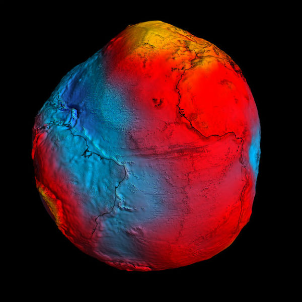 A precise model of Earth’s geoid is crucial for deriving accurate measurements of ocean circulation, sea-level change and terrestrial ice dynamics. The geoid is also used as a reference surface from which to map the topographical features on the planet. In addition, a better understanding of variations in the gravity field will lead to a deeper understanding of Earth’s interior, such as the physics and dynamics associated with volcanic activity and earthquakes. (Credit: ESA/HPF/DLR)
“Data from GOCE will lead to a unified global height system so that we can consistently study sea-level change apparent in tide gauge and satellite altimetry data.” Reiner Rummel from the Technical University of Munich
Through ESA’s Support to Science Element programme, scientists from the National Oceanography Centre Liverpool in the UK, the Technical University of Munich in Germany and Newcastle University in the UK have developed a new method that largely uses GOCE data to determine a reference level surface. This work complements that of Dalhousie University in Canada and other oceanographic research groups also making use of new geoid information.
GOCE+ Height System Unification STSE study
Source: ESA
they knew, building the panama canal, that the Pacific and the Caribbean were at different levels
Let’s consider recent findings: Sahara was green 5,000 y ago. The first Greek civilization (Homer’s) stalls, prior to that Santorini blows eliminating the Cretan civilization, evidence of cross ocean travels in the Pacific fade into myth, prior to that early copper starts come to naught, so what happened? Did the continent of Greenland move North? Did it become iced forcing the southward migration of advanced peoples who tried and failed to reestablish knowledge? Did the continent block ocean currents permanently changing weather patterns across the globe?
Maybe I am seeing too much in this, but if somebody took this exaggerated model of the Earth’s geoid and created a replica out of clay and spun it on the same axis as the Earth’s rotation in a weightless environment, would it maintain its spin axis or would centrifugal force throw the densest areas towards a new equator in order the achieve more balance? Albeit we’re lacking an image of the other side of the planet here so my question remains a bit nebulous for the moment… just some food for thought while west Antarctica melts away…
Napoleon knew about differences in the heights of seas. That’s why he abandoned his plan to build the Suez Canal.