
Tropical Cyclone Haruna spinning southwest of Madagascar
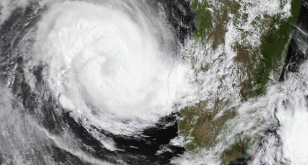
Image credit: TW
Tropical Cyclone Haruna (16S) in South Indian Ocean, is forecast to increase in intensity in the next 24 hours to a peak of 100 knots, gusting up to 125 knots. Increasing vertical wind shear and land interaction will begin to weaken the system in the next 24 hours.
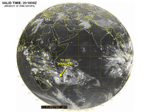
According to latest report by Joint Typhoon Warning Center (JTWC), Tropical Cyclone Haruna is located approximately 380 nm southwest of Antananarivo, Madagascar, has tracked southeastward at speed of 03 knots, generating 7.6 meter-high (25-foot-high) waves. Animated infrared satellite imagery shows the system continued to deepen as it maintained a large and symmetrical 30-nm eye. Upper level analysis indicates the system is just to the west of an anticyclone in an area of low (05-10 knot) vertical wind shear and excellent radial outflow.
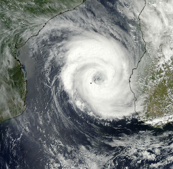 The MODIS instrument aboard NASA’s Aqua satellite captured this visible image of Tropical Storm Haruna on February 20, 2013 (Credit: NASA Goddard MODIS Rapid Response Team)
The area of strongest thunderstorms circled the eye and had cloud top temperatures colder than -63F (-52C). Those cold cloud top temperatures indicated strong storms with heavy rainfall, which was verified by NASA’s Tropical Rainfall Measuring Mission (TRMM) satellite. NASA’s TRMM Precipitation Radar (PR) was used to create a 3-D image that sliced through tropical storm Haruna’s center. TRMM data showed that towering thunderstorms on the northern edge of Haruna’s center were over 14.25 km (~8.85 miles) high.
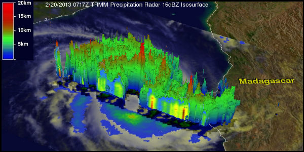 The TRMM satellite flew above Haruna on Feb. 20 at 0717 UTC. Some powerful storms Haruna’s northern edge showed rainfall over 108 mm (~4.25 inches) per hour and cloud tops as high as 14.25 km (~8.85 miles). (Credit: Hal Pierce/SSAI/NASA)
The system will peak intensity over the next 24 hours as the along-track environmental conditions remain favorable. Haruna is forecast to begin extra-tropical transition as it tracks into cooler waters (less than 26 degrees Celsius) southeast of Madagascar. Interaction with the rugged terrain of southern Madagascar, increasing vertical wind shear and cooling sea surface temperatures will gradually erode the system.
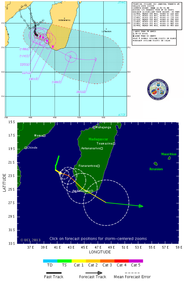 Haruna forecast track by TSR and JTWC
Satellite Animations
- Storm-Centered Infrared (Meteosat 7; CIMSS)
- Storm-Centered Enhanced Infrared (Meteosat 7; CIMSS)
- Storm-Centered Water Vapor (Meteosat 7; CIMSS)
- Storm-Centered Visible (Meteosat 7; CIMSS)
- Meteosat 7 Infrared (Meteosat 7; CIMSS)
- Meteosat 7 Infrared (Color Background) (Meteosat 7; CIMSS)
- Meteosat 7 Infrared (NHC Color Enhancement) (Meteosat 7; CIMSS)
- Meteosat 7 Water Vapor (Meteosat 7; CIMSS)
- Meteosat 7 Water Vapor (Color Background) (Meteosat 7; CIMSS)
Commenting rules and guidelines
We value the thoughts and opinions of our readers and welcome healthy discussions on our website. In order to maintain a respectful and positive community, we ask that all commenters follow these rules.