Tropical Depression 4E near Mexico getting better organized
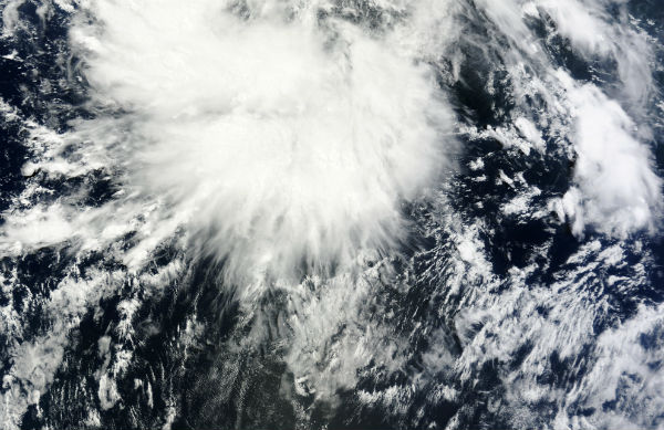
tropical-depression-4e-near-mexico

A new tropical depression formed in the Eastern Pacific Basin along with a second tropical wave which may develop this weekend.  it is expected that this depression will strengthen into Tropical Storm “Daniel” which is the next name on the Eastern Pacific list.

Showers and thunderstorms associated with a low pressure area located about 715 km (445 miles) south of Manzanillo, Mexico, continue to show signs of organization, and the system could become a tropical depression at any time. This system has a very high chance (90 percent) of becoming a tropical cyclone during the next 48 hours as it moves west-northwestward at about 10 mph.

According to National Hurricane Center’s latest public advisory, the center of Tropical Depression 4E was located near latitude 13.5N and longitude 107.8W. The depression is moving toward the west-northwest near 20 km/h (13 mph). This general motion is expected to continue for the next day or so, followed by a turn toward the west by Thursday night.

Maximum sustained winds are near 55km/h (35mph) with higher gusts. During the next 48 hours, gradual strengthening is forecast during the next 48 hours and the depression is expected to become a tropical storm later tonight or in the morning. The estimated minimum central pressure is 1005MB.

SUMMARY OF 200 PM PDT...2100 UTC...INFORMATION
----------------------------------------------
LOCATION...13.5N 107.8W
ABOUT 445 MI...715 KM SSW OF MANZANILLO MEXICO
ABOUT 665 MI...1070 KM SSE OF THE SOUTHERN TIP OF BAJA CALIFORNIA
MAXIMUM SUSTAINED WINDS...35 MPH...55 KM/H
PRESENT MOVEMENT...WNW OR 295 DEGREES AT 13 MPH...20 KM/H
MINIMUM CENTRAL PRESSURE...1005 MB...29.68 INCHES

Meanwhile, disorganized shower and thunderstorm activity extends several hundred miles west of Costa Rica over the far eastern north Pacific Ocean. For now, only slow development is expected over the next few days as the system moves westward at about 16 km/h (10 mph). This system has a low chance (20%) of becoming a tropical cyclone during the next 48 hours.

Source: NHC, MODIS

If you value what we do here, create your ad-free account and support our journalism.

Share:


Your support makes a difference

Dear valued reader,

We hope that our website has been a valuable resource for you.

The reality is that it takes a lot of time, effort, and resources to maintain and grow this website. We rely on the support of readers like you to keep providing high-quality content.

If you have found our website to be helpful, please consider making a contribution to help us continue to bring you the information you need. Your support means the world to us and helps us to keep doing what we love.

Support us by choosing your support level – Silver, Gold or Platinum. Other support options include Patreon pledges and sending us a one-off payment using PayPal.

Thank you for your consideration. Your support is greatly appreciated.

Sincerely,
Teo Blašković

$5 /month

  • Ad-free account
  • Clean user interface and fast browsing
  • Direct communication with us via chat and email
  • Suggest new features, content and applications
  • Early access to new apps and features

$50 /year

$10 /month

  • Ad-free account
  • Clean user interface and fast browsing
  • Direct communication with us via chat and email
  • Suggest new features, content and applications
  • Early access to new apps and features

$100 /year

$25 /month

  • Ad-free account
  • Clean user interface and fast browsing
  • Direct communication with us via chat and email
  • Suggest new features, content and applications
  • Early access to new apps and features

$200 /year

You can also support us on Patreon

support us on patreon

or by sending us a one-off payment using PayPal:


Commenting rules and guidelines

We value the thoughts and opinions of our readers and welcome healthy discussions on our website. In order to maintain a respectful and positive community, we ask that all commenters follow these rules:

  • Treat others with kindness and respect.
  • Stay on topic and contribute to the conversation in a meaningful way.
  • Do not use abusive or hateful language.
  • Do not spam or promote unrelated products or services.
  • Do not post any personal information or content that is illegal, obscene, or otherwise inappropriate.

We reserve the right to remove any comments that violate these rules. By commenting on our website, you agree to abide by these guidelines. Thank you for helping to create a positive and welcoming environment for all.

Leave a reply

Your email address will not be published. Required fields are marked *