
Tropical cyclone Kuena formed in Indian Ocean
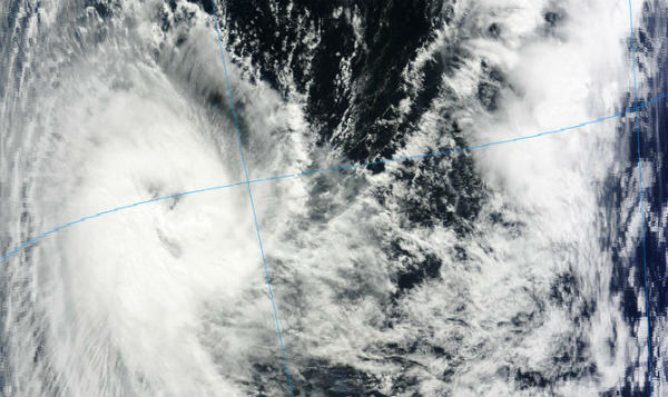
Image credit: TW
New cyclone is forming in Indian Ocean. Tropical cyclone 20S, named KUENA, is located 370 nm south-southeast of the Seychelles and is moving west-southwestward at speed of 7 knots (13 km/h) according to latest report by Joint Typhoon Warning Center (JTWC). The current intensity is assessed at 50 knots. Kuena is currently tracking along the northern periphery of the subtropical ridge and is forecast to continue tracking westward. Maximum significant wave heights is 4.6 meters (15 feet).


According to RSMC, Kuena has probably reached it intensity peak during morning. For now, it is forecasted to weaken in coming days before it gets close to the land. In June, environmental sea level pressures are higher than average.

Sources: JTWC, MeteoFrance, RSMC, MODIS, TRMM
Satellite Animations
- Meteosat 7 Infrared (Meteosat 7; CIMSS)
- Meteosat 7 Infrared (Color Background) (Meteosat 7; CIMSS)
- Meteosat 7 Infrared (NHC Color Enhancement) (Meteosat 7; CIMSS)
- Meteosat 7 Water Vapor (Meteosat 7; CIMSS)
- Meteosat 7 Water Vapor (Color Background) (Meteosat 7; CIMSS)

Commenting rules and guidelines
We value the thoughts and opinions of our readers and welcome healthy discussions on our website. In order to maintain a respectful and positive community, we ask that all commenters follow these rules.