
Active volcanoes in the world – March 21 – March 27, 2012
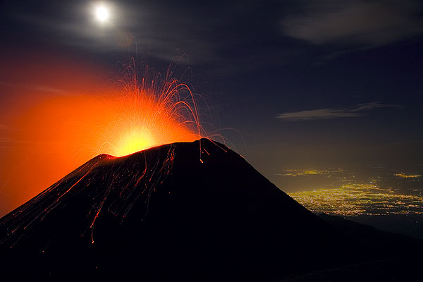
Image credit: Volcano Discovery
This report covers active volcanoes recorded from March 21 – March 27, 2012 based on Smithsonian/USGS criteria. New unrest has been noticed around 5 volcanoes, ongoing activity was reported for 11 volcanoes.
IJEN Eastern Java (Indonesia)
8.058°S, 114.242°E; summit elev. 2799 m
On 24 March, CVGHM reported that Ijen’s lake water chemistry changed during 10 January-17 March, exhibiting a significant increase in carbon dioxide, especially after 5 February, and an increase in acidity. The lake surface temperature increased from 28.8 degrees Celsius on 3 March to 45.1 degrees Celsius on 17 March. The lake water temperature at a depth of 5 m also rose from 42.7 to 44.7 degrees Celsius on 3 and 17 March, respectively. Seismicity increased starting in March. The Alert Level remained at 2 (on a scale of 1-4).
Geologic Summary. The Ijen volcano complex consists of a group of small stratovolcanoes constructed within the large 20-km-wide Ijen (Kendeng) caldera. The N caldera wall forms a prominent arcuate ridge, but elsewhere the caldera rim is buried by post-caldera volcanoes, including Gunung Merapi stratovolcano, which forms the 2,799 m high point of the Ijen complex. Immediately W of Gunung Merapi is the renowned historically active Kawah Ijen volcano, which contains a nearly 1-km-wide, turquoise-colored, acid crater lake. The picturesque lake is the site of a labor-intensive sulfur mining operation, in which sulfur-laden baskets are hand-carried from the crater floor. A half dozen small-to-moderate phreatic eruptions have taken place from Kawah Ijen during the 20th century.
ILIAMNA
Southwestern Alaska 60.032°N, 153.090°W; summit elev. 3053 m
AVO reported that during 21-27 March seismicity at Iliamna remained above background levels, although just slightly during 25-27 March. When not obscured by clouds, satellite and web camera views showed nothing unusual. The Alert Level remained at Advisory and the Aviation Color Code remained at Yellow.
Geologic Summary. Iliamna is a prominent, 3053-m-high glacier-covered stratovolcano in Lake Clark National Park on the western side of Cook Inlet, about 225 km SW of Anchorage. Its flat-topped summit is flanked on the south, along a 5-km-long ridge, by the prominent North and South Twin Peaks, satellitic lava dome complexes. The Johnson Glacier dome complex lies on the NE flank. Steep headwalls on the southern and eastern flanks expose an inaccessible cross-section of the volcano. Major glaciers radiate from the summit, and valleys below the summit contain debris-avalanche and lahar deposits. Only a few major Holocene explosive eruptions have occurred from the deeply dissected volcano, which lacks a distinct crater. Most of the reports of historical eruptions may represent plumes from vigorous fumaroles east and SE of the summit, which are often mistaken for eruption columns (Miller et al., 1998). Eruptions producing pyroclastic flows have been dated at as recent as about 300 and 140 years ago (into the historical period), and elevated seismicity accompanying dike emplacement beneath the volcano was recorded in 1996.
NEVADO DEL RUIZ
Colombia 4.895°N, 75.322°W; summit elev. 5321 m
According to INGEOMINAS, the Observatorio Vulcanológico and Sismológico de Manizales reported that during 19-25 March seismicity at Nevado del Ruiz increased and gas emissions remained at significant levels. Gas plumes rose 2 km above Arenas crater and sulfur dioxide odors were reported by local people. The Alert Level remained at III (Yellow; “changes in the behavior of volcanic activity”).
Geologic Summary. Nevado del Ruiz is a broad, glacier-covered volcano in central Colombia that covers >200 sq km. Three major edifices, composed of andesitic and dacitic lavas and andesitic pyroclastics, have been constructed since the beginning of the Pleistocene. The modern cone consists of a broad cluster of lava domes built within the summit caldera of an older Ruiz volcano. The 1-km-wide, 240-m-deep Arenas crater occupies the summit. Steep headwalls of massive landslides cut the flanks of Nevado del Ruiz. Melting of its summit icecap during historical eruptions, which date back to the 16th century, has resulted in devastating lahars, including one in 1985 that was South America’s deadliest eruption.
PACAYA
Guatemala 14.381°N, 90.601°W; summit elev. 2552 m
INSIVUMEH noted in a special report that on 20 March patterns of seismicity and emissions from Pacaya’s MacKenney cone changed, although remained characteristic of normal behavior for the volcano. On 26 March avalanches were detected and during 26-27 March gas plumes drifted S and SW. The report noted that after the eruption on 27 May 2010 only fumarolic emissions, mainly composed of water vapor, rose from MacKenney cone.
Geologic Summary. Eruptions from Pacaya, one of Guatemala’s most active volcanoes, are frequently visible from Guatemala City, the nation’s capital. Pacaya is a complex volcano constructed on the southern rim of the 14 x 16 kmPleistocene Amatitlan caldera. A cluster of dacitic lava domes occupies the caldera floor. The Pacaya massif includes the Cerro Grande lava dome and a younger volcano to the SW. Collapse of Pacaya volcano about 1,100 years ago produced a debris-avalanche deposit that extends 25 km onto the Pacific coastal plain and left an arcuate somma rim inside which the modern Pacaya volcano (MacKenney cone) grew. During the past several decades, activity at Pacaya has consisted of frequent Strombolian eruptions with intermittent lava flow extrusion on the flanks of MacKenney cone, punctuated by occasional larger explosive eruptions.
SOUFRIERE HILLS
Montserrat 16.72°N, 62.18°W; summit elev. 915 m
MVO reported that during 16-23 March activity at the Soufrière Hills lava dome was at a low level, although seismicity increased. Two swarms of volcano-tectonic earthquakes occurred, the first between 1604 and 1651 on 22 March (49 events) and the second between 0310 and 0527 on 23 March (54 events). Earthquakes in the second swarm were markedly larger than those in the first. Several changes on the volcano were observed on 23 March;fumarolic activity had increased and a new fumarole had appeared on the NW face of the lava dome behind Gages Mountain. In addition a vent producing pulsing steam emissions with a small amount of ash had formed in the back of the February 2010 collapse scar. Ash plumes rose 1.8 km (6,000 ft) a.s.l. and very light ashfall occurred on the W flank of the volcano. Audible roaring associated with the venting was heard intermittently from MVO, 5.75 km NW of the volcano. The Hazard Level remained at 2.
Based on a METAR weather report and analyses of satellite imagery, the Washington VAAC reported that on 24 March a gas-and-ash plume drifted 65 km WSW. Later that day the VAAC reported a detached area of ash drifting NW and a second small emission of ash drifting WNW. The next day haze and vog W of Soufrière Hills was detected in satellite imagery and a pilot reported ash at altitudes of 1.5-3 km (5,000-10,000 ft) a.s.l. drifting NW.
On 26 March MVO noted that activity returned to a low level following the ash-venting on 23 March. The report noted that Zone C on the volcanic risk map, which was temporarily closed the previous week due to an increase in volcano-tectonic earthquakes below Soufrière Hills, re-opened for day-time entrance on 27 March. Zone C is to the WNW of Soufrière Hills and includes Cork Hill, Weekes, Foxes Bay, Richmond Hill, and Delvins, and extends 500 m out to sea.
Geologic Summary. The complex dominantly andesitic Soufrière Hills volcano occupies the southern half of the island of Montserrat. The summit area consists primarily of a series of lava domes emplaced along an ESE-trending zone. English’s Crater, a 1-km-wide crater breached widely to the E, was formed during an eruption about 4,000 years ago in which the summit collapsed, producing a large submarine debris avalanche. Block-and-ash flow and surge deposits associated with dome growth predominate in flank deposits at Soufrière Hills. Non-eruptive seismic swarms occurred at 30-year intervals in the 20th century, but with the exception of a 17th-century eruption that produced the Castle Peak lava dome, no historical eruptions were recorded on Montserrat until 1995. Long-term small-to-moderate ash eruptions beginning in that year were later accompanied by lava-dome growth andpyroclastic flows that forced evacuation of the southern half of the island and ultimately destroyed the capital city of Plymouth, causing major social and economic disruption.
Ongoing Activity
CLEVELAND
Chuginadak Island 52.825°N, 169.944°W; summit elev. 1730 m
AVO reported on 23 March that the Volcano Alert Level and Aviation Color Code for Cleveland were lowered to Advisory and Yellow, respectively, because no explosions had been detected since 13 March and lava-domegrowth was not evident after that.
Geologic Summary. Symmetrical Mount Cleveland stratovolcano is situated at the western end of the uninhabited dumbbell-shaped Chuginadak Island in the east-central Aleutians. The 1,730-m-high stratovolcano is the highest of the Islands of Four Mountains group and is one of the most active in the Aleutians. Numerous large lava flows descend its flanks. It is possible that some 18th to 19th century eruptions attributed to Carlisle (a volcano located across the Carlisle Pass Strait to the NW) should be ascribed to Cleveland. In 1944 Cleveland produced the only known fatality from an Aleutian eruption. Recent eruptions from Mt. Cleveland have been characterized by short-lived explosive ash emissions, at times accompanied by lava fountaining and lava flows down the flanks.
KARYMSKY
Eastern Kamchatka (Russia) 54.05°N, 159.45°E; summit elev. 1536 m
KVERT reported that during 16-23 March seismic activity from Karymsky continued to be detected, and indicated that possible ash plumes rose to an altitude of 3 km (9,800 ft) a.s.l. during 17 and 20-21 March. Satellite imagery showed a thermal anomaly on the volcano on 15 and 17 March; cloud cover prevented observations on the other days. The Aviation Color Code remained at Orange.
Geologic Summary. Karymsky, the most active volcano of Kamchatka’s eastern volcanic zone, is a symmetricalstratovolcano constructed within a 5-km-wide caldera that formed about 7,600-7,700 radiocarbon years ago. Construction of the Karymsky stratovolcano began about 2,000 years later. The latest eruptive period began about 500 years ago, following a 2,300-year quiescence. Much of the cone is mantled by lava flows less than 200 years old. Historical eruptions have been Vulcanian or Vulcanian-Strombolian with moderate explosive activity and occasional lava flows from the summit crater. Most seismicity preceding Karymsky eruptions has originated beneath Akademia Nauk caldera, which is located immediately S of Karymsky volcano and erupted simultaneously with Karymsky in 1996.
KILAUEA
Hawaii (USA) 19.421°N, 155.287°W; summit elev. 1222 m
During 21-27 March HVO reported that the lava lake periodically rose and fell in the deep pit within Kilauea’s Halema’uma’u Crater. Almost daily measurements indicated that the gas plume from the vent continued to deposit variable amounts of ash and fresh spatter nearby. Incandescence was visible from both a small pit on the NE edge and a small spatter cone on the SE edge of the Pu’u ‘O’o crater floor, and on the upper part of the lava-tube system on the E flank. Lava flows continued to advance down the pali and across the coastal plain.
Geologic Summary. Kilauea, one of five coalescing volcanoes that comprise the island of Hawaii, is one of the world’s most active volcanoes. Eruptions at Kilauea originate primarily from the summit caldera or along one of the lengthy E and SW rift zones that extend from the caldera to the sea. About 90% of the surface of Kilauea is formed of lava flows less than about 1,100 years old; 70% of the volcano’s surface is younger than 600 years. A long-term eruption from the East rift zone that began in 1983 has produced lava flows covering more than 100 sq km, destroying nearly 200 houses and adding new coastline to the island.
KIZIMEN
Eastern Kamchatka (Russia) 55.130°N, 160.32°E; summit elev. 2376 m
KVERT reported moderate seismic activity at Kizimen during 16-23 March and a large thermal anomaly that was detected in satellite images. Video and satellite observations indicated both continued effusion of a large lava flow on the E flank and accompanying hot avalanches. Strong gas-and-steam activity was observed with the video camera. The Aviation Color Code remained at Orange.
Geologic Summary. Kizimen is an isolated, conical stratovolcano that is morphologically similar to Mount St. Helens prior to its 1980 eruption. The summit of Kizimen consists of overlapping lava domes, and blocky lava flows descend the flanks of the volcano, which is the westernmost of a volcanic chain north of Kronotsky volcano. The 2,376-m-high Kizimen was formed during four eruptive cycles beginning about 12,000 years ago and lasting 2,000-3,500 years. The largest eruptions took place about 10,000 and 8300-8400 years ago, and three periods of longterm lava-dome growth have occurred. The latest eruptive cycle began about 3,000 years ago with a large explosion and was followed by lava-dome growth lasting intermittently about 1,000 years. An explosive eruption about 1,100 years ago produced a lateral blast and created a 1.0 x 0.7 km wide crater breached to the NE, inside which a small lava dome (the fourth at Kizimen) has grown. A single explosive eruption, during 1927-28, has been recorded in historical time.
PUYEHUE-CORDON CAULLE
Central Chile 40.590°S, 72.117°W; summit elev. 2236 m
OVDAS–SERNAGEOMIN reported that although cloud cover often prevented satellite and web camera observations of the Cordón Caulle rift zone, part of the Puyehue-Cordón Caulle volcanic complex, during 20-27 March plumes were sometimes observed rising no higher than 1 km above the crater. The Alert Level was lowered to Orange on 23 March. Incandescence from the crater was observed during 23-27 March.
Geologic Summary. The Puyehue-Cordón Caulle volcanic complex (PCCVC) is a large NW-SE-trending late-Pleistocene to Holocene basaltic-to-rhyolitic transverse volcanic chain SE of Lago Ranco. The 1799-m-highPleistocene Cordillera Nevada caldera lies at the NW end, separated from Puyehue stratovolcano at the SE end by the Cordón Caulle fissure complex. The Pleistocene Mencheca volcano with Holocene flank cones lies NE of Puyehue. The basaltic-to-rhyolitic Puyehue volcano is the most geochemically diverse of the PCCVC. The flat-topped, 2236-m-high Puyehue volcano was constructed above a 5-km-wide caldera and is capped by a 2.4-km-wide summit caldera of Holocene age. Lava flows and domes of mostly rhyolitic composition are found on the eastern flank of Puyehue. Historical eruptions originally attributed to Puyehue, including major eruptions in 1921-22 and 1960, are now known to be from the Cordón Caulle rift zone. The Cordón Caulle geothermal area, occupying a 6 x 13 km wide volcano-tectonic depression, is the largest active geothermal area of the southern Andes volcanic zone.
REVENTADOR
Ecuador 0.077°S, 77.656°W; summit elev. 3562 m
Instituto Geofísico-Escuela Politécnica Nacional (IG) reported that during 21-25 March storm clouds prevented observations of Reventador. During 25-26 March incandescence from a high part of the volcano was observed. On 26 March a steam emission rose 500 m above the crater. Based on analysis of satellite imagery and seismic data, the Washington VAAC reported that an ashplume drifted 25 km NNW on 26 March. Later that day the ash had dissipated and seismicity decreased.
Geologic Summary. Reventador is the most frequently active of a chain of Ecuadorian volcanoes in the Cordillera Real, well E of the principal volcanic axis. It is a forested stratovolcano that rises above the remote jungles of the western Amazon basin. A 3-km-wide caldera breached to the E was formed by edifice collapse and is partially filled by a young, unvegetated stratovolcano that rises about 1,300 m above the caldera floor. Reventador has been the source of numerous lava flows as well as explosive eruptions that were visible from Quito in historical time. Frequent lahars in this region of heavy rainfall have constructed a debris plain on the eastern floor of the caldera.
SAKURA-JIMA
Kyushu 31.585°N, 130.657°E; summit elev. 1117 m
Based on information from JMA, the Tokyo VAAC reported that during 21-22 March explosions from Sakura-jima produced ash plumes that rose to altitudes of 1.8-2.7 km (6,000-9,000 ft) a.s.l. and drifted NE and S.
Geologic Summary. Sakura-jima, one of Japan’s most active volcanoes, is a post-caldera cone of the Aira calderaat the northern half of Kagoshima Bay. Eruption of the voluminous Ito pyroclastic flow was associated with the formation of the 17 x 23-km-wide Aira caldera about 22,000 years ago. The construction of Sakura-jima began about 13,000 years ago and built an island that was finally joined to the Osumi Peninsula during the major explosive and effusive eruption of 1914. Activity at the Kita-dake summit cone ended about 4,850 years ago, after which eruptions took place at Minami-dake. Frequent historical eruptions, recorded since the 8th century, have depositedash on Kagoshima, one of Kyushu’s largest cities, located across Kagoshima Bay only 8 km from the summit. The largest historical eruption took place during 1471-76.
SANGAY
Ecuador 2.002°S, 78.341°W; summit elev. 5230 m
According to the Washington VAAC, a pilot observed an ash plume from Sangay on 22 March that rose to an altitude of 8.2 km (27,000 ft) a.s.l. Cloud cover prevented satellite observations.
Geologic Summary. The isolated Sangay volcano, located E of the Andean crest, is the southernmost of Ecuador’s volcanoes, and its most active. It has been in frequent eruption for the past several centuries. The steep-sided, 5,230-m-high glacier-covered volcano grew within horseshoe-shaped calderas of two previous edifices, which were destroyed by collapse to the E, producing large debris avalanches that reached the Amazonian lowlands. The modern edifice dates back to at least 14,000 years ago. Sangay towers above the tropical jungle on the E side; on the other sides flat plains of ash from the volcano have been sculpted by heavy rains into steep-walled canyons up to 600 m deep. The earliest report of an historical eruption was in 1628. More or less continuous eruptions were reported from 1728 until 1916, and again from 1934 to the present. The more or less constant eruptive activity has caused frequent changes to the morphology of the summit crater complex.
SANTA MARIA
Guatemala 14.756°N, 91.552°W; summit elev. 3772 m
Based on analyses of satellite imagery and reports from INSIVUMEH, the Washington VAAC reported that on 23 March diffuse gas-and-ash plumes from Santa María’s Santiaguito lava-dome complex drifted 33 km SW. Ashfall was noted in areas within 18 km of the volcano. On 24 March an ash plume drifted 26 km SW. The next day rockfalls occurred around the summit area and gas-and-ash plumes drifted 28 km SE, S, and SW. A thermal anomaly was detected in satellite imagery at night.
INSIVUMEH reported that during 25-27 March explosions generated ash plumes that rose 800-900 m above the crater and drifted in multiple directions. Lava flows continued to produce avalanches that descended the flanks. Ashfall was reported 5 km S at Observatory Vulcanológico de Santiaguito (OVSAN), at the El Faro, La Florida, and Patzulin ranches (SW), and in the village of Santa María de Jesús (SE). On 26 March an explosion was followed by a pyroclastic flow that traveled down the W flank of Caliente Cone.
Geologic Summary. Symmetrical, forest-covered Santa María volcano is one of a chain of large stratovolcanoesthat rises dramatically above the Pacific coastal plain of Guatemala. The stratovolcano has a sharp-topped, conical profile that is cut on the SW flank by a large, 1-km-wide crater, which formed during a catastrophic eruption in 1902 and extends from just below the summit to the lower flank. The renowned Plinian eruption of 1902 followed a long repose period and devastated much of SW Guatemala. The large dacitic Santiaguito lava-dome complex has been growing at the base of the 1902 crater since 1922. Compound dome growth at Santiaguito has occurred episodically from four westward-younging vents, accompanied by almost continuous minor explosions and periodiclava extrusion, larger explosions, pyroclastic flows, and lahars.
SHIVELUCH
Central Kamchatka (Russia) 56.653°N, 161.360°E; summit elev. 3283 m
KVERT reported that explosive activity at Shiveluch continued during 16-23 March. Ground-based observers and satellite imagery indicated that a viscous lava flow continued to effuse in the crater formed during a 2010 eruption. During 15-21 March ash plumes rose to altitudes of 5-6 km (16,400-19,700 ft) a.s.l. Satellite imagery showed plumes drifting 194 km E and SE during 16-18 March and a weak thermal anomaly on the volcano during 16-18 and 20 March. The Aviation Color Code remained at Orange.
Geologic Summary. The high, isolated massif of Shiveluch volcano (also spelled Sheveluch) rises above the lowlands NNE of the Kliuchevskaya volcano group and forms one of Kamchatka’s largest and most active volcanoes. The currently active Molodoy Shiveluch lava-dome complex was constructed during the Holocene within a large breached caldera formed by collapse of the massive late-Pleistocene Strary Shiveluch volcano. At least 60 large eruptions of Shiveluch have occurred during the Holocene, making it the most vigorous andesitic volcano of the Kuril-Kamchatka arc. Frequent collapses of lava-dome complexes, most recently in 1964, have produced large debris avalanches whose deposits cover much of the floor of the breached caldera. Intermittent explosive eruptions began in the 1990s from a new lava dome that began growing in 1980. The largest historical eruptions from Shiveluch occurred in 1854 and 1964.
TUNGURAHUA
Ecuador 1.467°S, 78.442°W; summit elev. 5023 m
Instituto Geofísico-Escuela Politécnica Nacional (IG) reported that, although visual observations of Tungurahua during 21-25 March were occasionally limited due to cloud cover, steam plumes rose 0.5-4 km above the crater and drifted SW, W, NW, and NNE. On 21 March incandescence from the crater was observed and roaring noises were noted. The next day a steam-and-ash plume rose to a low height, and during 22-23 March ashfall was reported in Runtún (6 km NNE). Heavy rain during 24-25 March generated lahars in the Pampas area to the S and caused flooding in the sectors of Puela (8 km SW), Palitahua (S) and Ulba (NNE). Activity increased on 26 March. Roaring was heard in multiple areas. An ash plume rose 3 km above the crater and drifted NNE; ashfall was reported in Ventanas, Cusúa (8 km NW), Pondoa (about 8 km N), Baños (9 km N), San Francisco, and Río Verde.
Geologic Summary. The steep-sided Tungurahua stratovolcano towers more than 3 km above its northern base. It sits ~140 km S of Quito, Ecuador’s capital city, and is one of Ecuador’s most active volcanoes. Historical eruptions have all originated from the summit crater. They have been accompanied by strong explosions and sometimes bypyroclastic flows and lava flows that reached populated areas at the volcano’s base. The last major eruption took place from 1916 to 1918, although minor activity continued until 1925. The latest eruption began in October 1999 and prompted temporary evacuation of the town of Baños on the N side of the volcano.
Source: Global Volcanism Program
I'm a dedicated researcher, journalist, and editor at The Watchers. With over 20 years of experience in the media industry, I specialize in hard science news, focusing on extreme weather, seismic and volcanic activity, space weather, and astronomy, including near-Earth objects and planetary defense strategies. You can reach me at teo /at/ watchers.news.
Commenting rules and guidelines
We value the thoughts and opinions of our readers and welcome healthy discussions on our website. In order to maintain a respectful and positive community, we ask that all commenters follow these rules.