
Tropical Storm “Nestor” moving quickly toward Florida
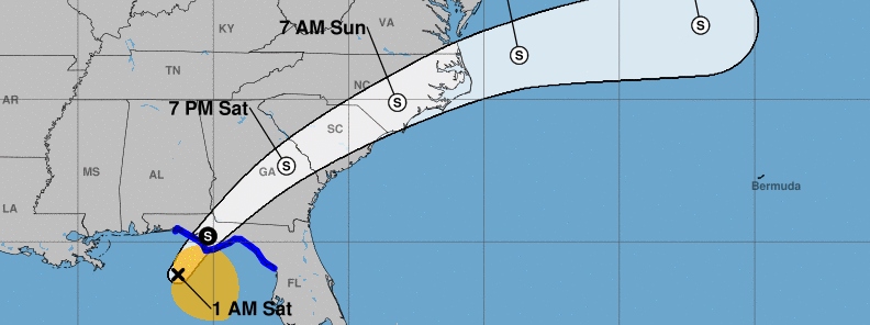
Image credit: NWS/NHC
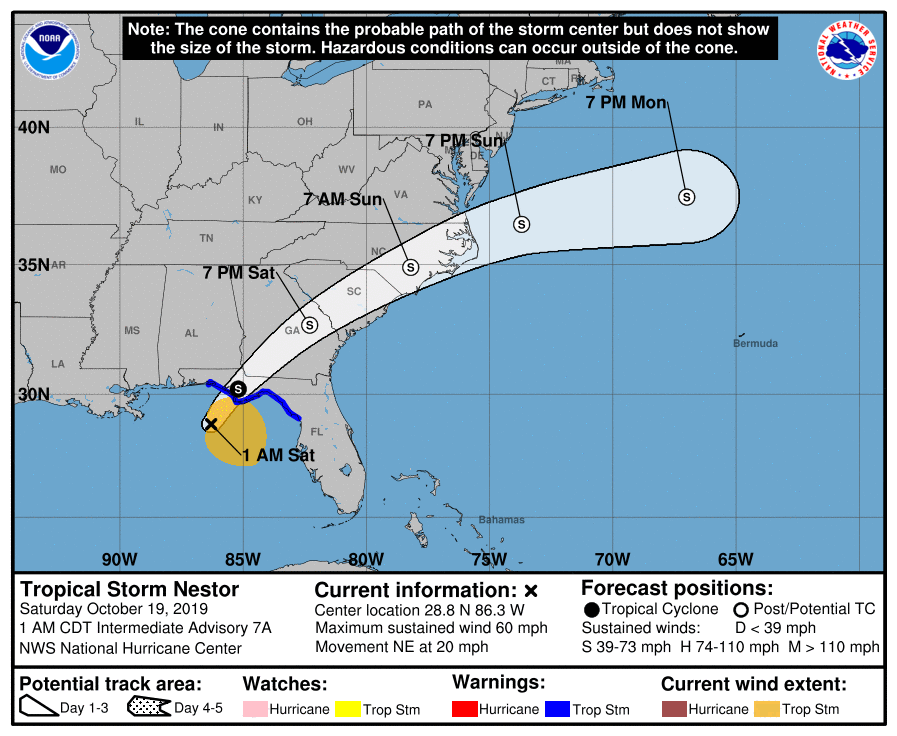
Tropical Storm "Nestor" formed October 18, 2019, as the 14th named storm of the 2019 Atlantic hurricane season. The system is moving quickly toward Florida. Landfall s expected over Florida Panhandle on Saturday morning (LT), October 19, 2019.
There is a danger of life-threatening storm surge inundation of up to 150 cm (5 feet) above ground level along the Florida Gulf Coast from Indian Pass to Clearwater Beach, where a Storm Surge Warning is in effect. Residents in these areas should follow advice given by local officials, NHC said.
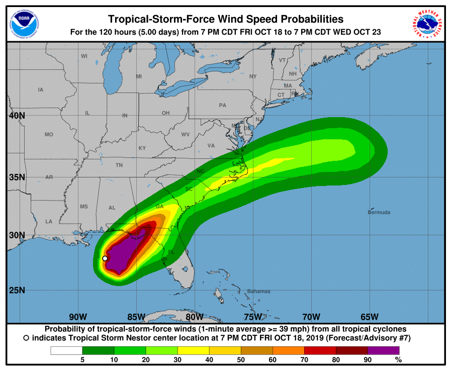
Tropical-storm-force winds are spreading across portions of the Florida Gulf Coast, where tropical storm warnings are in effect. Regardless of the exact track and intensity of the system, these winds will cover a large area, especially east of the center.
Isolated flash flooding is possible along the central and eastern Gulf Coast and Southeast United States coast into early Sunday morning.
Wind and coastal flooding hazards along the U.S. East Coast will be covered by non-tropical watches and warnings issued by local NWS offices, since the system is expected to lose its tropical characteristics after it moves inland along the Gulf Coast.
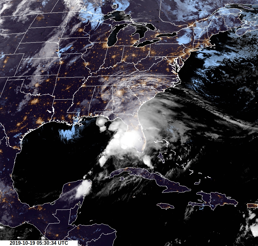
Tropical Storm "Nestor" at 05:30 UTC on October 19, 2019. Credit: NOAA/GOES-East
The tropical storm is moving quickly northeastward at about 37 km/h (23 mph). The models are in good agreement that this general motion should continue for the next couple of days, taking the center of the storm inland over the Florida Panhandle on Saturday morning (LT), October 19 and across portions of Georgia and the Carolinas later Saturday and Sunday. The weakening system is expected to slow down and turn eastward over the western Atlantic early next week before it merges with a cold front.
At 06:00 UTC today, the center of Tropical Storm "Nestor" was located about 140 km (85 miles) SW of Apalachicola and 155 km (95 miles) SSW of Panama City, Florida.
Its maximum sustained winds were 95 km/h (60 mph) and minimum central pressure of 998 hPa.
A Tropical Storm Warning is in effect for:
- Navarre, Florida to Yankeetown, Florida
A Storm Surge Warning is in effect for:
- Indian Pass, Florida to Clearwater Beach, Florida
The combination of a dangerous storm surge and the tide will cause normally dry areas near the coast to be flooded by rising waters moving inland from the shoreline. The water could reach the following heights above ground somewhere in the indicated areas if the peak surge occurs at the time of high tide:
- Indian Pass, FL to Chassahowitzka, FL: 90 – 150 cm (3 to 5 feet)
- Chassahowitzka to Clearwater Beach, FL: 60 – 120 cm (2 to 4 feet)
- Tampa Bay: 30 – 90 cm (1 to 3 feet)
Surge-related flooding depends on the relative timing of the surge and the tidal cycle, and can vary greatly over short distances.
Tropical storm conditions are expected to reach the coast within the warning area within the next few hours and continue through this afternoon.
Gale-force winds are likely along portions of the Atlantic coast of the southeastern United States later today.
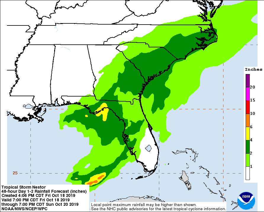
Nestor is expected to produce total rainfall accumulations of 50 – 100 mm (2 to 4 inches) this weekend from the central Gulf Coast and northern and central Florida to the eastern Carolinas, with isolated maximum amounts of 150 mm (6 inches).
A tornado or two is possible through this morning across the northern and central Florida Peninsula, NHC warns.
I'm a dedicated researcher, journalist, and editor at The Watchers. With over 20 years of experience in the media industry, I specialize in hard science news, focusing on extreme weather, seismic and volcanic activity, space weather, and astronomy, including near-Earth objects and planetary defense strategies. You can reach me at teo /at/ watchers.news.
Commenting rules and guidelines
We value the thoughts and opinions of our readers and welcome healthy discussions on our website. In order to maintain a respectful and positive community, we ask that all commenters follow these rules.