
Typhoon “Soulik” approaching southern Japan, landfall expected in South Korea
Featured image: Typhoon "Soulik" at 20:30 UTC on August 20, 2018. Credit: UW-CIMSS
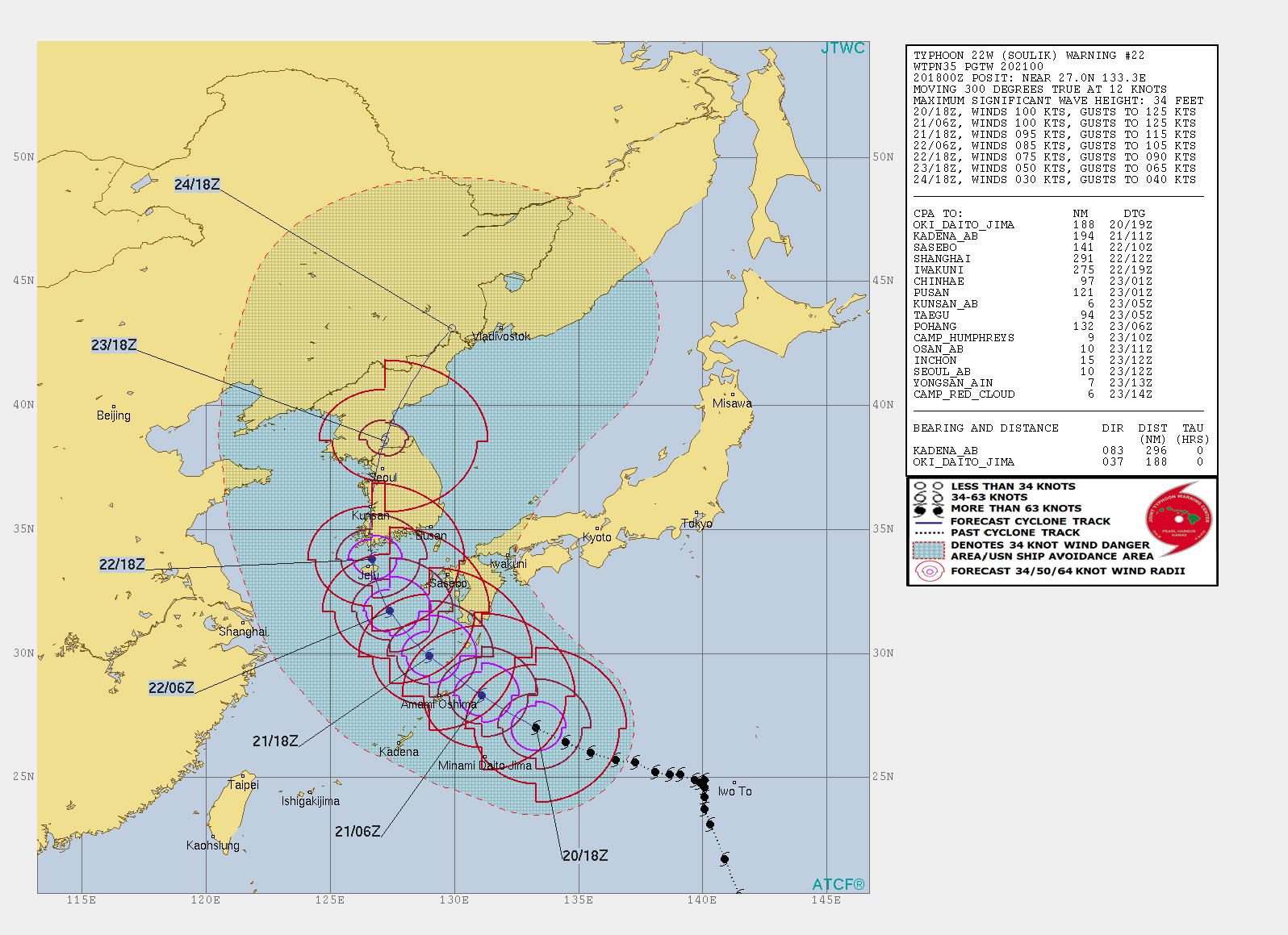
A Very Strong Typhoon "Soulik" is approaching southern Japan and is expected to cause strong winds and drop heavy rain in southern and western parts of the country. According to the JMA, it will pass very close to Kyushu and the Amami islands on the evening of August 21. The typhoon will start weakening over the next 36 hours and approach the Korean Peninsula with maximum sustained winds of 140 km/h (86 mph) on August 22.
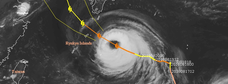
At 18:00 UTC on August 20, the center of Typhoon "Soulik" was located approximately 550 km (340 miles) east of Okinawa. The typhoon is heading WNW at 22 km/h (13.8 mph) with maximum sustained winds of 185 km/h (115 mph) and gusts to 231 km/h (142 mph).
Animated enhanced infrared satellite imagery depicts an annular-like system with an 83 km (52 miles) wide eye.
Soulik is expected to drop locally heavy rain along the Pacific coast of western and eastern Japan, with up to 180 mm (7 inches) in Tokai and 150 mm (5.9 inches) in western regions of Kinki and Shikoku during the 24-hour period ending 06:00 JST, August 21.
Heavy rain is also expected in the Amami region where up to 400 mm (15.7 inches) could fall during the 24-hour period ending 06:00 JST, August 22.
Between 200 and 300 mm (7.9 – 11.8 inches) are expected in the southern Kyushu and Shikoku regions.
Northern Kyushu and Tokai regions are forecast to receive between 100 and 200 mm (3.9 – 7.9 inches) and Kinki region between 100 and 150 mm (up to 5.9 inches).
High waves reaching 11 m (36 feet) are expected to reach southern Kyushu and the Amami islands, while waves of up to 6 m (19.6 feet) are likely to hit Okinawa, northern Kyushu and the Shikoku region.
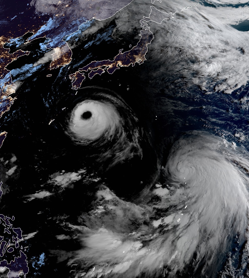
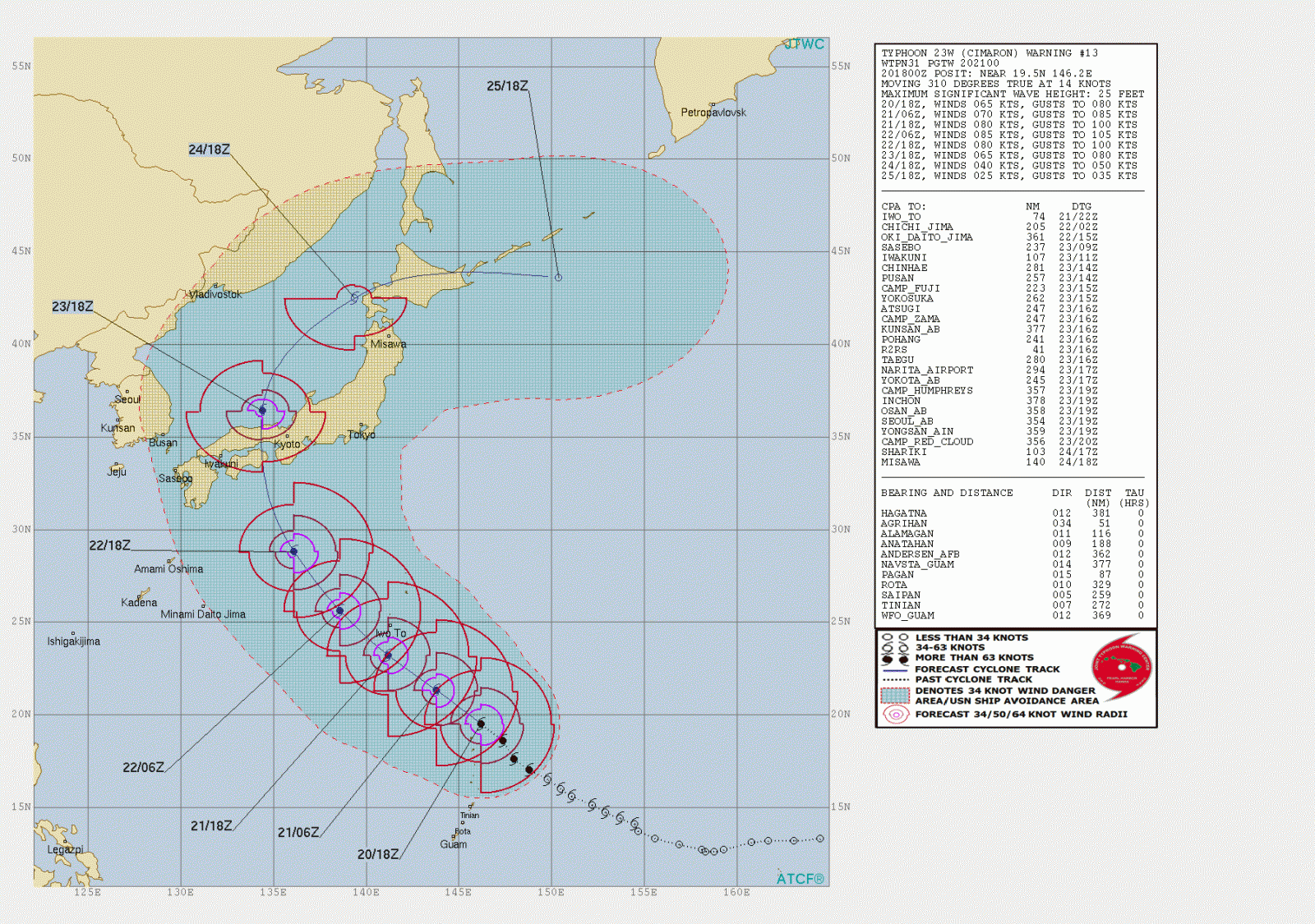
Typhoons Soulik and Cimaron at 20:40 UTC on August 20, 2018. Image credit: JMA/Himawari-8, RAMMB/CIRA
Another typhoon – Cimaron – is expected to approach Japan on August 22 and make landfall near Kyoto with maximum sustained winds of 150 km/h (92 mph).
JMA warned residents in areas in the typhoon's path to be on their guard against landslides and flooding caused by heavy rains.
I'm a dedicated researcher, journalist, and editor at The Watchers. With over 20 years of experience in the media industry, I specialize in hard science news, focusing on extreme weather, seismic and volcanic activity, space weather, and astronomy, including near-Earth objects and planetary defense strategies. You can reach me at teo /at/ watchers.news.
But I will kindle a fire in the wall of Rabbah and it shall devour the palaces thereof,with shouting in the day of battle, with a tempest in the day of the whirlwind” Amos 1:14. Act 7:5- Let their gods save them now in the these days of Gods battle, because they hated the blacks of slavery the children of Abraham: and acted as if the true and only God did not matter by foolishly saying in their hearts that he did not exsist! But he heard everything! As they can now see! Another one is coming!