
Unprecedented 200 000 homes without power as storm hits Auckland, New Zealand
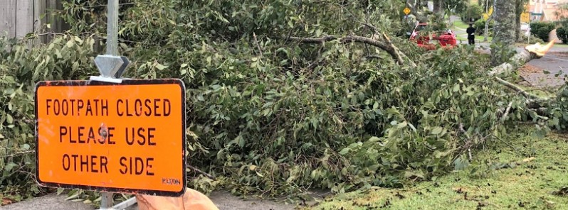
Image credit: Courtney Zoey
A powerful storm that hit Auckland, New Zealand on April 10, 2018 left widespread damage and an 'unprecedented' 200 000 properties without electricity. In addition, cell phone network was severely damaged, leaving many citizens without service. Another front is expected to move rapidly up New Zealand on April 12, bringing a few thunderstorms and a short, sharp spell of strong winds. A watch has been issued for Auckland and Northland tomorrow evening.
New Zealand's largest city was hit by a powerful storm on Tuesday, April 10, 2018, with wind gusts up to 100 – 150 (62 – 93 mph) across central Auckland and peaking at 213 km (132 mph) at Manukau Heads.
Weatherwatch.co.nz meteorologist Philip Duncan said forecasters had predicted strong winds but their severity was unexpected.
At the height of the storm, an unprecedented 200 000 homes and businesses were left without power. On Wednesday morning, some 120 000 properties were still without power and 80 000 by the end of the day. Some, however, may be without electricity for days.
Damage to the network was extensive and widespread, power company Vector said. "It could be several days before power was restored to some areas," it added.
More than 60 Vodafone cell sites were damaged in Auckland and are being repaired. To make it easier for the residents, Spark has opened up a free WiFi network for the city.
Residents are being warned to drive only if they have to, with debris and trees littering roads and multiple traffic lights, motorway signage and traffic cameras not working.
Here's the low pressure bringing the cold, windy and wet weather to New Zealand. Keep an eye on the Severe Weather Warnings and Watches at https://t.co/qHyE5zhh6X ^JL pic.twitter.com/IP9au16VjM
— MetService (@MetService) April 10, 2018
Severe gales hit Auckland, widespread gusts of 120km/h + 1 observation of 213km/h. To be prepared check warnings https://t.co/Sd5C6lrsSL (issued Mon am) and Severe Weather Outlook https://t.co/ePtVj8cXwp (issued Fri) + social media. The importance of being prepared! ^TA pic.twitter.com/QS3BzYDbq1
— MetService (@MetService) April 10, 2018
Severe Weather Warning for parts of Taranaki, Whanganui and Hawke's Bay. Find the full forecast at https://t.co/Sd5C6lrsSL ^JL pic.twitter.com/Bjd8dl3cjj
— MetService (@MetService) April 11, 2018
Last night was the coldest night of the year so far for Auckland, Wellington and Dunedin. Tonight is set to be the coldest for Christchurch and Hamilton, as well as Queenstown which drops below zero for the first time in 2018. Rug up warm! ^TA pic.twitter.com/qDsCzomQmh
— MetService (@MetService) April 11, 2018
According to MetSevice, tonight was the coldest night of the year for many regions across the country.
"Tonight Christchurch is set for a minimum temperature of 1 C (33.8 F), colder than night any so far this year, and in fact colder than any since November. Similarly, Queenstown will drop below freezing for the first time this year, with -1 C (30.2 F) in their forecast."
Hamilton will also have its coldest night of the year, while Auckland, Wellington and Dunedin were colder last night than tonight is expected to be.
Frosts and ice can still occur when the air temperature is just above zero, as the ground is better at radiating heat so can cool faster and further.
This means to take care on the roads for the next few days, although temperatures pick up again on Sunday.
I'm a dedicated researcher, journalist, and editor at The Watchers. With over 20 years of experience in the media industry, I specialize in hard science news, focusing on extreme weather, seismic and volcanic activity, space weather, and astronomy, including near-Earth objects and planetary defense strategies. You can reach me at teo /at/ watchers.news.
Commenting rules and guidelines
We value the thoughts and opinions of our readers and welcome healthy discussions on our website. In order to maintain a respectful and positive community, we ask that all commenters follow these rules.