• NWS confirms EF3 tornado in Wisconsin’s Fox Valley

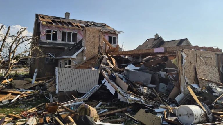
    The tornado that struck Wisconsin’s Fox Valley on Tuesday, July 27, 2026 has been officially rated EF3 by the National Weather Service (NWS), with preliminary surveys estimating peak winds of 225 km/h (140 mph). The tornado formed near Appleton before moving through Fox Crossing and Menasha, while the same outbreak produced widespread wind damage and giant hail across much of northern and eastern Wisconsin.
  • Moderate Risk of excessive rainfall issued for Tri-State area as heavy rain threatens parts of the Northeast

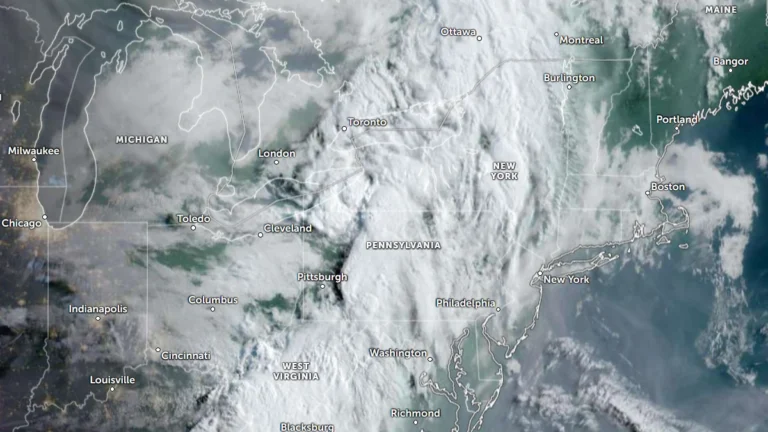
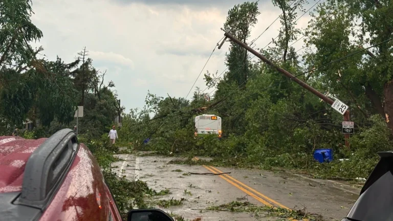
    A Moderate Risk of excessive rainfall and potentially significant flash flooding is in effect for parts of New Jersey, New York, and Connecticut on Tuesday, July 28, 2026 as an unusually strong upper-level low develops over the Northeast. The National Weather Service’s Weather Prediction Center warns that repeated thunderstorms may produce rainfall rates of up to 51 mm (2 inches) per hour, with the greatest threat centered on the New York City tri-state region.

  • Local State of Disaster declared after tornado tears through Menasha, Appleton and Neenah, Wisconsin

    A destructive tornado crossed Lake Winnebago before striking communities across Wisconsin’s Fox Valley on Monday, July 27, 2026, causing extensive damage in Menasha, Appleton, and Neenah. Menasha declared a local State of Disaster as emergency crews responded to heavily damaged neighborhoods, gas leaks, and widespread infrastructure damage following a broader outbreak of severe thunderstorms.

  • Hurricane Fausto moving toward Hawaiʻi, dangerous surf forecast

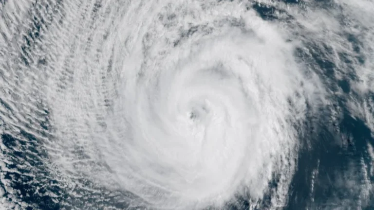
    Dangerous surf generated by Hurricane Fausto is expected to build along east-facing shores of Hawaiʻi starting July 26, 2026, before spreading westward through July 27, with additional hazards including heavy rainfall and damaging winds possible early next week. Forecast details are expected to improve over the coming days as the hurricane approaches.

  • Two dead in Upshur County due to catastrophic flooding in West Virginia

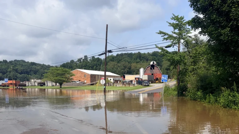
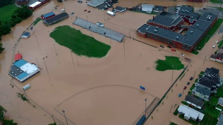
    Two people have died after catastrophic flash flooding swept across north-central West Virginia authorities confirmed on July 24, 2026. The floods were triggered by torrential thunderstorms that dumped more than 102 mm (4 inches) of rain in under 40 minutes in parts of the state with totals reaching over 178 mm (7 inches) in some areas through July 21.

  • Extreme Heat Watches issued for Utah, Montana, and northern Wyoming, temperatures up to 43°C (110°F) forecast through July 27

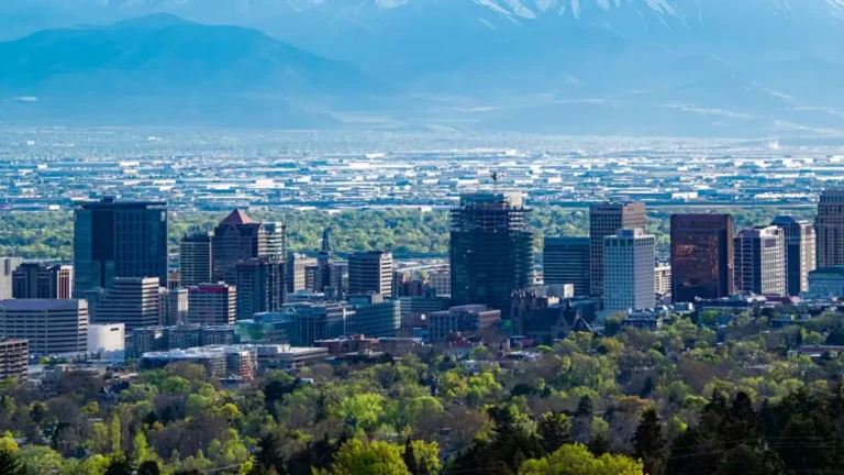
    Extreme Heat Watches have been issued for large portions of Utah, Montana, and north-central Wyoming as widespread dangerous heat is forecast from Friday, July 24, through Sunday, July 26, with some areas remaining under hazardous conditions into early next week. Afternoon temperatures are forecast to reach 35 to 43°C (95 to 110°F), while unusually warm nights across northern Utah are expected to limit overnight cooling and increase cumulative heat stress.

  • Extreme Heat Warnings issued for parts of Arizona, California and Nevada, temperatures above 49°C (120°F) forecast

    Extreme Heat Warnings have been issued across large parts of Arizona, California, and Nevada as a prolonged heat event is forecast to persist through at least Monday, July 27, 2026. Afternoon temperatures are expected to reach 38 to above 49°C (100 to more than 120°F), while exceptionally warm overnight lows are forecast to provide little relief, significantly increasing the risk of heat-related illness.

  • Tropical Storm Bertha makes landfall in St Bernard Parish, Louisiana, heads toward upper Texas coast

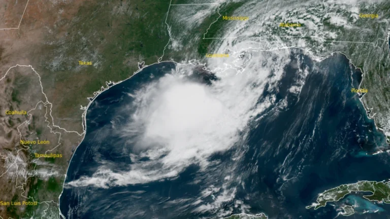
    Tropical Storm Bertha made landfall at approximately in St. Bernard Parish, Louisiana at approximately 13:50 CDT (18:50 UTC)on July 22, 2026, with maximum sustained winds of 72 km/h (45 mph). Storm surge of up to 1 m (3 feet), rainfall totals of 25 to 100 mm (1 to 4 inches) with isolated amounts reaching 150 mm (6 inches), and isolated flash flooding remain possible across portions of the central and western Gulf Coast through July 24.

  • State of Emergency declared for West Virginia after historic flooding

    Historic flooding in Upshur County and widespread impacts from severe thunderstorms prompted West Virginia Governor Patrick Morrisey to declare a State of Emergency for all 55 counties on July 21, 2026. The Sand Run stream gauge near Buckhannon rose to record levels, reportedly reaching major flood stage for the first time on record. Meanwhile, torrential rainfall totals of up to 127 mm (5 inches) in less than six hours caused flash flooding, infrastructure damage, and multiple road closures.

  • Dangerous heat expands across the Southern U.S. with major to locally extreme HeatRisk

    Dangerous heat is forecast to persist across the southern United States for several days while expanding into the Central and Southern Plains. The National Weather Service is forecasting widespread Major to locally Extreme HeatRisk, daytime highs of 35–41°C (95–105°F), heat index values reaching 41–46°C (105–115°F), and record warm overnight lows of 24–27°C (75–80°F) through Sunday, July 26, 2026. The prolonged combination of hot afternoons and unusually warm nights is expected to produce cumulative heat stress, particularly for people without adequate cooling or hydration.