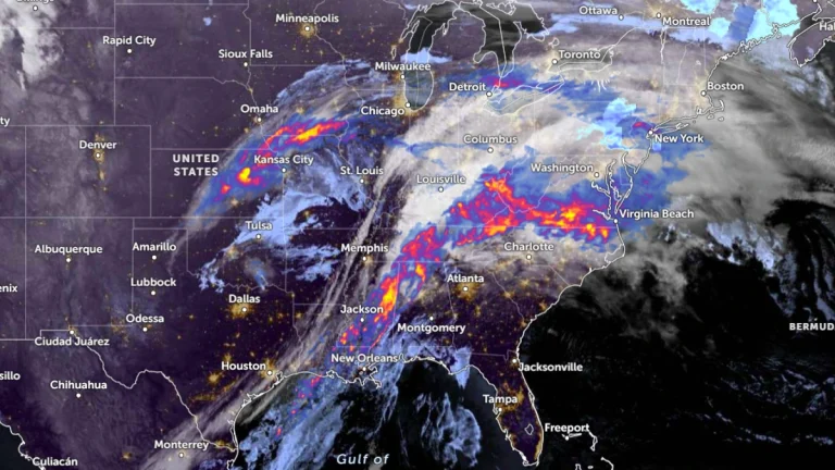
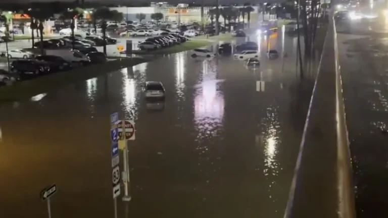
• Severe flash floods hit McAllen as thunderstorms sweep through South Texas

    Severe flash floods hit McAllen (population 146 000) as a line of thunderstorms swept across South Texas on Thursday, March 27, 2025, bringing 152 to 254 mm (6 to 10 inches) to parts of the region. Floodwaters entered a medical center in McAllen and submerged key routes across southern Texas, leading to hazardous travel conditions and extensive damage.

  • Historic fire-weather conditions forecast for southern Great Plains

    Extremely critical fire weather conditions are forecast for Friday, March 14, 2025, across parts of the southern Plains and Midwest due to historically strong winds and low humidity. A wildfire outbreak is possible in the southern Plains, with fast-moving and uncontrollable fires likely. Wind gusts between 95–130 km/h (60–80 mph) may cause rapid fire spread and significant danger to affected areas.

  • Tornado Watch issued for parts of Texas as storms move through Dallas-Fort Worth

    A Tornado Watch remains in effect on Tuesday, March 4, 2025, for areas east of the Dallas-Fort Worth metroplex in Texas as a line of strong storms moves across the region. The storms are expected to clear the area by midday, after which a Red Flag Warning will take effect for Killeen in Central Texas. Strong, dry winds following the system—forecast to reach 40—55 km/h (25—35 mph) with gusts up to 80 km/h (50 mph)—will increase fire weather risks, shifting the primary hazard from severe storms to the potential for rapid fire spread.

  • Red Flag Warning issued for all of South Texas

    A Red Flag Warning is in effect for South Texas from San Antonio to Port Mansfield, along with a Wind Advisory, both of which will remain in effect through much of Tuesday, March 4, 2025. Dry winds following a passing cold front will create dry conditions conducive to critical fire weather over the region.