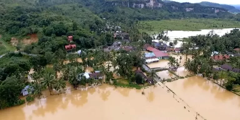
Deadly floods and landslides strike West Sumatra, lahar warnings issued, Indonesia
Two people have died in West Sumatra, Indonesia, due to a landslide in Agam regency, with floods and landslides affecting other areas, including Lima Puluh Kota.

Two people have died in West Sumatra, Indonesia, due to a landslide in Agam regency, with floods and landslides affecting other areas, including Lima Puluh Kota.

Floods caused by heavy rainfall affecting parts of Sumatra island, Indonesia since January 21, 2023, have damaged more than 15 000 homes and left at least 3 people dead.
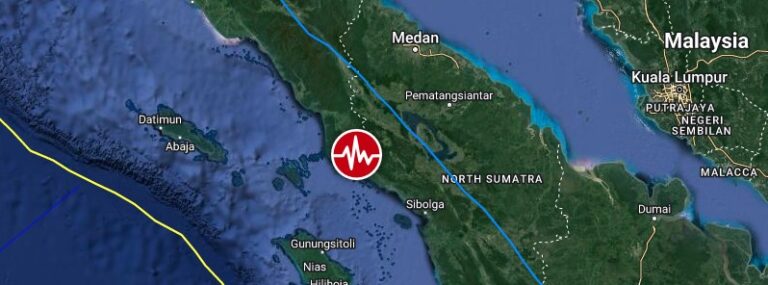
A strong and shallow earthquake registered by the BMKG and USGS as M6.2 hit northern Sumatra, Indonesia at 22:29 UTC on January 15, 2023 (05:30 LT, January 16). BMKG is reporting a depth of 23 km (14.3 miles) and USGS 37 km (23 miles).
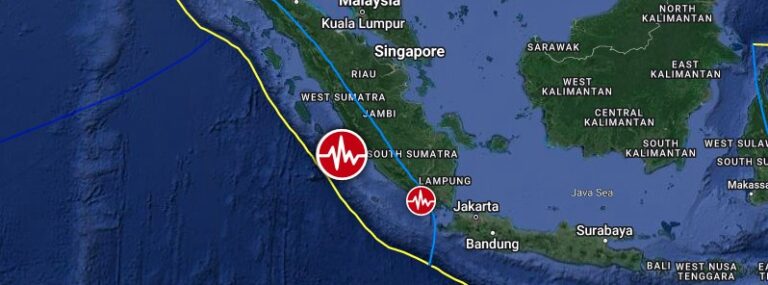
A strong and shallow earthquake, registered by the BMKG as M6.8, hit southwest of Sumatra, Indonesia at 13:37 UTC on November 18, 2022. The agency is reporting a depth of 10 km (6.2 miles). USGS is reporting M6.9 at a depth of 10 km; EMSC M6.7 at a depth of 10 km.
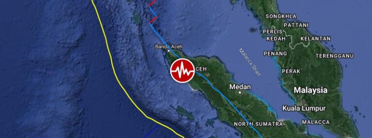
A strong and shallow earthquake, registered by the USGS as M6.2, hit off the west coast of northern Sumatra at 20:52 UTC on September 23, 2022 (02:52 LT, September 24). The agency is reporting a depth of 48 km (30 miles). EMSC is reporting M6.1 at a depth of 40 km (25 miles).
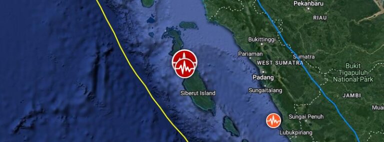
A strong and shallow earthquake registered by the USGS as M6.0 hit the Mentawai Islands, West Sumatra, Indonesia at 23:10 UTC on September 10, 2022. The agency is reporting a depth of 20 km (12.4 miles). EMSC is reporting M6.1 at the same depth.
A strong and shallow earthquake registered by the USGS as M6.2 hit northern Sumatra, Indonesia at 01:39 UTC on February 25, 2022. The agency is reporting a depth of 12.3 km (7.6 miles). EMSC and BMKG are reporting M6.2 at a depth of 10 km (6.2 miles). At least 2…
Heavy rains affecting Indonesia's island of Sumatra over the past days have forced about 24 000 people to evacuate their homes and left at least 2 people dead in the province of Aceh, officials said Tuesday, January 4, 2022. According to Regional Disaster…
A strong and shallow earthquake registered by the USGS as M6.6 hit off the coast of Sumatra, Indonesia at 06:33 UTC on May 14, 2021. The agency is reporting a depth of 10 km (6.2 miles). EMSC is reporting the same magnitude and depth. The epicenter was located 259…
A shallow earthquake registered by the USGS as M6.2 hit southwest of Sumatra, Indonesia at 12:52 UTC on February 10, 2021, at a depth of 10 km (6.2 miles). EMSC is reporting M6.2 at a depth of 40 km (25 miles). The epicenter was located 218 km (135 miles) SSW of…