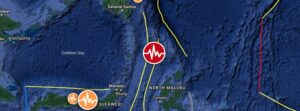
Strong M6.5 earthquake hits northern Molucca Sea, Indonesia

Strong M6.5 earthquake hits northern Molucca Sea, Indonesia

A strong and shallow earthquake registered by the BMKG as M6.5 hit the northern Molucca Sea, Indonesia at 09:48 UTC on April 9, 2024. The agency is reporting a depth of 10 km (6.2 miles). USGS is reporting M6.6 at a depth of 33 km (20.5 miles); EMSC M6.6 at a depth of 35 km (21.7 miles).

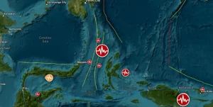
Very strong and shallow M7.0 earthquake hits northern Molucca Sea, Indonesia

Very strong and shallow M7.0 earthquake hits northern Molucca Sea, Indonesia

A very strong and shallow earthquake registered by the USGS hit the northern Molucca Sea, Indonesia at 06:06 UTC on January 18, 2023 (15:06 LT). The agency is reporting a depth of 48 km (29.8 miles). BMKG is reporting M7.1 at a depth of 64 km (39.7 miles); EMSC reporting M7.1 at a depth of 60 km (37.3 miles).

Shallow M6.2 earthquake hits Molucca Sea, Indonesia

Shallow M6.2 earthquake hits Molucca Sea, Indonesia

A strong and shallow earthquake registered by the Indonesian BMKG as M6.2 hit the Molucca Sea, Indonesia at 00:43 UTC on July 10, 2021 (07:33 WIB). The agency is reporting a depth of 10 km (6.2 miles). EMSC is reporting it as M6.3 at a depth of 60 km (37 miles),…

Strong M6.1 earthquake hits Molucca Sea, Indonesia

Strong M6.1 earthquake hits Molucca Sea, Indonesia

A strong earthquake registered by the USGS as M6.1 hit the Molucca Sea, Indonesia at 10:09 UTC on June 3, 2021. The agency is reporting a depth of 31.2 km (10.4 miles). EMSC is reporting M6.1 at a depth of 40 km (24.8 miles). The epicenter was located 127.5 km (79…

Strong and shallow M6.9 earthquake hits Molucca Sea, Indonesia

Strong and shallow M6.9 earthquake hits Molucca Sea, Indonesia

A strong and shallow earthquake registered by the USGS as M6.9 hit the Molucca Sea, Indonesia at 15:08 UTC on July 7, 2019. The agency is reporting a depth of 36.3 km (22.5 miles). EMSC is reporting M6.9 at a depth of 20 km (12.4 miles). The epicenter was located…

M6.6 earthquake, series of aftershocks hit Molucca Sea, Indonesia

M6.6 earthquake, series of aftershocks hit Molucca Sea, Indonesia

A strong earthquake registered by the USGS as M6.6 hit Molucca Sea, Indonesia at 17:27 UTC on January 6, 2019. The agency is reporting a depth of 60 km (37 miles). EMSC is reporting M6.6 at a depth of 40 km (25.8 miles). This earthquake can have a low humanitarian…

M6.5 earthquake registered in Molucca Sea, Indonesia

M6.5 earthquake registered in Molucca Sea, Indonesia

Geoscience Australia registered M6.5 earthquake at a depth of 100 km (62 miles) at 07:40 UTC on September 16, 2015. USGS is reporting M6.3 at a depth of 52.7 km (32.7 miles). According to the USGS, epicenter was located 140 km (87 miles) ENE of Bitung, 161 km (100 miles

Strong M6.6 earthquake registered in Molucca Sea, Indonesia

Strong M6.6 earthquake registered in Molucca Sea, Indonesia

A strong M6.6 earthquake was registered in Molucca Sea (Halmahera), Indonesia at 22:12 UTC on March 17, 2015. USGS is reporting depth of 41.7 km. Geoscience Australia is also reporting M6.6, but at a depth of 66 km. Epicenter was located 134 km (83 miles) NW of Kota Ter

Strong M6.6 earthquake registered in Molucca Sea, Indonesia

Strong M6.6 earthquake registered in Molucca Sea, Indonesia

A strong earthquake measuring M6.6 on the Richter scale was registered in Molucca Sea, Indonesia at 11:34 UTC on December 21, 2014. USGS is reporting depth of 54.6 km (34 miles). Geoscience Australia is reporting Mwp 6.6 at depth of 60 km.Epicenter was located 157 km (9