
Rare marine asteroid impact crater confirmed beneath the North Sea after decades-long debate
A new peer-reviewed study confirms that the Silverpit structure beneath the southern North Sea is a hypervelocity asteroid impact crater, resolving a scientific debate that has persisted since its discovery in 2002. The crater formed during the middle Eocene between 43 and 46 million years ago and is one of the rare marine impact structures preserved on Earth. Researchers combined high-resolution 3D seismic imaging, biostratigraphic dating, petrographic analysis of drill cuttings and numerical impact modelling to confirm the impact origin and reconstruct the event.
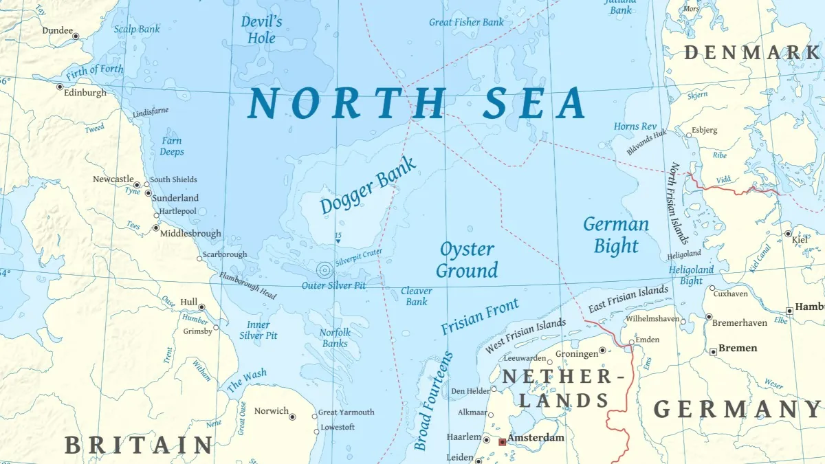
Silverpit Crater location map. Credit: Halava
Marine impact craters are among the rarest geological structures preserved on Earth. Although oceans cover more than 70% of the planet’s surface, only about 33 confirmed or probable marine impact craters have been identified worldwide. Rapid sedimentation, erosion, and tectonic activity typically obscure or destroy evidence of such events, making well-preserved examples extremely uncommon.
One of the most unusual of these structures lies beneath the southern North Sea, roughly 129 km (80 miles) off the coast of Yorkshire, United Kingdom — known as the Silverpit crater.
This structure is buried beneath younger sediments below the seabed and measures about 3 km (1.9 miles) in diameter. Since its discovery in 2002 using seismic data from hydrocarbon exploration surveys, the origin of the crater has been the subject of a long-running scientific debate.
The structure has attracted particular interest because it is preserved in subsurface seismic data with unusually high clarity. High-resolution three-dimensional seismic imaging now provides near-complete coverage of the crater and its surrounding deformation zone, allowing scientists to study the internal structure of a marine impact crater in exceptional detail. Only a handful of known impact craters have been imaged with comparable subsurface resolution.
Initial studies suggested that the circular structure represented an asteroid or comet impact. Its morphology included features commonly associated with hypervelocity impacts, such as a central uplift, concentric fault systems, and a circular crater floor surrounded by a broad zone of deformation extending roughly 20 km (12.4 miles) across.
However, alternative explanations were proposed in the years that followed.
Some researchers suggested the structure could have formed through salt movement deep within the basin, while others argued it may have resulted from hydrothermal venting or volcanic processes linked to subsurface intrusions.
The debate culminated in a public discussion among geologists in 2009, during which a majority of participants concluded that the evidence for an impact origin was insufficient.
A new study now provides the most comprehensive assessment of the structure and presents several independent lines of evidence confirming that the crater formed during a hypervelocity impact event in the middle Eocene, between 43 and 46 million years ago.
High-resolution three-dimensional seismic data reveal the full geometry of the structure, including a central uplift beneath the crater floor and an annular moat surrounding it. Concentric faults and curved radial faults extend through the surrounding sediments, forming a deformation zone approximately 20 km (12.4 miles) in diameter.
The seismic data also show a nested inner crater roughly 1 km (0.6 miles) wide and numerous smaller pits interpreted as secondary impact craters created by falling ejecta blocks.
The age of the crater was determined using biostratigraphic analysis of microscopic fossils preserved in rock cuttings from a nearby exploration well. Assemblages of calcareous nannofossils indicate that the event occurred during the middle Eocene between 43 and 46 million years ago.
The most decisive evidence for an impact origin comes from microscopic mineral structures recovered from sediments near the crater floor.
Petrographic analysis identified quartz and potassium feldspar grains containing planar deformation features known as shock lamellae. These structures form only under the extreme pressures generated during hypervelocity impacts, typically exceeding about 10–13 gigapascals, and cannot be produced by other geological processes.
Researchers also performed numerical impact simulations to test whether a cosmic impact could reproduce the structure observed in the seismic data. The model that best matched the crater’s geometry involved a rocky asteroid approximately 160 m (525 feet) in diameter striking a shallow marine basin at a speed of about 15 km/s (9.3 miles/s).
The simulations suggest that the asteroid struck a seabed covered by roughly 100 m (328 feet) of seawater and sediment layers of clay and chalk. The impact would have excavated a transient crater approximately 3 km (1.9 miles) wide within about 12 seconds before collapsing to form the central uplift and surrounding deformation zone observed in seismic data.
Structural deformation patterns preserved in the subsurface also allow reconstruction of the impact trajectory. Curved radial faults and asymmetric fault distributions indicate that the asteroid likely struck the seabed at a low angle from the west-northwest.
The impact would have ejected large volumes of sediment and rock across the seafloor. Seismic images reveal clusters of small circular depressions surrounding the main crater that researchers interpret as secondary craters formed when large blocks of debris fell back to the surface.
Evidence preserved in the crater fill suggests that the cavity was rapidly flooded by seawater after the impact. Returning water likely generated strong resurge currents and tsunami waves that redistributed sediments within and around the crater in the hours following the event. These processes are inferred from seismic observations and supported by the impact simulations.
Seismic analysis shows that the chalk layer beneath the crater floor is significantly thinner than in surrounding areas, suggesting that between about 0.9 and 2.2 km³ (0.2–0.5 mi³) of carbonate rock may have been lost during the impact. Researchers interpret this as the result of impact-induced thermal decomposition of carbonate minerals, which would have released large volumes of carbon dioxide gas during crater formation.
Because the Silverpit crater remains buried beneath younger sediments, its internal structure has been preserved from erosion and tectonic deformation that have altered many older impact sites on land.
Similar preservation has allowed scientists to study another marine impact structure, the Nadir crater off the coast of West Africa, which has also been imaged using modern seismic data. Together, the two structures provide rare insights into how asteroid impacts interact with sedimentary seabeds and shallow marine environments.
Studying craters such as Silverpit helps reconstruct the long-term history of asteroid collisions on Earth and improves understanding of how impacts may behave in oceanic environments.
References:
Nicholson, U. A., de Jonge-Anderson, I., Gillespie, A., Kenkmann, T., Dunkley Jones, T., Collins, G. S., Frankel, J., Bray, V., Gulick, S. P. S., & Parr, R. (2025). Multiple lines of evidence for a hypervelocity impact origin for the Silverpit Crater. Nature Communications. https://doi.org/10.1038/s41467-025-63985-z
I'm a dedicated researcher, journalist, and editor at The Watchers. With over 20 years of experience in the media industry, I specialize in hard science news, focusing on extreme weather, seismic and volcanic activity, space weather, and astronomy, including near-Earth objects and planetary defense strategies. You can reach me at teo /at/ watchers.news.
The North Sea debate was Holocene and asking interesting questions like those provoked by the Alaskan ‘muck fields’. Then this distraction.
A biased model made to fit their conclusion? Why that speed, that dimension used for proposed impactor? Was there a water layer? The depth of the Kimmeridge? Strata all horizontal? What exactly was ‘g’ 40Mya? How was the atmosphere then? Moot. Am I supposed to download and unpack their model to review calculations? Working not shown. I note their alleged impact structure-size revisions, again, ok but why and implication for alternative causation? They noticed two shocked-quartz grains; around the k-t horizon- are we shocked? Could there even have been pressurised gas involved- not asked? Wider-field faulting patterns, why not show those and needed for modelling? Suggested impactor angle, why.
‘Consensus’ proclamation 2009, not science. 2026, proclamation proof of hypothesis by CGI. Frankly, I do not care salt or impaction due to its suggested size and epoch. It is a distraction, media control- how so shockingly weak ‘science’ yet Nature, 2002-2026 and counting..wait for the letters, endless, pointless.
Are we satisfied it’s not a novel Mull Dyke Swarm structure?
Enough with these pontifications of 40Mya, back to the Holocene future, something that does not invoke Callanish on Europa. Ridiculous.
Teo, thank you for this despite my frustrations with it, your render superb, I appreciate all that you do for us Watchers.