
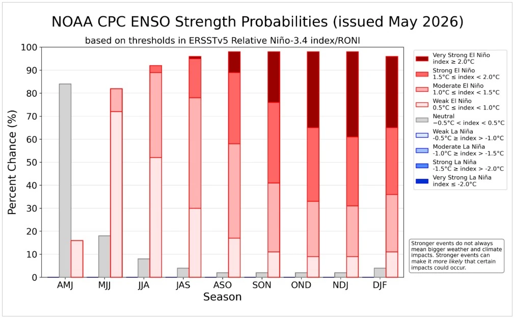
NOAA raises El Niño odds to 82%, but strength remains uncertain
El Niño has an 82% chance of developing during May–July 2026 and a 96% chance of continuing through Northern Hemisphere winter 2026–27, NOAA’s Climate Prediction Center (CPC) reported on May 14. Current conditions remain ENSO-neutral, and CPC said peak strength remains substantially uncertain, with no strength category above 37%.
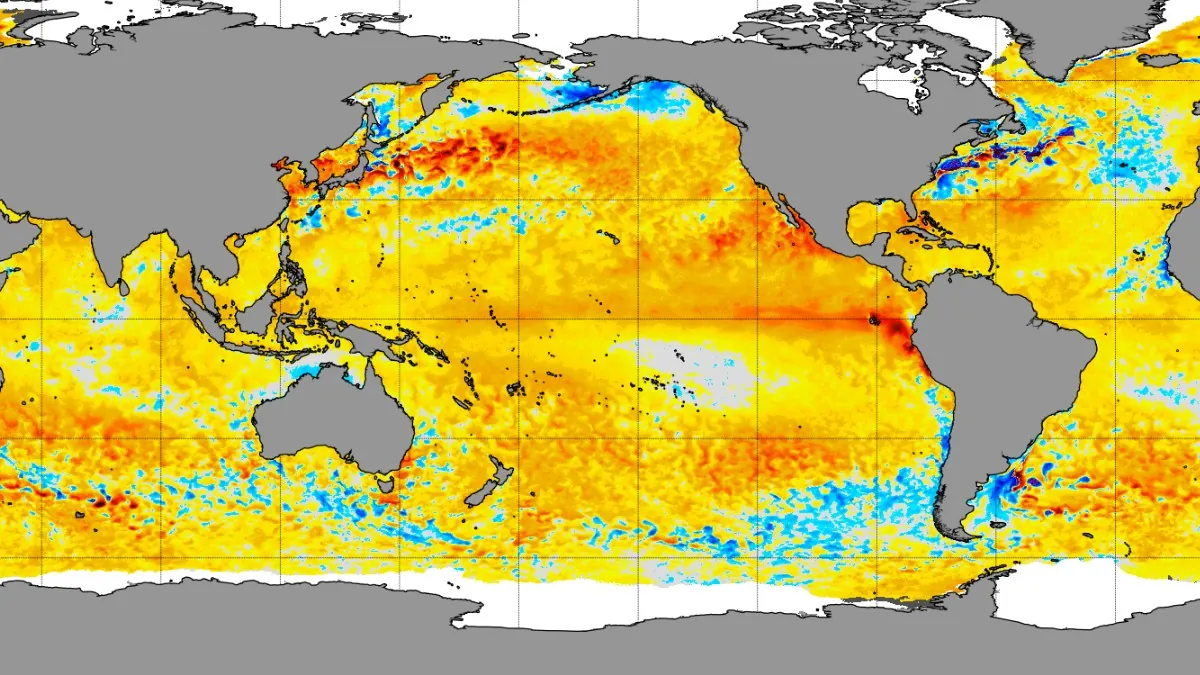
Daily 5km SST Anomalies - May 13, 2026. Credit: NOAA
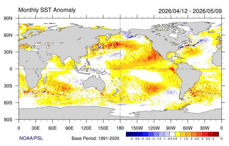
CPC’s May 14 ENSO Diagnostic Discussion lists the ENSO Alert System status as El Niño Watch, while retaining ENSO-neutral conditions for the past month. Near-average sea surface temperatures continued across the east-central equatorial Pacific, with the latest weekly Niño-3.4 index at +0.4°C. The westernmost Niño-4 index was +0.5°C, while the easternmost Niño-1+2 index reached +1.0°C.
Subsurface ocean heat increased for the sixth consecutive month across the equatorial Pacific. Significantly above-average subsurface temperatures were widespread between 180° and 100°W, adding to the oceanic signal that has developed below the surface before El Niño conditions have fully coupled with the atmosphere.
CPC reported low-level westerly wind anomalies over the western equatorial Pacific and upper-level westerly anomalies over the central and east-central Pacific. Convection was near average near the Date Line and suppressed around Indonesia, but the coupled ocean-atmosphere system still reflected ENSO-neutral conditions.
The North American Multi-Model Ensemble average, including NCEP’s Climate Forecast System version 2, favors El Niño formation by next month and persistence through Northern Hemisphere winter 2026–27.
CPC said confidence in El Niño occurrence has increased since last month, but the strength forecast remains unresolved, with no peak-strength category exceeding a 37% chance.
The strongest El Niño events in the historical record are characterized by significant ocean-atmosphere coupling through summer, but it remains to be seen whether that coupling develops in 2026.
“The strongest El Niño events in the historical record are characterized by significant ocean-atmosphere coupling through the summer, and it remains to be seen whether this occurs in 2026,” CPC forecasters said. “Stronger El Niño events do not ensure strong impacts — they can only make certain impacts more likely.”
References:
1 EL NIÑO/SOUTHERN OSCILLATION (ENSO) DIAGNOSTIC DISCUSSION – NOAA/CPC – May 14, 2026
2 ENSO: Recent Evolution, Current Status and Predictions – NOAA/CPC – May 11, 2026
I'm a dedicated researcher, journalist, and editor at The Watchers. With over 20 years of experience in the media industry, I specialize in hard science news, focusing on extreme weather, seismic and volcanic activity, space weather, and astronomy, including near-Earth objects and planetary defense strategies. You can reach me at teo /at/ watchers.news.
Thank you for that, Teo. Yes, coupling during summer, impedance-matching perhaps but a very deep dive questioning on that might be interesting, ‘Chatgpt’ without hallucinations- and this is also what is so appreciated about this site.
While we see the anomalies on Pac rim, the zone west of Rapanui invites a ‘why?’; deeper and deep buoy network temperature trends could be interesting?
Any remote-sensing satellite Pac oceanic gas-release that could help us see this all more clearly? Perhaps methane signatures? I would take SO2 corrected for shipping lanes, too.
On the subsurface, was that a statistically-anomalous sudden heat pulse or gradual-onset, how is the trend shape at that depth going?
Thank you again.