
Gulf storm brings flash flood threat to Florida on May 10
A storm system moving along the Gulf Coast is forecast to bring heavy rains and thunderstorms across the Florida Panhandle and much of the southeast starting Saturday, May 10, 2025, threatening millions across the region.
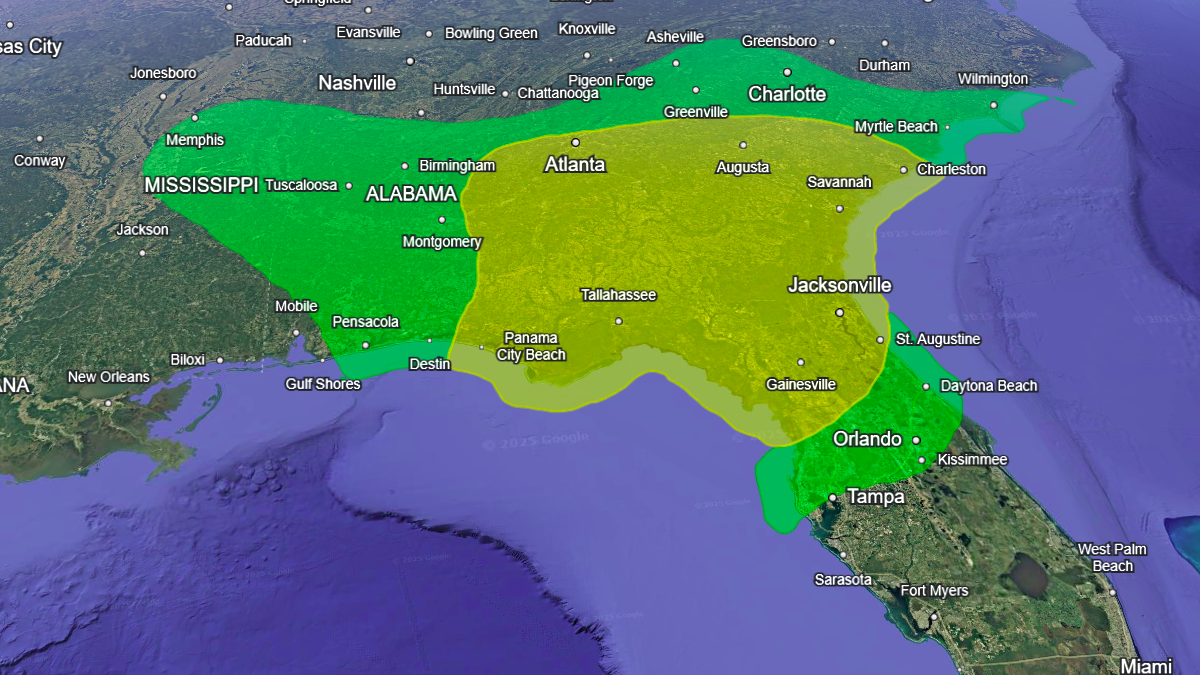
Excessive rainfall outlook for May 11, 2025. Image credit: NWS/Google Earth
Heavy rainfall and thunderstorms are forecast across the southeastern United States from Saturday through early next week as a storm system along the Gulf Coast channels deep moisture inland.
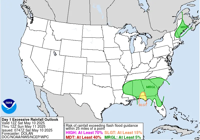
The Weather Prediction Center (WPC) has issued a Marginal Risk (level 1 of 4) for excessive rainfall from the Lower Mississippi River Valley to the Southeast coast through the weekend. These rains could result in localized flash flooding.
On Saturday, the highest flash flood risk is expected across the Florida Panhandle and southeastern Alabama, where the WPC has issued a Slight Risk (level 2 of 4) for excessive rainfall. Saturated soils in parts of the region may contribute to rapid runoff.
The system is forecast to remain nearly stationary over Louisiana on Sunday, continuing to direct heavy rainfall into the Southeast. The WPC has outlined an expanded Slight Risk area covering northern Florida, much of Georgia, and parts of South Carolina.
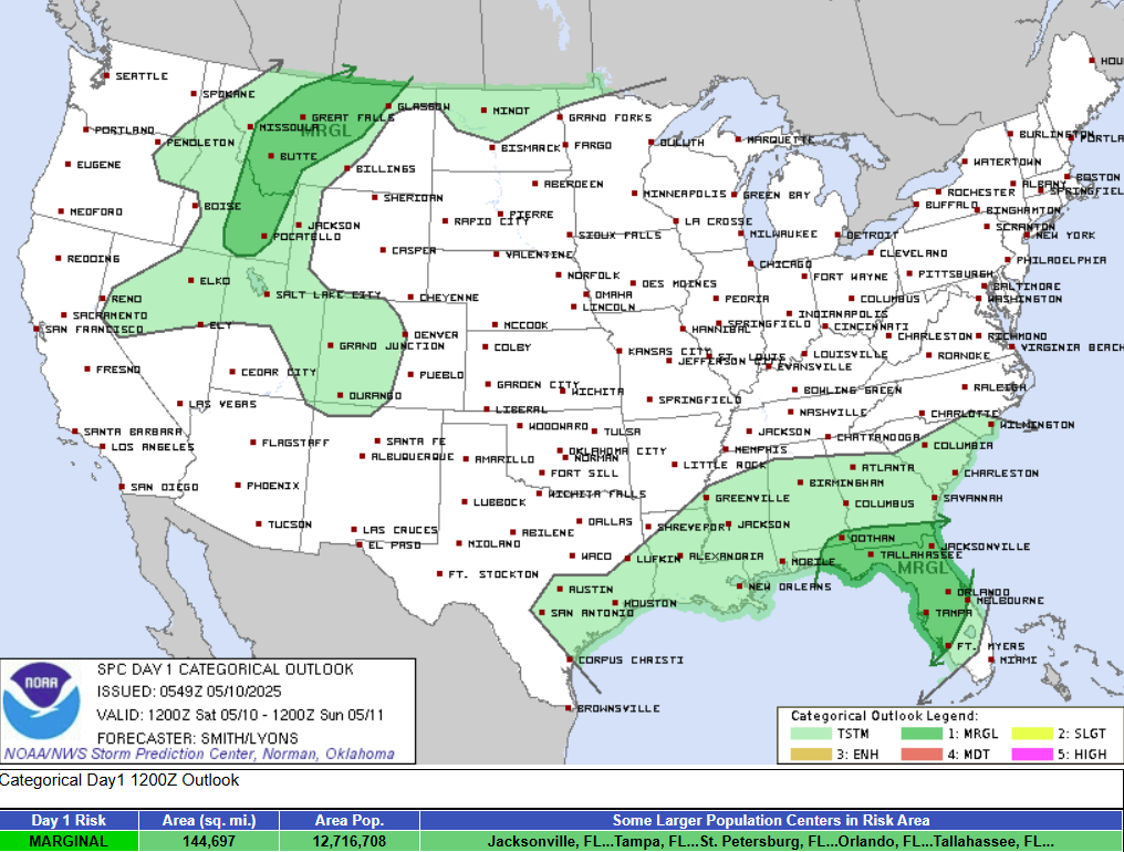
Meanwhile, the Storm Prediction Center (SPC) has issued a Marginal Risk (level 1/5) from the Central Gulf Coast and Lower Mississippi Valley to the Georgia Coast this weekend.
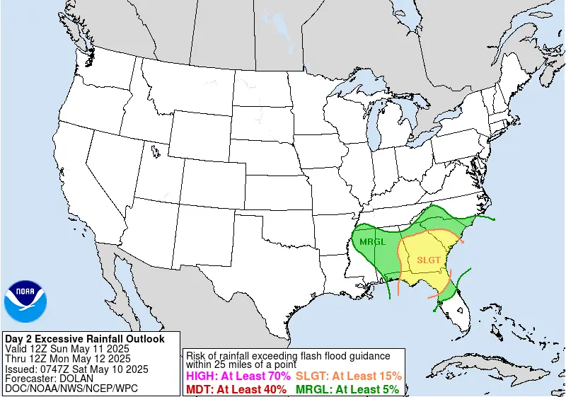
The storm will begin to move eastwards on Monday, May 12, but the threat of excessive rainfall will extend northwards into the southern Mid-Atlantic and as far south as the Florida Peninsula. The slow progress of this storm system will keep heavy rainfall in the forecast into Tuesday, May 13, across the Mid-Atlantic.

Rishav Kothari is Editor-in-Chief of The Watchers, where he runs the newsroom and covers earthquakes, volcanoes, severe weather and space weather.
Published in the last 24 hours
- High Risk of excessive rainfall covers Florida’s Space Coast as St. Johns River near Cocoa reaches 5.67 m
- Four small asteroids will pass close to Earth from November 21 to 23
- Cyclone Akvan weakens after landfall near Gopalpur; more than 300 000 evacuated in Odisha, India
- A broad low over southeastern Florida and the northwestern Bahamas has a 30 percent chance of subtropical or tropical development within 48 hours and a 50 percent chance within 7 days, the National Hurricane Center says
