
Series of strong weather systems target the United States
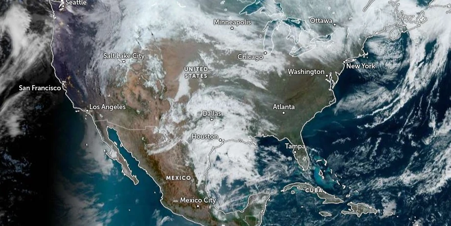
Image credit: NOAA/GOES-East, Zoom Earth, The Watchers. Acquired at 14:50 UTC on March 21, 2024
A series of potent weather systems will impact the United States over the coming days, causing a wide array of severe conditions from heavy snowfall across the northern states to thunderstorms and potential severe weather in the southern regions. Travel disruptions and severe weather warnings have been issued for affected areas.
The National Weather Service (NWS) meteorologists are forecasting a significant return of winter weather across the Northern Tier of the United States, as multiple rounds of snow and severe weather conditions are expected to affect various parts of the country.
A strong storm system, rapidly intensifying over Eastern Maine, has already produced heavy snowfall across the state, with more expected through the evening. In addition to snow, gusty winds are anticipated, exacerbating conditions due to a tight pressure gradient.
The weather scenario, dubbed March madness, is set to continue with the arrival of the next winter storm targeting the Interior Northeast and New England by late Friday, March 22, 2024. Northern Vermont, New Hampshire, and much of interior Maine are facing high probabilities (greater than 70%) of receiving at least 20 cm (8 inches) of snow, with a 50 – 70% chance of exceeding 30 cm (12 inches) in some areas.
Residents and travelers in these regions are advised to stay informed and plan accordingly to avoid treacherous travel conditions.
The Northern Rockies and Plains, along with the Great Lakes, are also on alert for snow impacts from two distinct systems. The first system is expected to bring light to moderate snow, affecting areas from northeast Montana through the Dakotas and into the Upper Midwest and Great Lakes by Friday.
Significant snowfall is forecasted, especially in parts of Wisconsin and Michigan, where the highest probabilities for at least 10 cm (4 inches) of snow are predicted. However, the effectiveness of snow accumulation may be reduced due to the March sun angle and the fact that snowfall is expected during daylight hours.
A separate system, following closely behind, is forecasted to spread additional snowfall across the Northern Plains by Saturday, March 23. This system, part of a larger upper-level trough, will also bring heavy snow across the Sierra and high elevations of the Intermountain West and central and northern Rockies, with continued impacts expected into early next week.
Meanwhile, the Gulf Coast is bracing for more spring-like weather conditions, with showers and thunderstorms developing.
The Storm Prediction Center (SPC) has highlighted southeast Texas with a Slight Risk of severe weather, indicating the potential for large hail, strong wind gusts, and isolated tornadoes. Heavy rainfall may also lead to isolated flooding concerns in parts of the southern Plains and western Gulf Coast.
As the system moves east on Friday, the Southeast and southern Florida are preparing for possible severe storms and urban flooding impacts, especially across South Florida.
A Slight Risk of Excessive Rainfall has been issued for the region. By Saturday, moisture surging northward is expected to cause heavy rain and potential flash flooding along the Mid-Atlantic and Northeast coastlines.
References:
1 Short Range Forecast Discussion – NWS Weather Prediction Center College Park MD – 353 AM EDT Thu Mar 21 2024
I'm a dedicated researcher, journalist, and editor at The Watchers. With over 20 years of experience in the media industry, I specialize in hard science news, focusing on extreme weather, seismic and volcanic activity, space weather, and astronomy, including near-Earth objects and planetary defense strategies. You can reach me at teo /at/ watchers.news.
Commenting rules and guidelines
We value the thoughts and opinions of our readers and welcome healthy discussions on our website. In order to maintain a respectful and positive community, we ask that all commenters follow these rules.