
Hurricane “Kay” expected to bring heavy rain and strong winds to Baja California
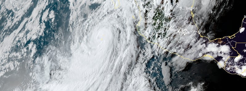
Featured image: Hurricane "Kay" at 23:50 UTC on September 6, 2022. Credit: NOAA/GOES-East, RAMMB/CIRA, The Watchers
Hurricane “Kay” is expected to bring strong winds and heavy rain to portions of the southern Baja California Peninsula on September 7, 2022. Kay is the 12th named storm of the 2022 Pacific hurricane season and the 8th hurricane.
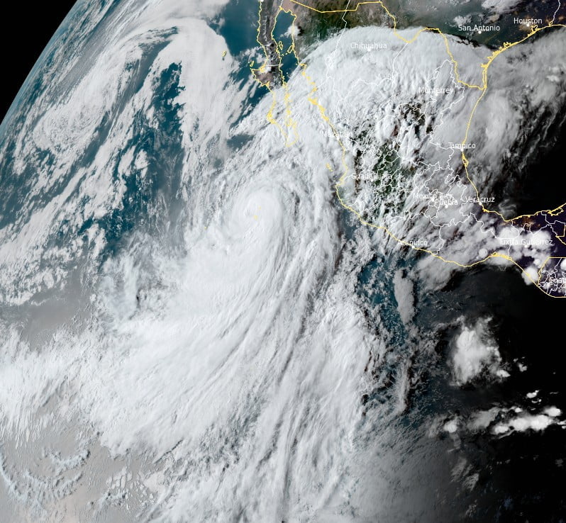
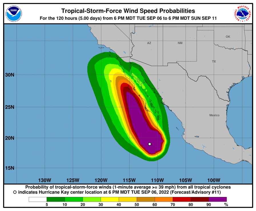
- Kay is a very large tropical cyclone, producing an extensive area of high seas, with swells affecting portions of southwestern Mexico and the southern Baja California peninsula.
- Although it is likely to weaken before it makes its closest approach to the west-central coast of the Baja peninsula, it is forecast to remain a large and dangerous hurricane through that time.
- In addition, high wind, surf, and rainfall impacts will extend far from the center so users should not focus on the exact forecast track.
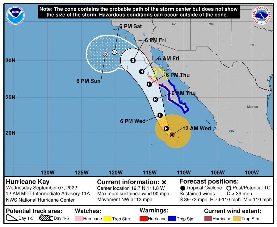
At 06:00 UTC on September 7, the center of Hurricane “Kay” was located about 410 km (255 miles) SSW of the southern tip of Baja California, according to the National Hurricane Center (NHC).1
It had maximum sustained winds of 150 km/h (90 mph) and minimum central pressure of 975 hPa.
The hurricane was moving NW at 20 km/h (13 mph).
A turn toward the north-northwest is expected today, and this motion should continue into Friday, September 9.
Strengthening is forecast during the next 24 hours, and Kay could become a major hurricane during that time. Weakening is forecast to begin by Thursday, but Kay is forecast to remain a strong hurricane when it passes near the Baja California peninsula.
On the forecast track, the center of Kay is expected to pass to the west of the southern Baja California peninsula today, and be near the west-central coast of the Baja California peninsula Thursday and Friday.
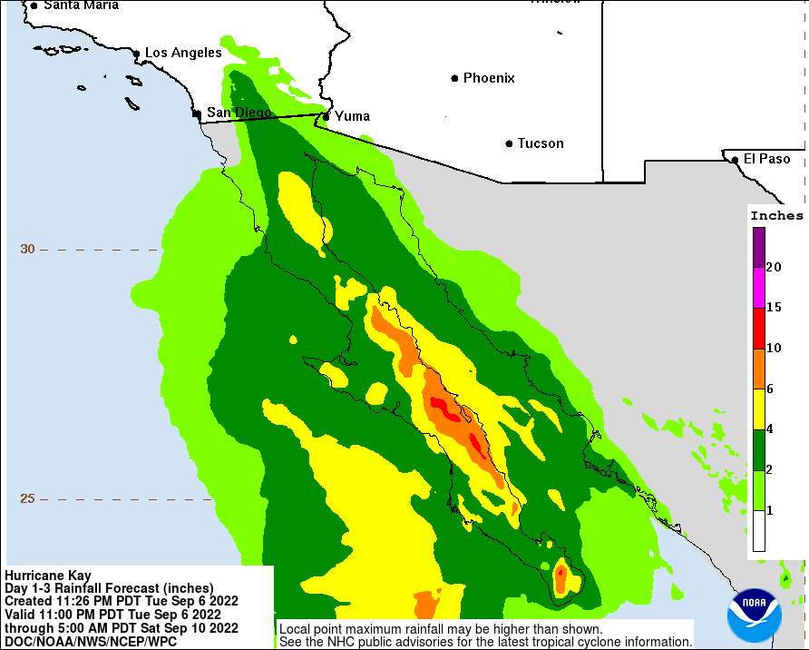
NHC forecasters warn that heavy rainfall produced by Hurricane “Kay” could lead to flash flooding, including landslides, across portions of the Baja California peninsula and mainland northwestern Mexico through Friday.2
Tropical storm conditions are expected over portions of the Baja California peninsula beginning Wednesday morning, where a Tropical Storm Warning is in effect.
Hurricane conditions are possible along portions of the west-central Baja California coast on Thursday, where a hurricane watch has been issued. Additional tropical storm watches and warnings for the northern Baja California peninsula could be required later tonight and Wednesday.
References:
1 Hurricane Kay Intermediate Advisory Number 11A – NWS National Hurricane Center Miami FL – 1200 AM MDT Wed Sep 07 2022
2 Hurricane Kay Discussion Number 11 – NWS National Hurricane Center Miami FL – 0900 PM MDT Tue Sep 06 2022
I'm a dedicated researcher, journalist, and editor at The Watchers. With over 20 years of experience in the media industry, I specialize in hard science news, focusing on extreme weather, seismic and volcanic activity, space weather, and astronomy, including near-Earth objects and planetary defense strategies. You can reach me at teo /at/ watchers.news.
Commenting rules and guidelines
We value the thoughts and opinions of our readers and welcome healthy discussions on our website. In order to maintain a respectful and positive community, we ask that all commenters follow these rules.