
Tropical Storm “Chanthu” approaching Japan, residents advised to be on alert for landslides, strong winds and high waves
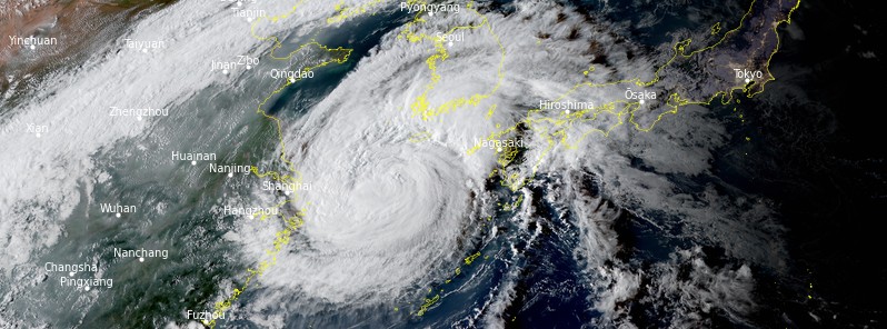
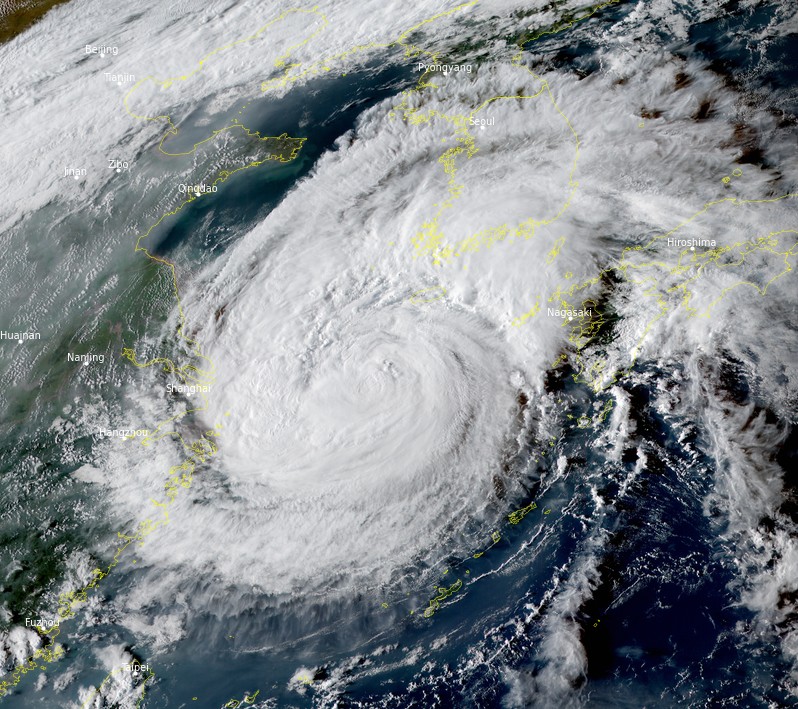
Featured image: Tropical Storm "Chanthu" at 08:00 UTC on September 16, 2021. Credit: JMA/Himawari-8, RAMMB/CIRA, TW
Japanese weather officials are advising people in the west of the country to be on alert for landslides, strong winds and high waves caused by Tropical Storm "Chanthu."
- The system is still hovering over the East China Sea, but it's slowly moving toward Japan.
- Chanthu is expected to become a low-pressure system on Friday morning, according to the Japan Meteorological Agency (JMA), with rain and winds gradually intensifying in western Japan.
At 06:00 UTC on September 16, the center of Tropical Storm "Chanthu" was located about 528 km (328 miles) west-southwest of Sasebo, Japan.
Its maximum 10-minute sustained winds were 95 km/h (60 mph), with gusts up to 130 km/h (80 mph) while maximum 1-minute sustained winds were 100 km/h (65 mph). The minimum central barometric pressure was 990 hPa and the system is moving north-northeast at 13 km/h (8.1 mph).1
The system is expected to make landfall along the northwestern coast of Kyushu, Japan near 09:00 UTC on September 16, track over the inland and cross just south of Tokyo on September 18, according to the JTWC.2
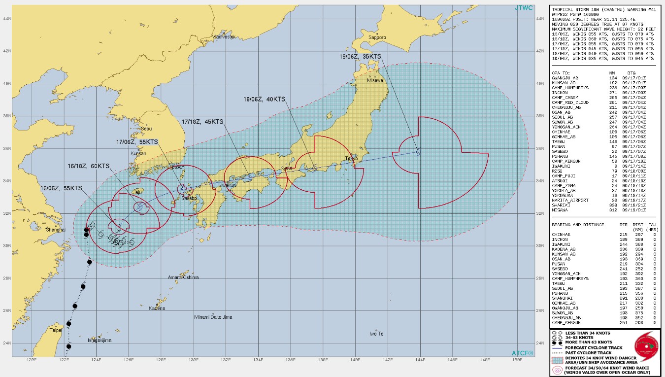
There remains a short window of opportunity for intensification over the next 12 – 18 hours as the vertical wind shear remains relatively low while at the same time the system continues to tap into robust poleward outflow.
In 24 hours to Friday morning (LT), September 17, 150 mm (5.9 inches) of rainfall is expected in the Shikoku region, 120 mm (4.7 inches) in southern Kyushu, and 100 mm (3.9 inches) in northern Kyushu.3
In 24 hours to Saturday morning (LT), Shikoku, Kinki, and Tokai could produce 200 – 300 mm (7.8 – 11.8 inches). Northern Kyushu and Chugoku could see 100 – 200 mm (3.9 – 7.8 inches) and southern Kyushu 100 – 150 mm (3.9 – 5.9 inches).
Tropical Storm "Chanthu" at 08:00 UTC on September 16, 2021. Credit: JMA/Himawari-8, RAMMB/CIRA, TW
References:
1 Tropical Storm 19W (Chanthu) Warning #41 Issued at 16/0900Z
2 Tropical Storm 19W (Chanthu) Warning #41 Issued at 16/0900Z – Prognostic reasoning
3 Severe tropical storm Chanthu approaching Japan – NHK
I'm a dedicated researcher, journalist, and editor at The Watchers. With over 20 years of experience in the media industry, I specialize in hard science news, focusing on extreme weather, seismic and volcanic activity, space weather, and astronomy, including near-Earth objects and planetary defense strategies. You can reach me at teo /at/ watchers.news.
Commenting rules and guidelines
We value the thoughts and opinions of our readers and welcome healthy discussions on our website. In order to maintain a respectful and positive community, we ask that all commenters follow these rules.