
Sustained ash emissions at Semisopochnoi volcano, Aviation Color Code raised to Red, Alaska
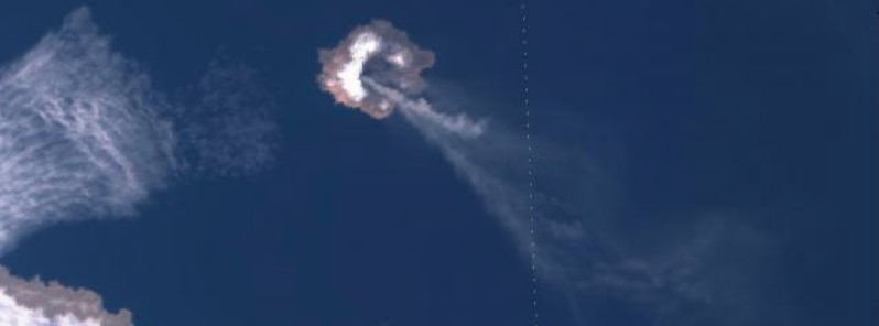
Image credit: Copernicus EU/Sentinel-3, Hannah Dietterich
The Alaska Volcano Observatory (AVO) has raised the Aviation Color Code to Red and the Alert Level to Warning for Semisopochnoi volcano on Friday, April 16, 2021, after sustained ash emissions rose up to 6 km (20 000 feet) a.s.l.
Satellite data suggest ash emissions from Semisopochnoi volcano have been ongoing since early April 15 (LT) and are continuing with no decrease in intensity, AVO reported at 00:24 UTC today.
The ash cloud extends more than 350 km (217 miles) southeast of the volcano with heights up to 6 km (20 000 feet) above sea level.
Based on the length and height of the ash plume and the sustained nature of ash emissions, AVO has raised the Color Code to RED and the Alert Level to WARNING at 03:15 UTC today.
Semisopochnoi is monitored by satellite data, regional infrasound, and lightning detection instruments.
An infrasound array on Adak Island may detect explosive emissions from Semisopochnoi with a slight delay (approximately 13 minutes) if atmospheric conditions permit.
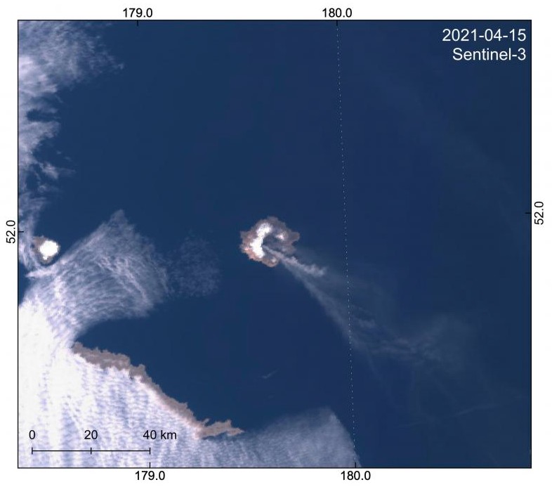
Sentinel-3 image captures an eruptive plume from Semisopochnoi volcano drifting southeast and extending >330 km from the vent. Sentinel-3 image captures an eruptive plume from Semisopochnoi volcano drifting southeast and extending >330 km from the vent. Credit: Copernicus EU/Sentinel-3, Hannah Dietterich
Geological summary
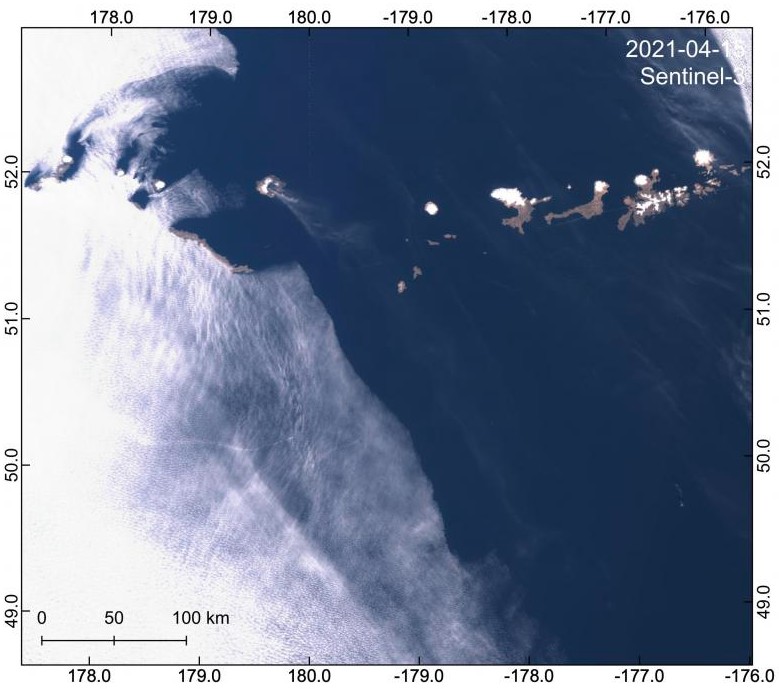
Semisopochnoi, the largest subaerial volcano of the western Aleutians, is 20 km (12.4 miles) wide at sea level and contains an 8 km (5 miles) wide caldera. It formed as a result of the collapse of a low-angle, dominantly basaltic volcano following the eruption of a large volume of dacitic pumice.
The high point of the island is 1 221 m high (4 005 feet) Anvil Peak, a double-peaked late-Pleistocene cone that forms much of the island's northern part.
The three-peaked 774 m (2 539 feet) high Mount Cerberus volcano was constructed during the Holocene within the caldera. Each of the peaks contains a summit crater; lava flows on the northern flank of Cerberus appear younger than those on the southern side.
Other post-caldera volcanoes include the symmetrical 855 m (2 903 feet) high Sugarloaf Peak SSE of the caldera and Lakeshore Cone, a small cinder cone at the edge of Fenner Lake in the NE part of the caldera.
Most documented historical eruptions have originated from Cerberus, although Coats (1950) considered that both Sugarloaf and Lakeshore Cone within the caldera could have been active during historical time.
This volcano is located within the Aleutian Islands, a UNESCO Biosphere Reserve property.
I'm a dedicated researcher, journalist, and editor at The Watchers. With over 20 years of experience in the media industry, I specialize in hard science news, focusing on extreme weather, seismic and volcanic activity, space weather, and astronomy, including near-Earth objects and planetary defense strategies. You can reach me at teo /at/ watchers.news.
Commenting rules and guidelines
We value the thoughts and opinions of our readers and welcome healthy discussions on our website. In order to maintain a respectful and positive community, we ask that all commenters follow these rules.