
M6.3 earthquake hits Davao Gulf, Mindanao, Philippines
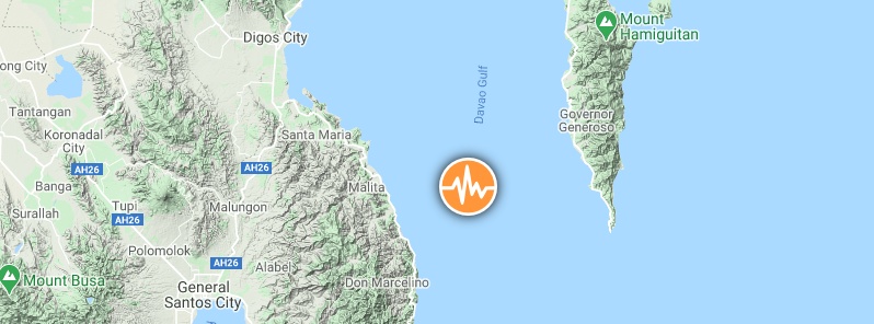
Image credit: TW/SAM, Google
A strong earthquake registered by the USGS as M6.3 hit Davao Gulf, Mindanao, Philippines at 15:23 UTC (23:23 LT) on September 6, 2020. The agency is reporting a depth of 119.1 km (74 miles). PHIVOLCS registered it as M6.4 at a depth of 143 km (88 miles); EMSC as M6.3 at a depth of 122 km (75 miles).
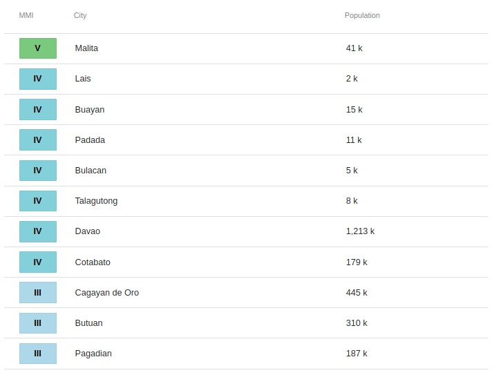
The epicenter was located 18.7 km (11.6 miles) ENE of Talagutong (population 7 983), 27.4 km (17.0 miles) ESE of Malita (population 41 114), 47.5 km (29.4 miles) NNE of Caburan (population 12 618), 48.7 km (30.2 miles) SE of Santa Maria (population 16 758), and 88.6 km (54.9 miles) SSE of Davao (population 1 212 504).
There are about 4 230 000 people living within 100 km (62 miles).
PHIVOLCS said it doesn't expect damage from this earthquake but aftershocks are likely.
Based on all available data there is no tsunami threat from this earthquake.
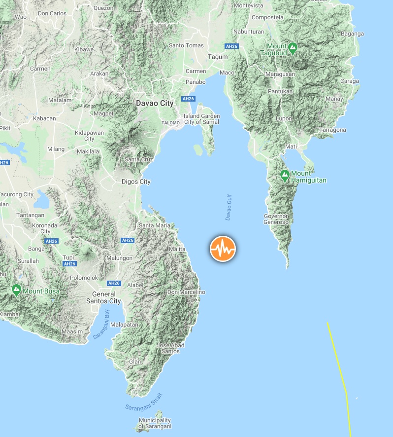
Image credit: TW/SAM, Google
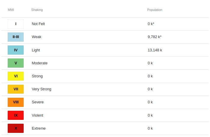
Estimated population exposure to earthquake shaking
Selected cities exposed
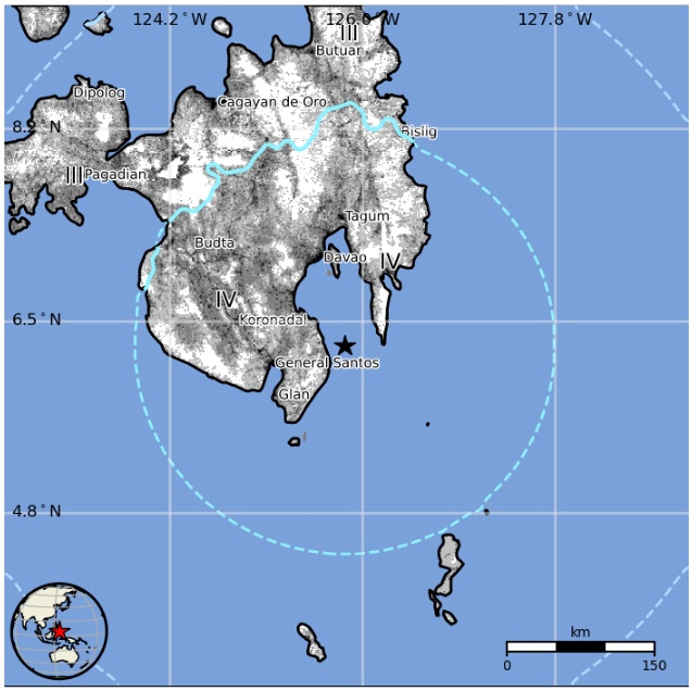
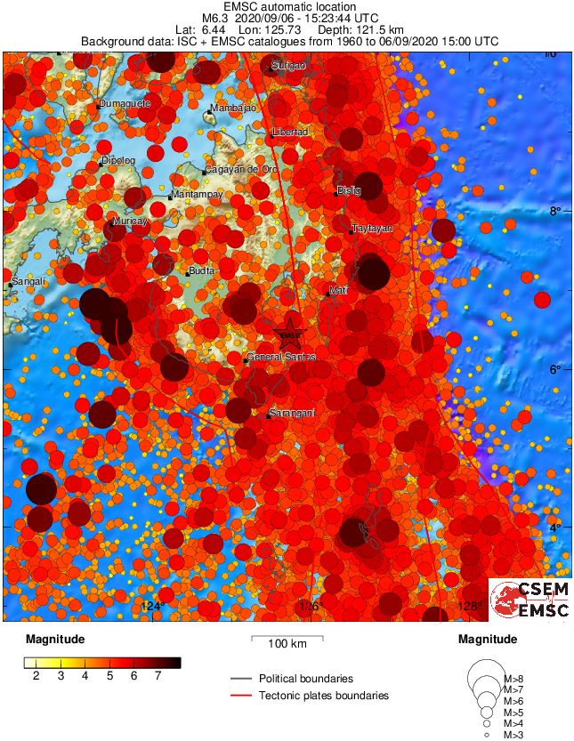
Regional seismicity
I'm a dedicated researcher, journalist, and editor at The Watchers. With over 20 years of experience in the media industry, I specialize in hard science news, focusing on extreme weather, seismic and volcanic activity, space weather, and astronomy, including near-Earth objects and planetary defense strategies. You can reach me at teo /at/ watchers.news.
Commenting rules and guidelines
We value the thoughts and opinions of our readers and welcome healthy discussions on our website. In order to maintain a respectful and positive community, we ask that all commenters follow these rules.