
Late season snow and unusually cold May temperatures from North America to Europe
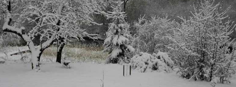
Image credit: Arvis Liepa
A late-season cold blast has been dumping spring snow from North America to parts of Europe since early May, causing records to tumble in several areas as the cold Arctic air ripped through west to east.
The intense Arctic outbreak brought rare snow and record cold temperatures to portions of North America, with some areas experiencing below-freezing temperatures and significant snowfall.
On May 5, residents across Northern New England woke up to unseasonal May snow. "As you go across the Great Lakes and the interior Northeast, we actually have wind chills in the freezing range," Fox News meteorologist Janice Dean described.
On May 9, unseasonably cold air swept across Lake Erie, dumping snow as well in Lake View. Winter-like conditions then resulted in low visibility.
On May 12, Toronto recorded -3 °C (26.6 °F), the coldest in the history of Canada. Local media noted that the last time Toronto residents felt temperatures this cold was back in 1939, during the Great Depression period, with -2.2 °C (28 °F).
Today's ~6am low of -3.8°C is the lowest temperature Toronto-Pearson has recorded on May 12th since records began in 1938. #TOWx pic.twitter.com/fNGf1AB6lX
— Toronto Weather Records (@YYZ_Weather) May 12, 2020
Thundersnow in Kingston and surrounding regions were reported in southern Ontario. According to the Weather Network, the Sun's angle caused air parcels to rise up into the cold and unstable air, where temperatures where around -20 °C (-4 °F).
"The air aloft was so chilly that super-cooled water droplets accreted on the falling snowflakes before they reached the surface, distorting the classic snowflake," Weather Network meteorologist Tyler Hamilton explained.
Hamilton noted that a thunderstorm is an unusual form of weather that usually occurs during winter, and it's particularly rare that it happened mid-May.
Meanwhile, Ottawa also recorded its coldest May 12 ever as the Ottawa Airport recorded temperatures of -4.6 °C (26.7 °F), breaking the previous record of -1.7 °C (28.9 °F) set in 1940.
Much of Europe reported heavy snow and piercing cold temperatures since the first week of May.
In a video uploaded by Romania's National Road Infrastructure Management Company on May 7, roads along the Cluj area was shown covered in snow as snow continued to fall. Snow-removal operations were then carried out that day.
In Lithuania, photos and videos on social media showed whiteout conditions as snow blanketed trees and flowers.
Snowfall in Vilnius, Lithuania yesterday, May 12th. Thanks to Il Monte for the report – posted with permission. pic.twitter.com/8krdj8F8Yw
— severe-weather.EU (@severeweatherEU) May 13, 2020
Winter has visited Lithuania yesterday.
Thanks to Vidmantė Zygmantė for the report. Posted with permission. pic.twitter.com/K4F1Y7FF5O
— severe-weather.EU (@severeweatherEU) May 13, 2020
More fresh snow impressions from Latvia today, May 12th. Photos by Ainārs Kadišs. Thanks to Arvis Liepa for the report – posted with permission. pic.twitter.com/0f7ZeV3cMx
— severe-weather.EU (@severeweatherEU) May 12, 2020
Fresh snow in spring, Taken in Lithuania today, May 12th. Thanks to Donata Mienė for the report – posted with permission. pic.twitter.com/wVcUXh9Q3X
— severe-weather.EU (@severeweatherEU) May 12, 2020
Very rare snowfall also reached Turkey, with up to 10 cm (4 inches) recorded in high sections. Municipal teams conducted snow removal in some areas.
Winter still lingers on the North plateau in Turkey.
The photo was captured by Ziya Krtş on Saturday. Posted with permission. pic.twitter.com/htySvL8UCm
— severe-weather.EU (@severeweatherEU) May 11, 2020
On May 11, parts of Scotland were hit by snow as a mass of Arctic air traveled south on the back of a meridional jet stream flow. The polar blast came after the UK experienced a relatively mild April this year.
#A87 #Skye to #Inverness road at top of Glensheil lots snow and still falling #Scotland (10:00hrs 12/03/20) @donder1969 @angie_weather @ThePhotoHour @StormHour @VisitScotland @BBCWthrWatchers pic.twitter.com/5vPZb6dN6x
— James MacInnes (@Macinnesplant) March 12, 2020
In Germany, a blizzard reportedly struck the mountain peak of Brocken and engulfed the entire town of Wernigerode.
Snow was reported in higher elevations in Bavaria. It was very cold in many areas, with temperatures dropping around 2 °C (35.6 °F). Below freezing temperatures of -2.6 °C (27.3 °F) were recorded in Nuremberg on May 12.
"Snowfall is occurring in some regions along the front, especially over Poland and Belarus," Severe Weather Europe reported on the same date. "Further south and southwest, storms were ongoing along the leading frontal boundary since yesterday afternoon." Tromso, Norway also reported heavy snow on the 12th.
Heavy snowfall falling in #Tromsø, Norway yesterday afternoon 12th May! Video Via Tromso love https://t.co/zjGQBupY2x #severeweather #ExtremeWeather pic.twitter.com/f3EhgDQ9XG
— WEATHER/ METEO WORLD (@StormchaserUKEU) May 13, 2020
On May 14, an intense snowstorm hit the Kola Peninsula in the far northwest of Russia, resulting in traffic disruptions across the region. Murmansk citizens took to social media to share photos and videos of snowy streets.
Мощный снегопад обрушился на Мурманскую область https://t.co/X9PznDzKqX pic.twitter.com/xroZgk5NKN
— РИА Новости (@rianru) May 14, 2020
Мурманск на связи
Шло 14 мая
Нас опять засыпало снехом
pic.twitter.com/aKd9LVmOVi— Приключения Кратоса в России (@kratos_v_rossii) May 13, 2020
Unprecedented late night frost was reported in the Netherlands for the second night in a row on from May 14 into 15. In the Utrecht city, De Bilt the temperature dropped down to -1.2 °C (29.8 °F), it was -1.0 °C (30.2 °F) on the night before.
According to the weather agency Weeronline, such light night frost in De Bilt is special.
Two or more frost nights after May 10 were experienced in De Bilt only in 1909, 1941, 1946 and 1973. On average, the last frost day of the season in De Bilt is April 15.
On May 16, the weather took a turn as a heatwave spread across the southern Mediterranean, spreading into south Italy, southern Balkans, Turkey, and Israel, among other places.
Meanwhile, it was stormy over Barcelona, Spain, and cloudy over Germany. Several thunderstorms and wind warnings are in place to much of the continent.
Commenting rules and guidelines
We value the thoughts and opinions of our readers and welcome healthy discussions on our website. In order to maintain a respectful and positive community, we ask that all commenters follow these rules.