
Bahamas take direct hit from catastrophic Category 5 Hurricane “Dorian” – the strongest in history to hit the region
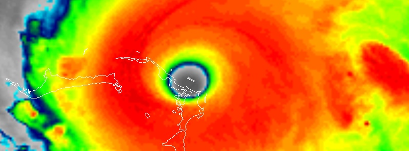
Featured image: Hurricane "Dorian" over the Bahamas at 18:40 UTC on September 1, 2019. Credit: NOAA/GOES-East
Hurricane "Dorian," now a destructive Category 5 storm, has made landfall in Elbow Cay, Abaco Islands, the northwestern Bahamas at 16:40 UTC on September 1, 2019, with maximum sustained winds of 298 km/h (185 mph) and wind gusts up to 354 km/h (220 mph), making it the strongest hurricane to hit the northwestern Bahamas in modern record. Its eye made the second landfall at 18:00 UTC on Great Abaco Island near Marsh Harbor, tying for the strongest Atlantic hurricane landfall on record with the 1935 Labor Day hurricane. The hurricane will move dangerously close to the Florida east coast late Monday, September 2.
"This is probably the saddest and worst day of my life to address the Bahamian people," the premier of Bahamas, Hubert Minnis, said. "We're facing a hurricane … one that we've never seen in the history of the Bahamas." He reportedly broke down in tears during the briefing.
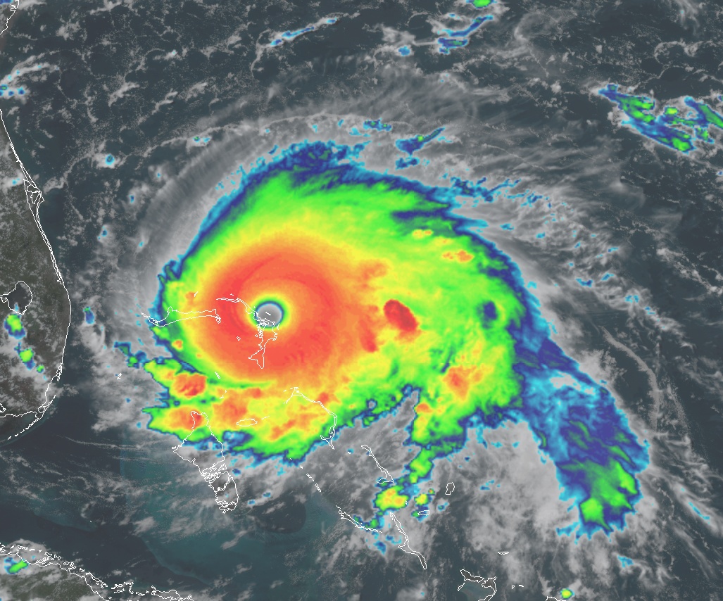
Hurricane "Dorian" over the Bahamas at 18:20 UTC on September 1, 2019. Credit: NOAA/GOES-East, RAMMB/CIRA, TW
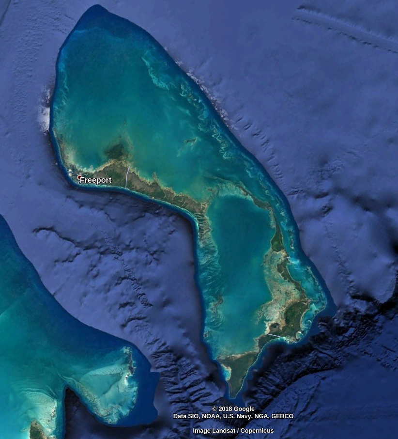
Northern Bahamas. Image credit: Google
According to the NHC, Dorian tied the record for the strongest ever Atlantic hurricane landfall when it slammed into the Abacos islands today.
With maximum sustained winds of 298 km/h (185 mph) Dorian also tied for the 2nd strongest Atlantic hurricane sine 1950, CSU meteorologist Philip Klotzbach said.
The eye of #Dorian has made a second landfall at 2 pm EDT (1800 UTC) on Great Abaco Island near Marsh Harbour. Maximum sustained winds were 185 mph at the time. This is tied for the strongest Atlantic hurricane landfall on record with the 1935 Labor Day hurricane. pic.twitter.com/O9hrotTTbS
— National Hurricane Center (@NHC_Atlantic) September 1, 2019
#HurricaneDorian has made landfall on the Abacos w/ max winds of 185 mph. That landfall intensity is even slightly stronger than Hurricane Irma’s landfall intensity of 180 mph in Barbuda, Saint Martin & British Virgin Islands. Absolute devastation occurred from those landfalls. pic.twitter.com/netCK7NWdw
— Philip Klotzbach (@philklotzbach) September 1, 2019
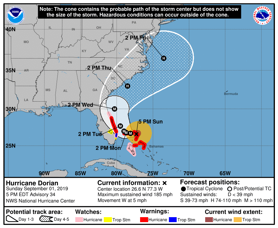
At 11:00 LT (15:00 UTC), NHC said that the Abaco Islands are under "catastrophic conditions". At the time, the center of the storm was located about 30 km (20 miles) ENE of Great Abaco Island and 330 km E of West Palm Beach, Florida, U.S.
At 21:00 UTC, its center was located about 150 km (95 miles) E of Freeport, Grand Bahama. Maximum sustained winds were 295 km/h (185 mph) and minimum central pressure 910 hPa.
Dorian is moving toward the west near 7 km/h (5 mph). A slower westward to west-northwestward motions should continue for the next day or two, followed by a gradual turn toward the northwest.
On this track, the core of extremely dangerous Hurricane "Dorian" will continue to pound Great Abaco this evening and move near or over Grand Bahama Island tonight and Monday, September 2.
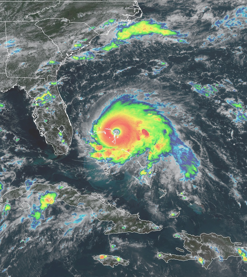
The hurricane will move dangerously close to the Florida east coast late Monday.
This is a category 5 hurricane on the Saffir-Simpson Hurricane Wind Scale. Some fluctuations in intensity are likely, and Dorian is expected to remain a catastrophic hurricane during the next few days. Hurricane-force winds extend outward up to 75 km (45 miles) from the center and tropical-storm-force winds extend outward up to 220 km (140 miles).
Inhabitants from Grand Bahama have started evacuating from the storm's expected target area.
There are reports of major damage throughout Abacos, but we'll have to wait for the hurricane to move away from the islands to understand the full extent of the damage.
A scene of devastation in Abaco #hurricanedorian pic.twitter.com/S2lp1NDXF4
— Tribune242 (@Tribune242) September 1, 2019
Elbow Cay suffered significant damage in 1999 from Hurricane "Floyd." It nearly cut a new inlet near White Sound. The road remains damaged to this day.
Floyd hit the Bahamas with winds of 249 km/h (155 mph) and waves up to 15 m (50 feet) in height. A 6.10 m (20 feet) storm surge inundated many islands with over 1.5 m (5 feet) of water throughout. The wind and waves toppled power and communication lines, severely disrupting electricity and telephone services for days.
The damage was greatest at Abaco Island, Cat Island, San Salvador Island, and Eleuthera Island, where Floyd uprooted trees and destroyed a significant number of houses.
Numerous restaurants, hotels, shops, and homes were devastated, severely limiting in the recovery period tourism on which many rely for economic well-being.
Damaged water systems left tens of thousands across the archipelago without water, electricity, or food.
Despite the damage, however, few deaths were reported, as only one person drowned in Freeport, and there were few injuries reported.
Pity
I posted as far back as 5 years ago the offer of a invention of mine that would disperse down a H5 in about 1/2 hour; This to Obama, McCain, Miami Uni., FEMA, US Embassy, White House and recently to Al Gore & Trump.
Not even an acknowledgement indeed in all these years !
The system applies as well to tornadoes, although easiest & fastest to implement !
Only one country tried in the past, but unsuccessfully, to tackle the problem. Japan. A patent was even lodged on their 20 submarines trial.
The problem is all those so-called lawmakers makers don’t give two hoots for the destruction & losses of lives. They are quietly weathering (so to say) the rampage in cosy protected abodes. Right ?
As for the underling servants receiving my communication they probably dismissed it as worthless since in their little minds such huge catastrophe are considered acts-of-god, hence without remedies.
See the result & the coming results once surveys will assess the damage !
Ok ?
No remedies again, since as the saying goes:
People see in things only what they want to see
And they want to see only what they know.
In my view there is likeness that Dorian will cross Florida, get into the Gulf of Mexico, regain power and finally go on a rampage in Louisiane & Texas…
Let see.
Best regards
Jean-Paul Turcaud
Exploration geologist
Australia mining ⚒ Pioneer
Founder of the True Geology